FTB 09-26-2022: Another Gorgeous Day Ahead With Isolated Storms Possible South

Issue Date: Monday, September 26th, 2022
Issue Time: 9:10AM MDT

— Flooding is NOT expected today

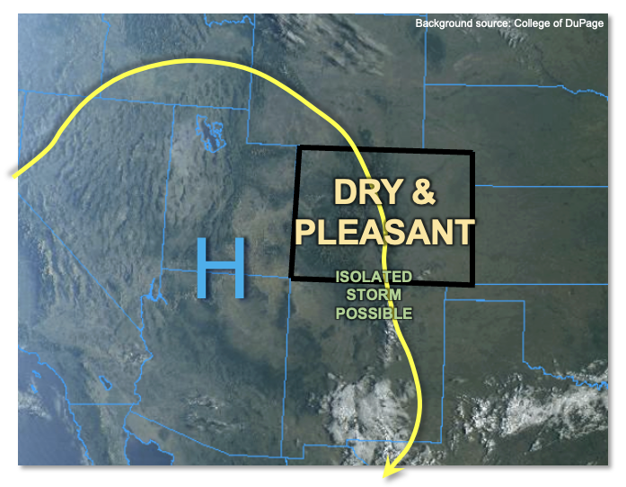
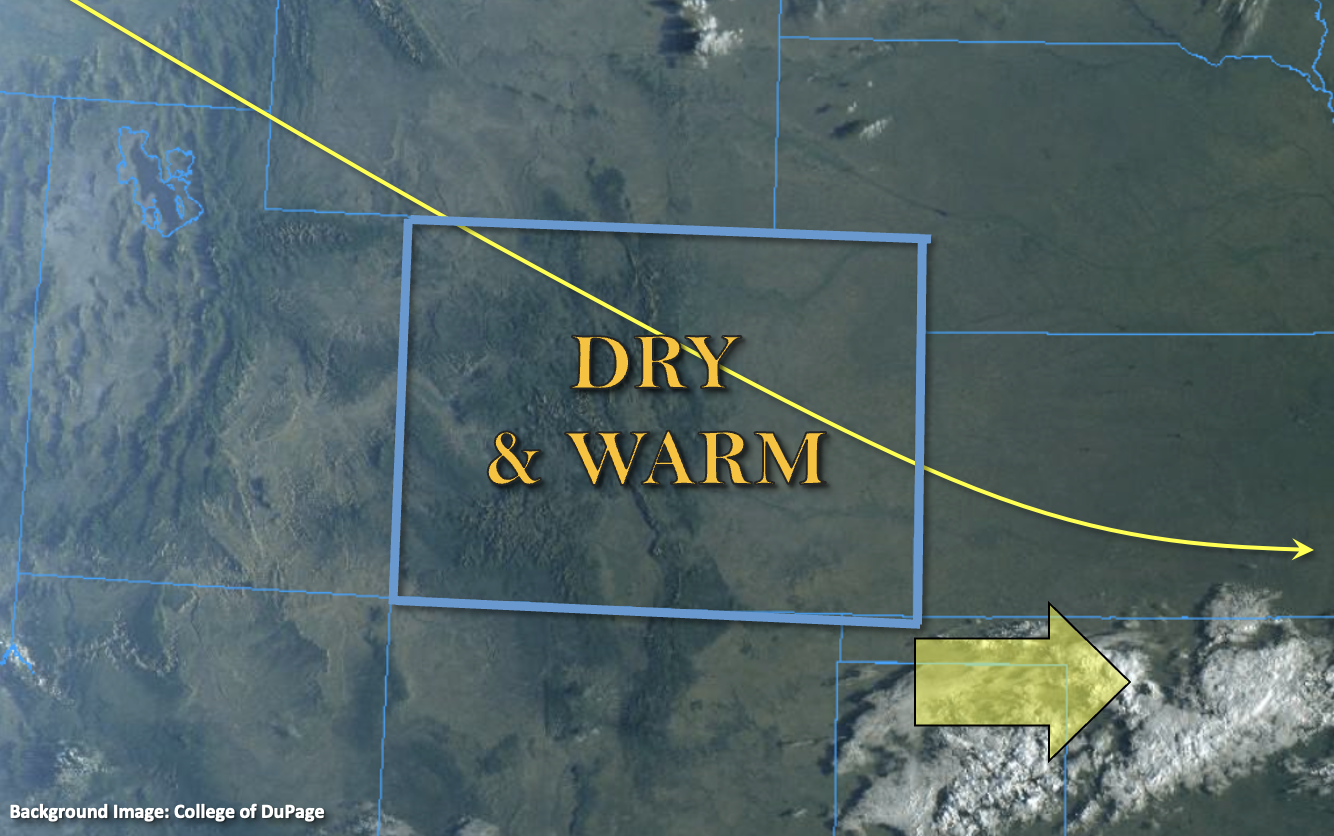
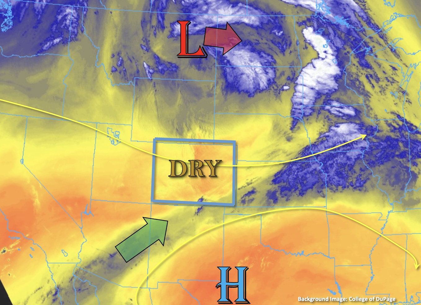
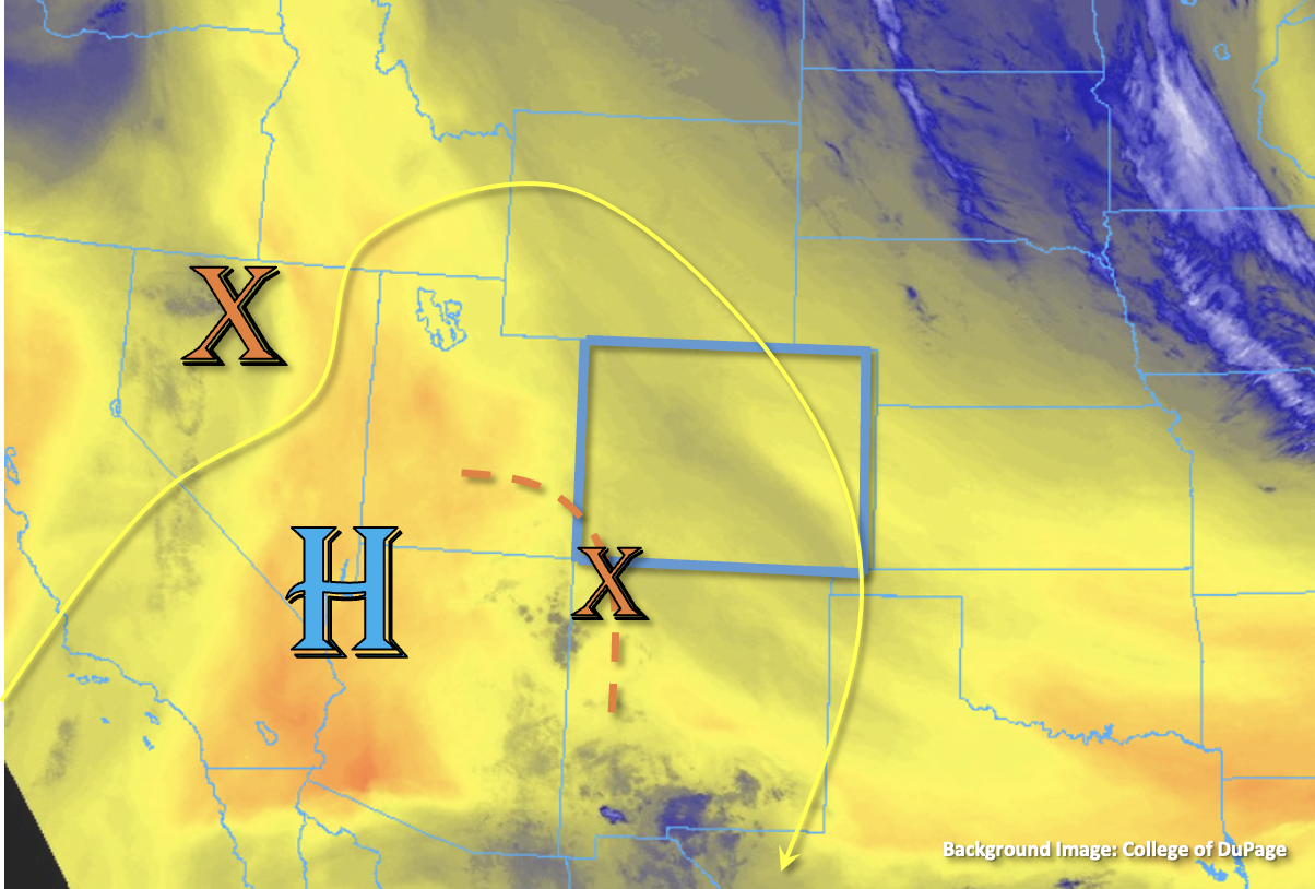
Drier air continues to remain over the state with a slight boost in mid-level moisture, which is shown by the darker shade in the water vapor imagery below. This moisture has helped to increase PW at Grand Junction slightly to 0.44 inches. Platteville’s PW has dropped to 0.38 inches, indicating the little moisture that arrived with the cold front yesterday morning has mixed out. With drier north and northwesterly flow, little surface moisture and subsidence continuing today, most of the state should remain rain-free with seasonable or marginally above seasonable temperatures forecast. There is a little better moisture and mid-level energy circulating around the high over the Southwest corner. As the High builds eastward today, this and upslope circulation may allow for some isolated storms to develop over the San Juan Mountains. Due to the dry surface layer, only light to briefly moderate rainfall rates are forecast. Therefore, flooding issues are NOT expected.

Today’s Flood Threat Map

For more information on today’s flood threat, see the map below. If there is a threat, hover over the threat areas for more details, and click on burn areas to learn more about them. For Zone-Specific forecasts, scroll below the threat map.

Zone-Specific Forecasts:

Southeast Mountains, San Juan Mountains & Central Mountains:

Isolated, weak storms may be possible over the San Juan Mountains and to a lesser extent over the Southeast and Central Mountains later today. Very isolated max 30-minute rain rates up to 0.5 inches may be possible, but most storms should produce totals under 0.2 inches. Some brief breezy conditions may also be possible from outflow winds under the stronger storm cores. Flooding is NOT expected.

Primetime: 2:30PM to 8:30PM

Northern Mountains, Front Range, Northwest Slope, Grand Valley, Southwest Slope, Urban Corridor, Raton Ridge, San Luis Valley, Southeast Plains, Northeast Plains & Palmer Ridge:

Another dry day is ahead with some afternoon fair-weather cumulus possible over the southern portions of the high terrain zones. Flooding is NOT expected. High temperatures should reach into the 70s °F for the mountain valleys and 80s °F for lower elevations. Breezy conditions are expected this afternoon for portions of the eastern plains, which may somewhat elevate the fire danger.

FTB 09-25-2022: Beautiful Fall Sunday On Tap Statewide

Issue Date: Sunday, September 25th, 2022
Issue Time: 8:40AM MDT

— Flooding is NOT expected today

As shown in this morning’s satellite image, below, there is hardly a cloud across the state. An upper-level ridge over the Great Basin will strengthen a bit today, allowing for dry northerly flow across Colorado. Morning PW came in at 0.32 inches in Grand Junction, while Platteville has pushed a tad higher to 0.52 inches after a weak cool front passage. On both sides of the Continental Divide, however, mid-level subsidence will allow for generally clear skies and seasonable fall temperatures.

Along the higher peaks of our far southern border, just enough moisture exists to develop a few clouds within the usual afternoon anabatic upslope flow. A brief, weak storm cannot be ruled out here, but precipitation will be hard to generate and some gusty winds will be the most likely sensible impact. Thus, flooding is NOT expected today.

Today’s Flood Threat Map

For more information on today’s flood threat, see the map below. If there is a threat, hover over the threat areas for more details, and click on burn areas to learn more about them. For Zone-Specific forecasts, scroll below the threat map.

Zone-Specific Forecasts:

San Juan Mountains & Southeast Mountains:

A sunny morning will give way to some afternoon cumulus clouds along with seasonable fall temperatures. An isolated storm cannot be ruled out above 9,000 feet over the Sangre de Cristo and San Juan mountains. Max 30-min rain rates up to 0.2 inches possible, along with brief gusty winds. Flooding is NOT expected today.

Primetime: 2PM to 6PM

Northern Mountains, Central Mountains, Grand Valley, Southwest Slope, San Luis Valley, Northwest Slope, Northeast Plains, Southeast Plains, Front Range, Urban Corridor, Palmer Ridge & Raton Ridge:

A beautiful sunny day is expected with seasonable fall temperatures. Flooding is NOT expected today.

FTB 09-24-2022: Pleasant Day Ahead With Dry & Warm Conditions Forecast

Issue Date: Saturday, September 24th, 2022
Issue Time: 8:15AM MDT

— Flooding is NOT expected today

Much drier air has settled in over the state, which can be seen by the clear skies in the visible satellite imagery below. PW at Grand Junction and Platteville were both measured around 0.34 inches this morning, which is about 3x less than a few days ago. The lack of moisture and continued dry northwesterly flow aloft means nearly a zero percent chance of measurable rainfall this afternoon. A few isolated sprinkles may be possible over the southern high terrain, but the more likely scenario is just an increase in cloud cover. As predicted, flooding is NOT expected today. A dry cool front is forecast to move through the state overnight into tomorrow morning, which should mainly affect eastern Colorado. So, expected cooler temperatures over that area to start off the morning.

Today’s Flood Threat Map

For more information on today’s flood threat, see the map below. If there is a threat, hover over the threat areas for more details, and click on burn areas to learn more about them. For Zone-Specific forecasts, scroll below the threat map.

Zone-Specific Forecasts: 

Southeast Mountains, San Juan Mountains, Northern Mountains, Central Mountains, Northwest Slope, Grand Valley, & Southwest Slope:

A few sprinkles may be possible over the southern San Juan and Southeast Mountains. More virga and cloud cover are forecast than meaningful rainfall. Otherwise, a clear and beautiful day is ahead. Flooding is NOT expected.

Primetime: 4PM to 8PM

Front Range, Urban Corridor, Raton Ridge, San Luis Valley, Southeast Plains, Northeast Plains & Palmer Ridge:

It will be another warm and dry day for these zones. It could get a little breezy over the Northeast Plains this afternoon with isolated gusts up to 20 mph possible. With no rainfall in the forecast, flooding is NOT expected. A dry cool front moves through the area late tonight into tomorrow morning, so some chilly overnight temperatures will be possible.  


FTB 09-23-2022: Much Drier & An Uptick In Temperature 

Issue Date: Friday, September 23rd, 2022
Issue Time: 9AM MDT

— Flooding is NOT expected today

Only a narrow band of subtropical moisture can be seen in the water vapor imagery below (green arrow). As the Low to our north progresses eastward throughout the morning, rising heights behind the Low and building High pressure to our south will help to cut off the plume. Drier westerly flow has already moved over most of the state, and PW at Grand Junction has plummeted to 0.56 inches. Drying has also begun over the adjacent plains of eastern Colorado as witnessed by a PW value of 0.45 inches at Platteville. The ongoing westerly and northwesterly flow aloft should continue to scour out the remaining moisture over the far eastern plains, which is causing some fog and cloud cover this morning. With subsidence and advection of a drier air mass into the state, little to no rainfall is expected today. Best chance for an isolated, weak shower will be over the southern San Juan and Southeast Mountains, but with only light accumulations possible, flooding is NOT expected. The rising heights and drier air are also expected to produce warmer temperatures today. The hottest temperatures this afternoon should be located over the southeast corner, closest to the High.

Today’s Flood Threat Map

For more information on today’s flood threat, see the map below. If there is a threat, hover over the threat areas for more details, and click on burn areas to learn more about them. For Zone-Specific forecasts, scroll below the threat map.

Zone-Specific Forecasts:

Southeast Mountains, San Juan Mountains, Central Mountains, Northwest Slope, Grand Valley, Northern Mountains, San Luis Valley & Southwest Slope:

Best chance for an isolated storm or two today will be over the southern San Juan and Southeast Mountains where a little moisture may be able to hang on. If showers develop, high bases mean only light rainfall would be possible. Max 30-minute rain rates should remain under 0.1 inches, so flooding is NOT expected.

Primetime: 2PM to 7PM

Front Range, Urban Corridor, Raton Ridge, Southeast Plains, Northeast Plains & Palmer Ridge:

Warm and dry weather is forecast today. The fog and cloud cover over the plains should burn off by late morning. A high-based shower or two may try to develop along the Continental Divide over the southern Front Range, but more virga than meaningful rainfall is expected.