Issue Date: Tuesday, June 19, 2018
Issue Time: 10:20AM MDT
— A MODERATE flood threat has been issued for portions of the Northeast Plains, Palmer Ridge and Southeast Plains
— A LOW flood threat has been issued for the Urban Corridor, Front Range, Northeast Plains, Palmer Ridge and Southeast Plains
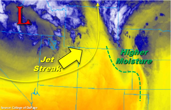
The visible satellite imagery below shows some lingering high clouds from the overnight, heavy rainfall. While it may take a bit to burn off this cloud cover, breaks in the clouds indicate this is a likely scenario (at least over some areas). Breaks in clouds over Weld and Morgan County should be monitored closely because where the sun can shine through, instability can build for another round of severe thunderstorms this evening. Models indicate a boundary from the north setting off storms over the Urban Corridor tonight in the high moisture environment. If these or any other storms track over the area that received heavy rainfall yesterday, increased runoff and flooding is likely due to saturated soils. The loaded gun sounding at Denver this morning shows quite a cap, but upper level atmospheric support this afternoon should help break it. With freezing levels at 8957 feet and a humped hodograph, there will be a large hail threat and possibly a tornado for the severe thunderstorms that form this afternoon and evening.
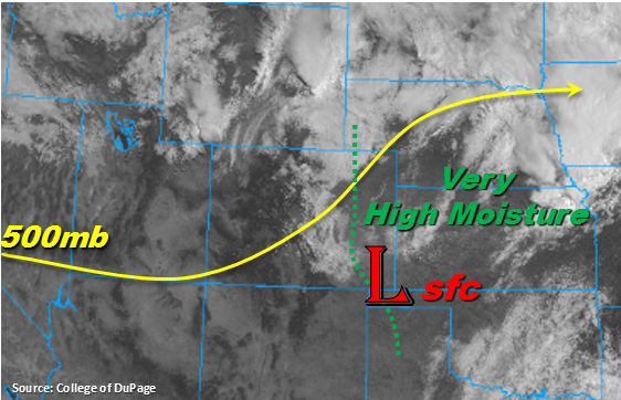
High moisture remains over eastern Colorado again today. Dew points are forecast to be in the 50-60F range, which means the heavy rainfall threat returns. Expecting storms to fire off the southern Front Range, Southeast Mountains and Palmer Ridge later this afternoon. Storm motion today will be to the east/southeast, and models indicate that the discrete severe thunderstorms that fire further south this afternoon will eventually form a MCS over the far Southeast Plains by the early evening. A second wave of storms is expected to form later tonight as a boundary slides down from the north, which could also create some late night thunderstorms over the Urban Corridor. This second wave of storms will continue the flood threat over the Southeast Plains/Palmer Ridge overnight. A Low and Moderate flood threat have been issued due to the likelihood of road and small stream flooding, arroyo flooding and field ponding.
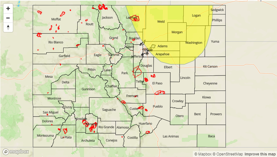
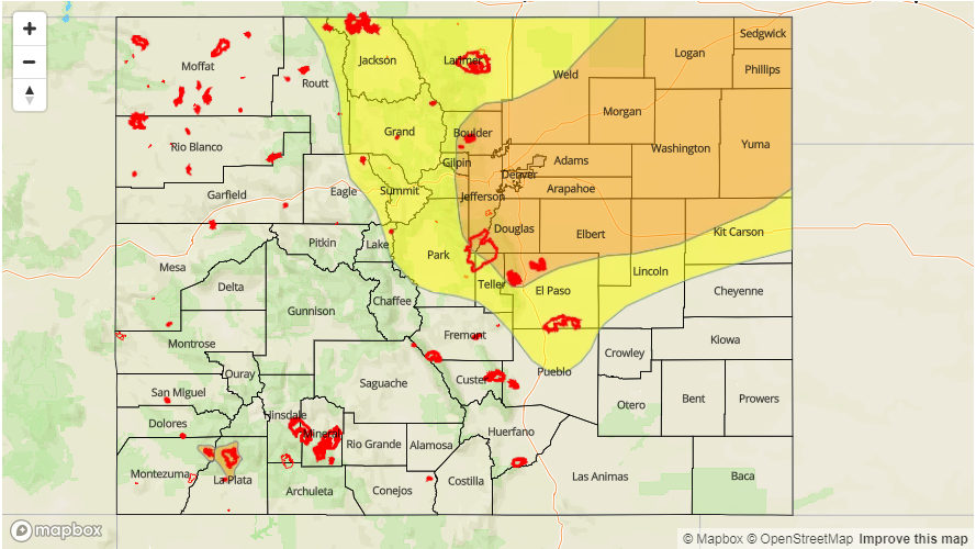
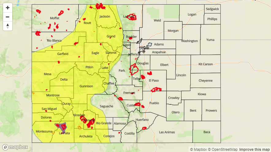
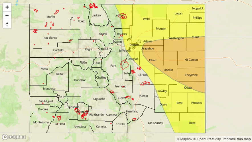
Today’s Flood Threat Map
For more information on today’s flood threat, see the map below. For Zone-Specific forecasts, scroll below the map.

Zone-Specific Forecasts:
Palmer Ridge, Front Range, Urban Corridor, Northeast Plains, Southeast Plains, Raton Ridge, Southeast Mountains:
Severe weather and heavy rainfall threat return once again to eastern Colorado. Expected severe thunderstorms today to produce large hail (up to 2.25 inch), gusty winds and possibly a tornado. High dew points will promote efficient rain rates as well. Should storms form over the northern Urban Corridor this afternoon, rain rates up to 1.25 inches/hour will be possible. If these storms track over Weld and Morgan Counties, expect some flash flooding due to saturated soils from heavy, overnight rain. Further south, over the Palmer Ridge and Southeast Plains, max 1-hr rain rates up to 2 inches/hour will be possible. Overnight rainfall over the eastern plains is expected and local totals by tomorrow morning could exceed 3 inches near the CO/KS border. For the storms that form over the Southeast Mountains, max 1-hr rain rates will be much lower (0.25 inches/hour) due to moisture being scoured east. A Moderate and Low flood threat have been issued for street flooding, field ponding and local stream flooding.
Primetime: 2PM – 5AM
San Luis Valley, San Juan Mountains, Northern Mountains, Southwest Slope, Grand Valley, Central Mountains, Northwest Slope:
Dry air continues to be entrained over the area from the southwest, which means there is no chance for rainfall again today. The strong winds yesterday associated with the passing trough have ended, which will drop the Red Flag Warning. Expect a few clouds over the Northern Mountains and Northwest Slope this afternoon, but should be clear elsewhere. High temperatures will continue to be on the increase, but highs today will be average for this time of year.