Issue Date: 7/25/2018
Issue Time: 8:50 AM
A MODERATE FLOOD THREAT IS FORECAST FOR PORTIONS OF THE SOUTHWEST SLOPE AND SAN JUAN MOUNTAINS.
A LOW FLOOD THREAT IS FORECAST FOR PORTIONS OF THE SOUTHWEST SLOPE, SAN JUAN MOUNTAINS, CENTRAL MOUNTAINS, NORTHERN MOUNTAINS, FRONT RANGE, SOUTHEAST MOUNTAINS, RATON RIDGE, SOUTHEAST PLAINS, URBAN CORRIDOR, PALMER RIDGE, AND NORTHEAST PLAINS.
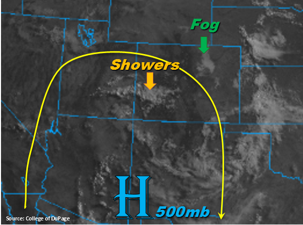
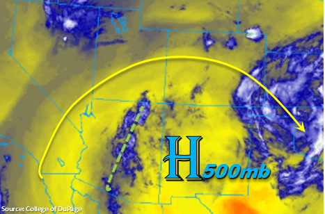
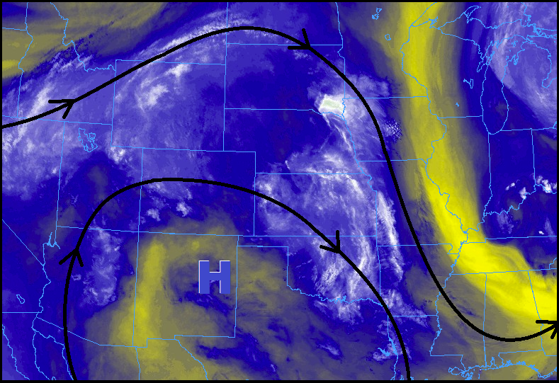
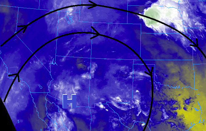
High pressure aloft will be centered to the southwest of Colorado again over Arizona, sliding slightly west/southwest as the day wears on. This will keep a mid-level moisture stream overtop Colorado, though the depth of this moisture has backed off a bit as compared to previous days. Even so, the remaining moisture will provide the fuel necessary for another day of scattered showers/thunderstorms across the state. The good news is that much of the moisture is confined to the mid-levels of the atmosphere, so precipitation efficiency will be reduced, and storm motions will be quicker than the last few days – this all means the flood threat will be mitigated a bit, but not completely.
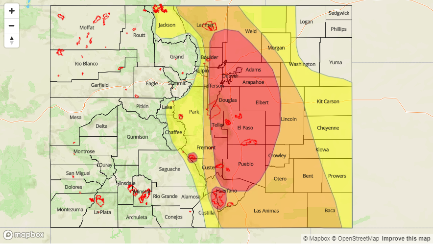
Most showers and storms will be fairly run-of-the-mill, producing periods of moderate rainfall and gusty winds. Heavy rainfall from the past few days over vulnerable terrain (i.e., burn scars) will make for sensitive responses to additional rainfall. Along/east of the Front Range/Southeast Mountains, sufficient instability and wind shear will be in place for the development of a few strong-to-severe thunderstorms, capable of producing heavy rain, strong winds (gusts to 65 mph), large hail (up to 1.0-1.25 inches in diameter), and an isolated tornado or two. For more information on timing and rain rates, please see the zone-specific forecast discussions below.
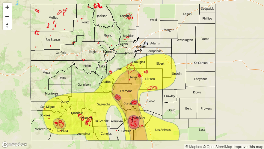
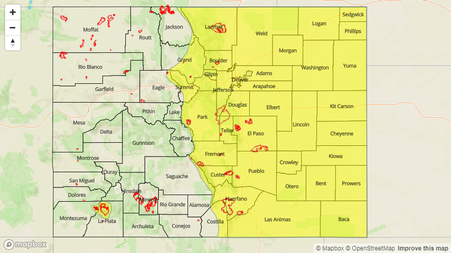
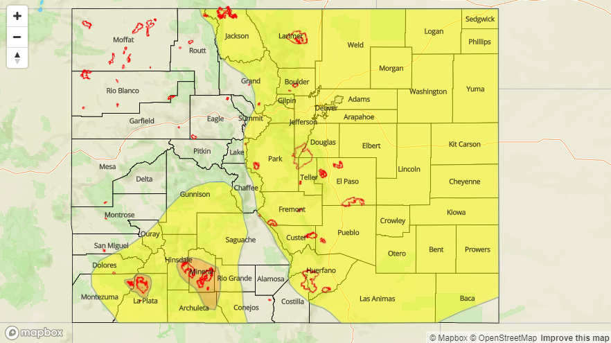
Today’s Flood Threat Map
For more information on today’s flood threat, see the map below (hover over threat areas for more details). For Zone-Specific forecasts, jump below the map.

Zone-Specific Forecasts
Front Range, Southeast Mountains, Urban Corridor, Palmer Ridge, Northeast Plains, Southeast Plains, and Raton Ridge:
Scattered showers/thunderstorms are expected again today/tonight, developing first over the mountains between 11 AM and Noon, spreading eastward over the lower elevations with time. A few storms will become strong-to-severe, with heavy rainfall remaining a threat. Areas that have received heavy rainfall, especially those that have experienced flooding from heavy rainfall, over the last couple of days should be particularly aware of any additional rainfall. Flash flooding, street/field flooding, and mud flows/debris slides from burn scars are potential impacts. Maximum rain rates are as follows:
Front Range and Southeast Mountains: 0.8-1.2 inches/hour
Urban Corridor, Palmer Ridge, and Raton Ridge: 1.0-1.5 inches/hour
Northeast Plains and Southeast Plains: 2.0-2.5 inches/hour
Timing: Noon – 10 PM for the mountains, 1 PM – Midnight for the lower elevations. A few showers/storms will linger into the early morning hours, mainly east of I-25 and south of I-70.
Northern Mountains, Northwest Slope, Central Mountains, Grand Valley, San Juan Mountains, Southwest Slope, and San Luis Valley:
Scattered showers/thunderstorms are expected again today, beginning around lunchtime and continuing into the evening hours. Storm motions and relatively dry air below cloud bases will help mitigate the flood threat somewhat, but southern and central Colorado locations that have received heavy rainfall over the last few days will be more sensitive than usual to any additional rainfall. Therefore, a moderate flood threat has been issued for a few burn scars, with a broad low flood threat area elsewhere. Maximum rain rates are as follows:
Northwest Slope: 0.1-0.25 inches/hour
Northern Mountains, Central Mountains, San Juan Mountains, and Southwest Slope: 0.6-1.2 inches/hour
Grand Valley and San Luis Valley: 0.25-0.5 inches/hour
Timing: Noon – 9 PM, with a couple lingering showers over southern mountains until midnight