Issue Date: Friday, August 10th, 2018
Issue Time: 09:15AM MDT
— A LOW flood threat has been issued for the 416 and Burro burn areas
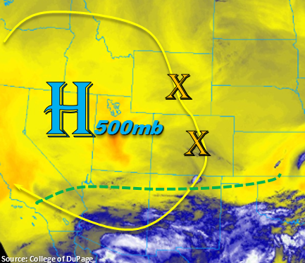
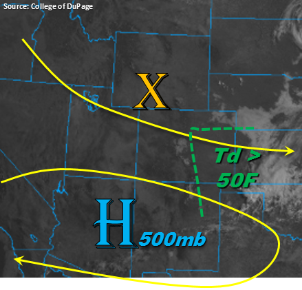
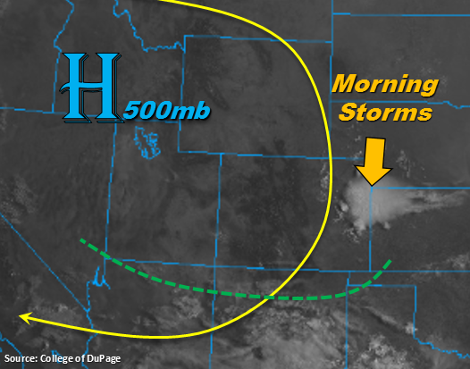
Morning storms over the Northeast Plains to start Friday. This thunderstorm complex will continue to crawl south/southwest throughout the morning producing lightning, gusty winds and light-to-moderate rainfall. Similar to Wednesday morning, some additional convection may initiate as the sun begins to heat the surface, but it shouldn’t make it further south than the Palmer Divide. Max 1-hour rain rates up to 0.7 inches are possible, so not expecting any flooding. The visible satellite imagery below again shows the heavy subtropical moisture remaining to our south (below the green line). The north/northeast upper-level flow will continue today, so showers and thunderstorms should be confined to the higher terrains. This flow may also pull in a little extra moisture to the far southwest corner of the state near the CO/NM border throughout the day. In spite of this, there will still be quite a spread between the temperature and dew point. This is anticipated to promote gusty winds rather than heavy rainfall this afternoon.
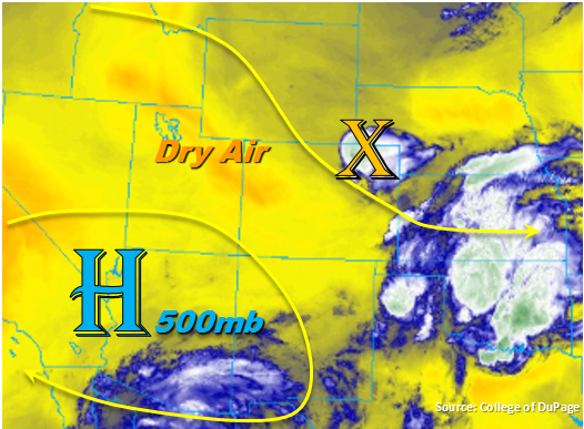
Convection will return to the southwest corner of the state this afternoon, which will bring another day of measurable rain to the San Juan and Central Mountains. The only difference from Thursday is the center of action will shift a little further west. Storm motion will be fairly swift to the south/southwest, and with dry soils, widespread flooding is not foreseen. However, rain rates will be high enough to trigger mud flows and debris slides over the 416 and Burro burn areas if a storm tracks directly over a recent scar. A Low flood threat has been issued for these areas. Over the Southeast Mountains and Southern Front Range, shower and thunderstorm activity will be more isolated. Similar to yesterday, storm formation will be greatest along or near the Continental Divide. An isolated storm is also possible where the Southern Front Range and Palmer Ridge intersect. Decreases in surface moisture over this area should keep rain rates low enough that they won’t pose a threat to the burn scars in the region. Storm activity over the mountains should decrease with sundown with all activity ending a couple of hours after that.
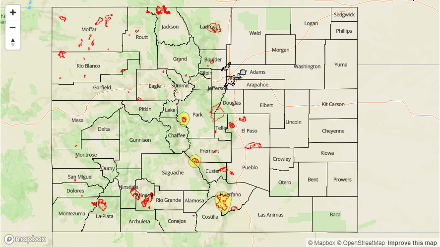
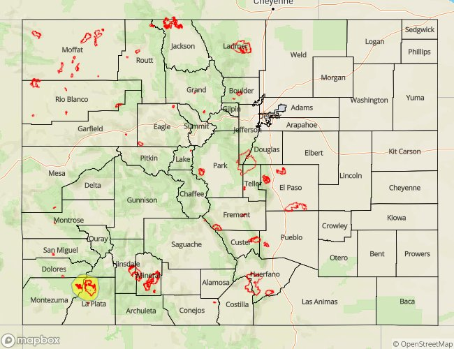
Today’s Flood Threat Map
For more information on today’s flood threat, see the map below. For Zone-Specific forecasts, scroll below the map.

Zone-Specific Forecasts:
Southeast Mountains, Central Mountains, Southwest Slope, Raton Ridge, San Juan Mountains, San Luis Valley, Front Range, Palmer Ridge:
Storm activity will look similar to yesterday except there will be another westward shift with the center of action. The strongest convection this afternoon will be over the San Juan and Central Mountains. Storm motion will be to the southwest, so expecting storms to wander into the southern Southwest Slope as well. Max 1-hour rain rates up to 0.6 inches are possible with 24-hour totals near 1 inch. Initially, thunderstorms are anticipated to produce gusty winds with the second round of storms producing more wetting rains this evening. Storms over the eastern mountains will be more isolated and should be confined to near the Continental Divide, though an isolated storm in Teller County may be possible. A Low flood threat has been issued for the 416 and Burro burn scars. Threats for storms that track over these recent burns scars are mud flows, debris slides and localized flash flooding.
Primetime: 1PM – 10PM
Northern Mountains, Northwest Slope, Grand Valley, Northeast Plains, Southeast Plains, Urban Corridor:
Convection to start the morning over the Northeast Plains. This system should move south/southwest throughout the morning producing light-to-moderate rainfall and gusty winds. Max 1-hour rain rates up to 0.7 inches are possible. The northeasterly flow aloft and arid air mass should keep these regions dry this afternoon. Some cloud cover is likely over the higher terrains this evening. High temperatures will be similar to yesterday.
Primetime: 9AM – 11:30AM