Issue Date: 8/18/2018
Issue Time: 8:42 AM
A LOW FLOOD THREAT IS FORECAST FOR PORTIONS OF THE FRONT RANGE, SOUTHEAST MOUNTAINS, URBAN CORRIDOR, NORTHEAST PLAINS, SOUTHEAST PLAINS, PALMER RIDGE, AND RATON RIDGE.
A LOW FLOOD THREAT IS FORECAST FOR PORTIONS OF THE SOUTHWEST SLOPE AND SAN JUAN MOUNTAINS.
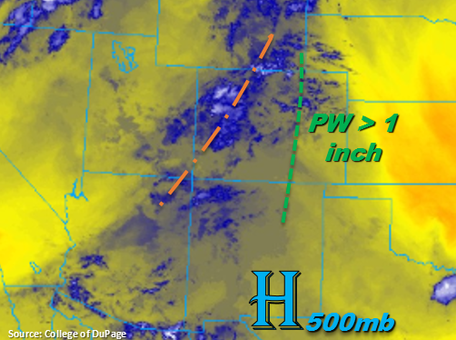
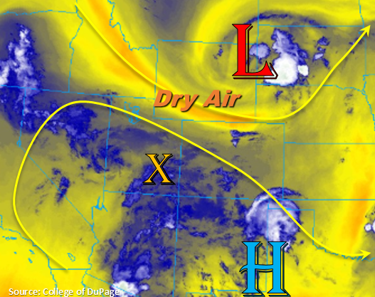
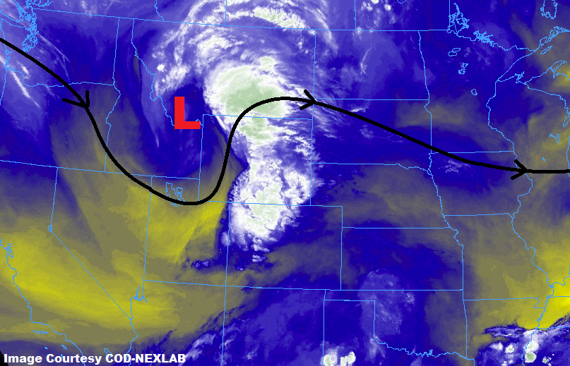
An upper-level disturbance, highlighted in the water vapor image below, will shift across Wyoming today, reaching western Nebraska by sunrise tomorrow. As it does so, it will provide the forcing for scattered showers/thunderstorms again today/tonight. In fact, an area of showers is already moving across western Colorado this morning associated with this upper-level disturbance. This shower activity will continue to move eastward, reaching the Front Range by 10-11 AM or so, and then reaching the Urban Corridor shortly thereafter. As this activity moves off the mountains, it will encounter better low-level moisture, especially east of I-25. This moisture, combined with the daytime heat and upper-level support, will result in a few strong-to-severe thunderstorms capable of heavy rainfall, hail, and strong winds.
Fortunately, storms should be moving at a good enough pace to mitigate much of the flood threat, so only a low threat is warranted. The areas with the most relative risk of flooding today will be those that received heavy rainfall yesterday, urban areas with poor drainage, and sensitive burn scar areas. Behind the initial line of storms, isolated-to-widely scattered showers and thunderstorms will dot the state during the afternoon and evening in response to a secondary disturbance associated with the upper-level low. All activity should come to an end, or exit the state to the east, by 1 AM or so.
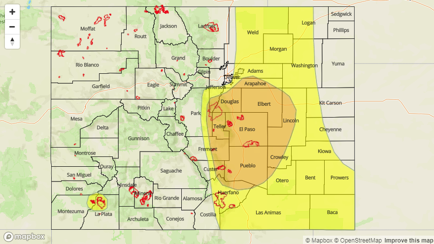
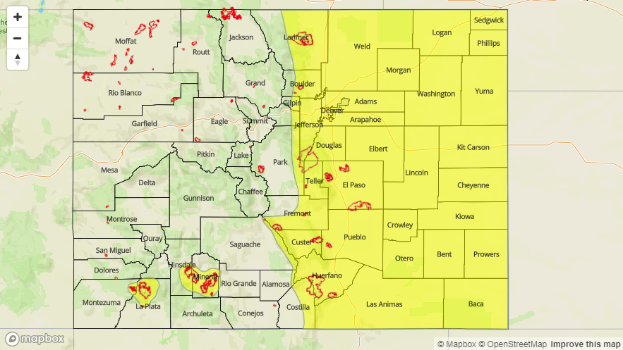
Today’s Flood Threat Map
For more information on today’s flood threat, see the map below (hover over threat areas for more details). For Zone-Specific forecasts, jump below the map.

Zone-Specific Forecasts
Urban Corridor, Palmer Ridge, Northeast Plains, Southeast Plains, and Raton Ridge:
Scattered showers/thunderstorms are expected again today/tonight, with the initial corridor of storms moving across the area from west to east, beginning around lunchtime and exiting the state around midnight. A secondary disturbance will kick off isolated-to-widely scattered showers/storms behind the initial round of storms. Most of the heavy rainfall will occur east of I-25 where low-level moisture is best, but there is enough moisture west of I-25 for brief periods of heavy rainfall. Maximum rain rates are as follows:
Urban Corridor: 1.0-1.5 inches/hour
Palmer Ridge and Raton Ridge: 1.2-1.6 inches/hour
Northeast Plains and Southeast Plains: 1.5-2.5 inches/hour
Timing: 11 AM – 1 AM
Northern Mountains, Northwest Slope, Front Range, Central Mountains, Grand Valley, Southeast Mountains, San Juan Mountains, Southwest Slope, and San Luis Valley:
Scattered showers/thunderstorms are expected today/tonight, with an area of activity already ongoing this morning. West of the Continental Divide, moisture lacks a bit, so expect rain rates to be light-to-moderate. The only area of concern west of the Divide will be the sensitive burn scars in southwest Colorado; a low flood threat has been issued. East of the Divide, moisture will be sufficient for periods of moderate-to-heavy rainfall, but storm motions will mitigate much of the flood threat concern. Still, a low flood threat has been issued, with the primary concerns being sensitive burn scars. Maximum rain rates are as follows:
Northwest Slope, Northern Mountains, Grand Valley, and Central Mountains: 0.2-0.4 inches/hour
Southwest Slope, San Juan Mountains, and San Luis Valley: 0.4-0.7 inches/hour
Front Range and Southeast Mountains: 0.6-1.2 inches/hour
Timing: Ongoing – 10 PM, with a few lingering showers/weak storms over the Front Range and Southeast Mountains until Midnight