Issue Date: 5/27/2019
Issue Time: 9:20 AM
A LOW FLOOD THREAT IS FORECAST TODAY FOR PORTIONS OF THE URBAN CORRIDOR, FRONT RANGE, PALMER RIDGE, AND NORTHEAST PLAINS.
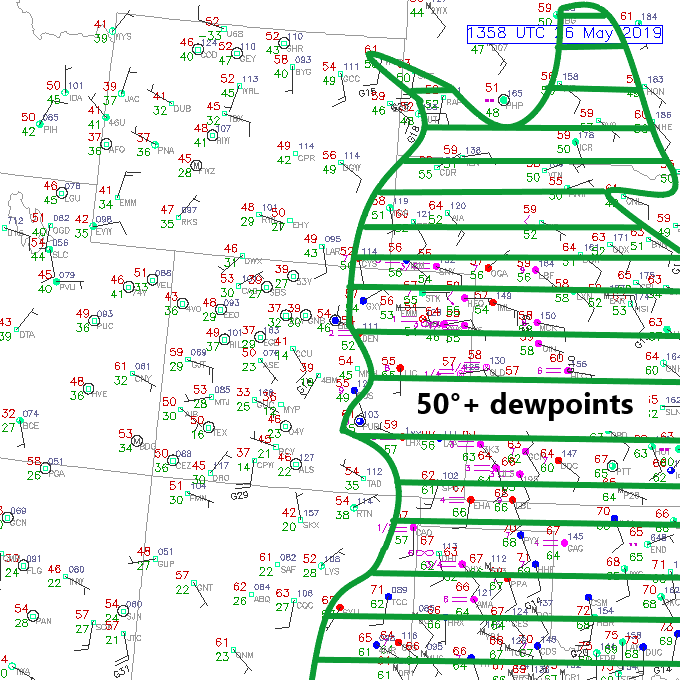
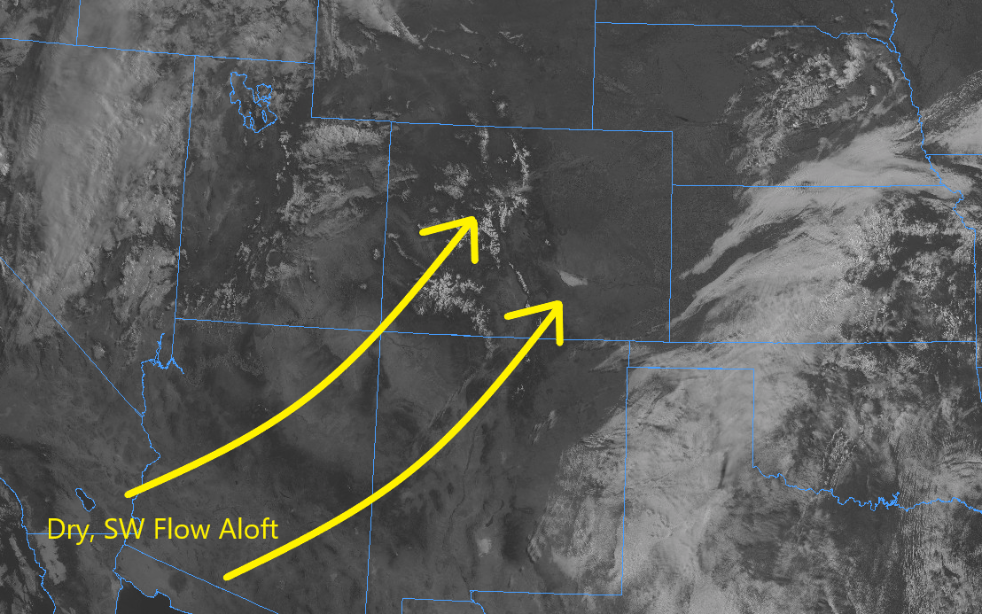
An upper-level low that has slowly progressed across the Western US over the last several days will finally begin its march into the state in earnest today, becoming centered over Colorado by 6 AM tomorrow morning. Ahead of this upper-level low, strong southwest flow aloft will contribute ample wind shear to the environment today; coupled with good instability, the development of scattered strong-to-severe storms is expected over northeast Colorado this afternoon and evening. Along with large hail, strong winds, and an isolated tornado or two, these storms will be capable of producing periods of heavy rainfall as they move towards the northeast; thus, the issuance of the low flood threat for portions of the Urban Corridor, Palmer Ridge, Front Range, and Northeast Plains.
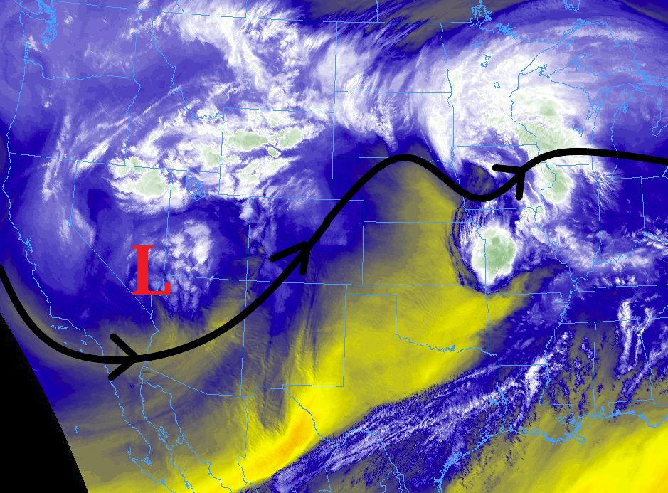
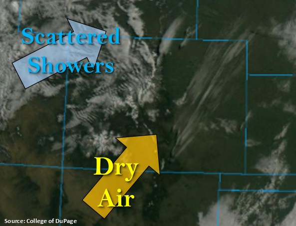
To the south, an arced dry line will set up roughly along a line from Monument – Eads – Campo; south and west of this dryline, and east of the mountains, moisture will be scoured out, and mostly sunny skies and breezy southwest winds will be the main weather story today. Over the High Country, the low will provide broad support for scattered showers/thunderstorms of the garden variety this afternoon/evening, with snow falling in the highest elevations. As the evening wears on, snow levels will drop to around 9000 feet. Jackpot totals of 6-12 inches, and perhaps up to 18 inches, will be possible for the highest elevations of the Front Range, Northern Mountains, and Central Mountain through tomorrow evening. For more details on timing and rain rates, please see the zone-specific forecast discussions below.
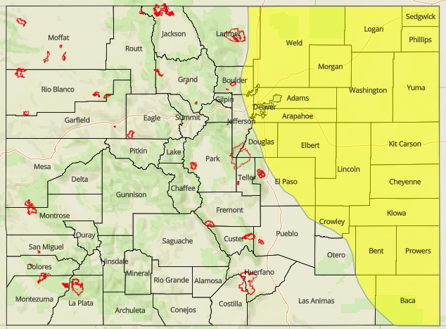
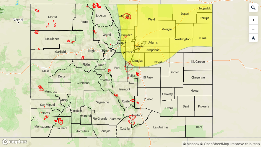
Today’s Flood Threat Map
For more information on today’s flood threat, see the map below. For Zone-Specific forecasts, jump below the map.

Zone-Specific Forecasts
Urban Corridor, Northeast Plains, Southeast Plains, Palmer Ridge, and Raton Ridge:
Scattered thunderstorms are expected north and east of the arced dryline from Monument – Eads – Campo this afternoon and evening, with a few being strong/severe, mainly north of I-70. To the south and west of this dryline, dry conditions and gusty southwest winds will be the weather story. Maximum rain rates will be 0.75-1.5 inches/hour over the Urban Corridor and Palmer Ridge, 1.5-2.25 inches/hour over the Northeast Plains, and 0.5-0.75 inches/hour over the Southeast Plains. The Raton Ridge is expected to remain dry.
Timing: Noon – 10 PM, with lingering showers/storms over the Urban Corridor and Northeast Plains into the early morning hours
Front Range, Southeast Mountains, Northern Mountains, Northwest Slope, San Luis Valley, Central Mountains, San Juan Mountains, Grand Valley, and Southwest Slope:
Scattered showers and thunderstorms are expected today, with most of the activity being garden-variety, producing periods of light-to-moderate precipitation (snow above 9000-10000 feet) and gusty winds. The Front Range, thanks to moisture transport from the east, will have the potential for a brief period of heavy rainfall, thus the inclusion in the low flood threat. Due to the approach of the upper level low, scattered activity will continue into the overnight hours across the High Country, mainly over the higher terrain. Maximum rain rates are as follows:
Front Range: 1.0-1.25 inches/hour
Southeast Mountains: 0.05-0.15 inches/hour
Central Mountains, San Juan Mountains, Southwest Slope, Grand Valley, Northwest Slope, and Northern Mountains: 0.25-0.5 inches/hour
San Luis Valley: < 0.1 inches/hour
Timing: 11 AM – 11 AM