Issue Date: 5/25/2019
Issue Time: 8:50 AM
NO FLOOD THREAT IS FORECAST TODAY.
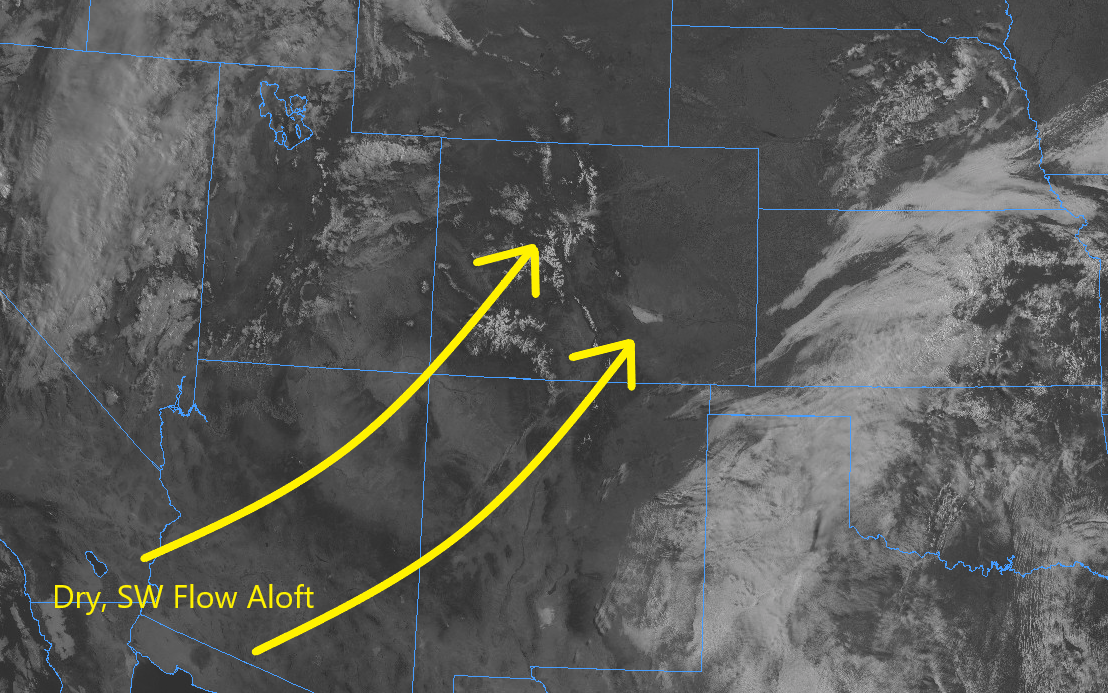
A pleasant start to the holiday weekend is expected today, as much of the state will experience abundant sunshine and temperatures a few degrees warmer than yesterday. Already this morning, you’ve probably noticed that ball of fire in the sky that has been too scarce recently. Just look at the visible satellite image below – very few clouds can be found anywhere in Colorado. Dry, southwest flow aloft, coupled with dry air in the lower levels, will make sure that remains the case for much of the state throughout the day. However, there will be two areas of exceptions to the dry rule today east of the Continental Divide.
The first area of exception will be over the far southeast plains, where dewpoints in the 50s will spread in during the afternoon hours in response to a surface low pressure circulation developing over the Raton Ridge region. This will strengthen a dry line over far southeast Colorado, which will become the forcing mechanism for a couple isolated strong-to-severe thunderstorms near the CO/KS/OK border. These storms will be capable of producing large hail (up to 2 inches in diameter), strong winds up to 70 mph, and an isolated tornado or two.
The second area of exception will be over the Front Range, Urban Corridor, Palmer Ridge, and Northeast Plains regions. During the afternoon and evening, isolated, terrain-induced, high-based showers and thunderstorms will be possible as daytime heat works on available residual moisture. Gusty winds and virga will be about all this activity can muster, with perhaps a brief period of light rain from the most persistent shower/storm. As this activity moves over the Northeast Plains this evening, access to better surface moisture will allow for periods of moderate rainfall underneath an isolated storm.
For more details on timing and rain rates, please see the zone-specific forecast discussions below.
Today’s Flood Threat Map
For more information on today’s flood threat, see the map below. For Zone-Specific forecasts, jump below the map.

Zone-Specific Forecasts
Front Range, Urban Corridor, Northeast Plains, Southeast Plains, Palmer Ridge, and Raton Ridge:
Sunny and dry for most, with isolated afternoon/evening storms within the two areas of exception listed above. Maximum rainfall rates will be as follows: 0.75-1.2 inches/hour over the far Southeast Plains associated with the strong-to-severe storms, 0.05-0.15 inches/hour over the Front Range, 0.2-0.4 inches/hour over the Urban Corridor and Palmer Ridge, and 0.5-1.0 inches/hour over the Northeast Plains.
Timing: 1 PM – 8 PM over the Southeast Plains, 1 PM – 7 PM for the Front Range, 2 PM – 8 PM for the Urban Corridor and Palmer Ridge, 3 PM – Midnight for the Northeast Plains
Southeast Mountains, Northern Mountains, Northwest Slope, San Luis Valley, Central Mountains, San Juan Mountains, Grand Valley, and Southwest Slope:
Plenty of sunshine and dry conditions will be the name of the weather game today, with high temperatures around normal for this time of year. Cumulus clouds will bubble over the higher terrain during the afternoon and evening hours as sunshine plays on residual moisture, but little-to-no precipitation is expected. The best chance at even a sprinkle will be over the higher terrain of the Central Mountains, Southeast Mountains, and Northern Mountains regions.
Timing: 1 PM – 7 PM