Issue Date: Thursday, June 20th, 2019
Issue Time: 9:20AM MDT
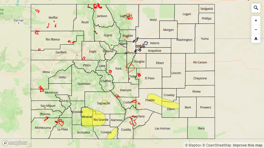
–A LOW flood threat is issued for Saguache Creek, the headwaters of the and along the Rio Grande in Mineral and west Rio Grande Counties and for the San Antonio and Conejos Rivers in south central Colorado.
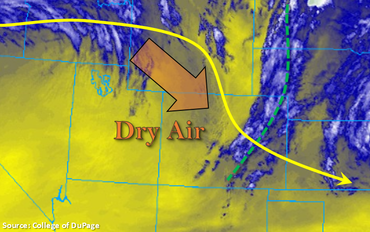
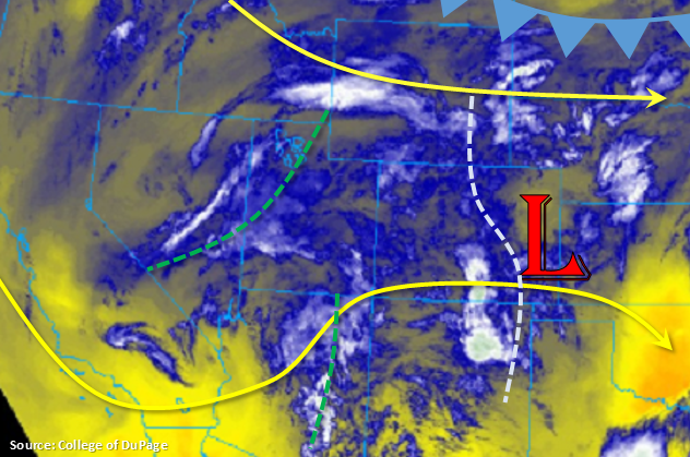
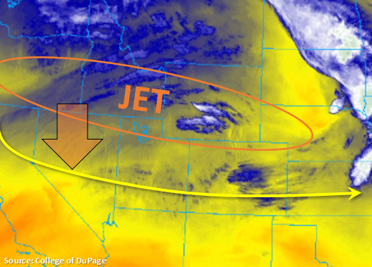
Taking a look at the water vapor imagery below, a relatively dry air mass remains over Colorado as indicated by the shades of yellow. The next system, currently over the Pacific Northwest, will begin to drop south today with the back of the jet sagging into Nevada. This will turn flow aloft from westerly to more southwesterly by this afternoon. As this transition occurs, winds will advect the drier air mass over AZ and NM into the southern half of Colorado, which should limit rainfall chances over this area. A couple light showers may form over the high terrains, but only trace amounts are forecast. Over northwest Colorado, a cold front will move through early this afternoon and help kick off thunderstorm activity. Expect trailing storms over the Northwest Slope and Northern Mountains this afternoon. Overnight rainfall is also anticipated over this area with favorable dynamics remaining over the region, so decent accumulations will be likely by tomorrow morning.
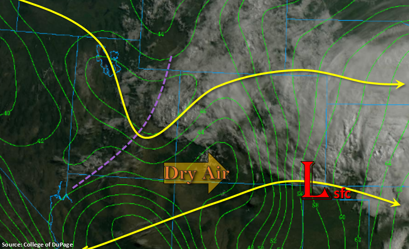
To the east, upslope flow will set off storms over the Front Range around 1PM. Additional convergence along the Palmer Ridge, due to a surface trough, will initiate some weak thunderstorms over this area as well. Expect the high-based storms to move west and then northwest with the flow aloft. Limited low-level moisture and fast steering winds will likely only produce moderate rainfall totals, so flooding is not anticipated. Over the Southeast Mountains, downsloping winds on the southwest side of the surface trough will keep rainfall limited to along and near the Continental Divide.
The Low flood threat continues for Saguache Creek, the headwaters of the and along the Rio Grande in Mineral and west Rio Grande Counties and for the San Antonio/Conejos Rivers in south central Colorado. Minor flooding continues to be reported by local emergency management over these areas. Elevated flows continue over the upper Arkansas River, but flows are forecast to decrease east of Pueblo Dam. No AHPS gages are not forecast to rise above Action stage today.
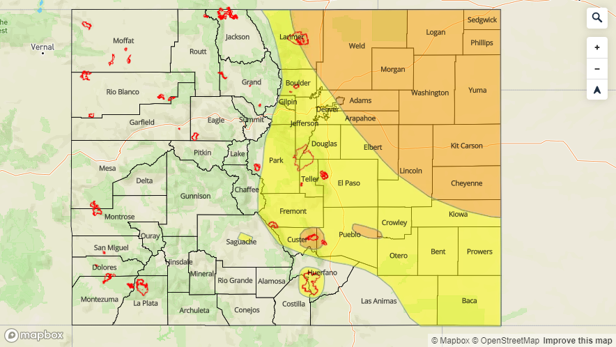
Today’s Flood Threat Map
For more information on today’s flood threat, see the map below. For Zone-Specific forecasts, scroll below the map.


Zone-Specific Forecasts:
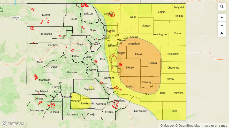
Front Range, Palmer Ridge, Urban Corridor, Northeast Plains, Northern Mountains, Northwest Slope, Grand Valley, Central Mountains:
Thunderstorms are forecast to be high-based this afternoon, which should limit the rainfall reaching the surface. Gusty winds may be possible along with small hail and dangerous cloud to ground lightning under the stronger storms. Highest rainfall accumulations for the day are anticipated over the northwest corner due to trailing storms and over the far Northeast Plains where better moisture remains intact. Storms over eastern Colorado should end by midnight. Flooding is not forecast, and max 1-hr rain rates are as follows:
Northwest Slope/Northern Mountains: 0.3 inches with 24-hour totals up to 0.8 inches over the Northern Mountains
Central Mountains/Front Range/Palmer Ridge: 0.1 inches
Northeast Plains: 0.5 inches
Primetime: 12PM to 9AM
San Juan Mountains, Southwest Slope, San Luis Valley, Southeast Plains, Southeast Mountains, Raton Ridge:
Best chance for rainfall today will be over San Juan Mountains and Southeast Mountains near the Divide. With dew points dropping off to below 30°F, more cloud cover is anticipated than rainfall. However, a couple storms may produce a sprinkle or two. Skies will begin to clear overnight as the southwest winds pull in a very dry air mass from Arizona and New Mexico. High temperatures similar to yesterday will continue to melt the snowpack, so rivers will remain elevated again this afternoon. Flows are anticipated to drop off over the Arkansas, so the flood threat has been removed. Please follow your local NWS office for the latest on the riverine flooding threat over your area.
Primetime: 1PM to 7PM