Issue Date: Monday, July 22, 2019
Issue Time: 10:05AM MDT
–A MODERATE threat is issued for portions of the Southeast Mountains and Raton Ridge. This threat includes the Spring Creek, Hayden Pass and Junkins burn areas
–A LOW threat is issued for portions of the Front Range, Urban Corridor, and Palmer Ridge
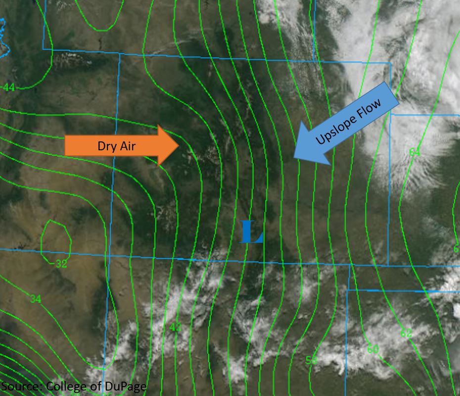
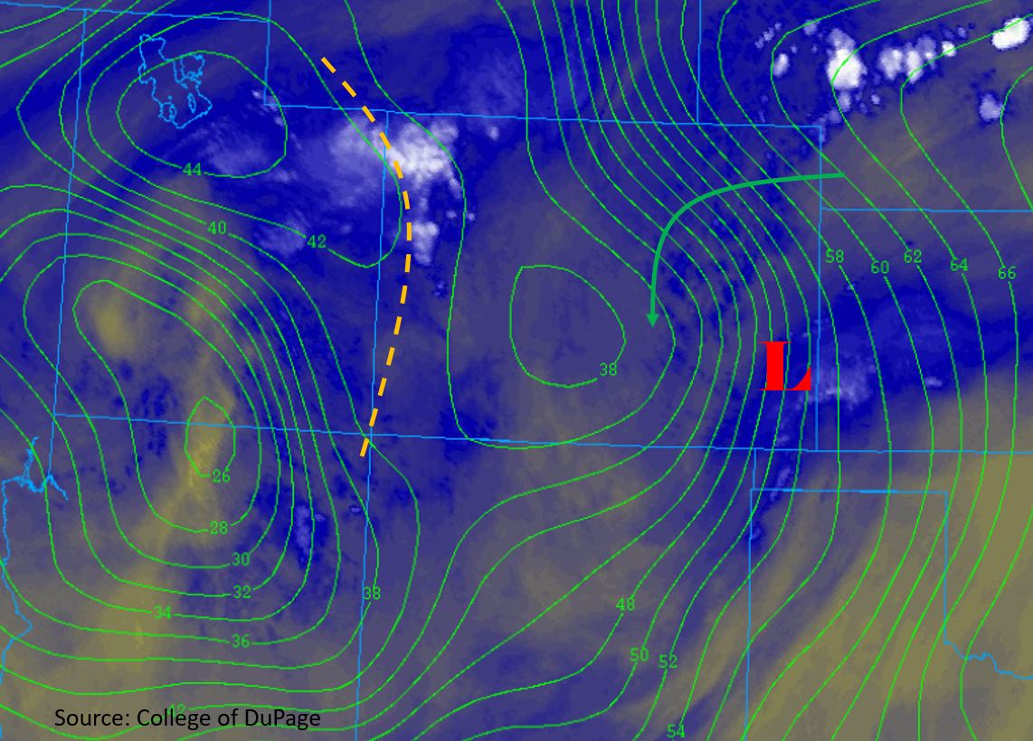
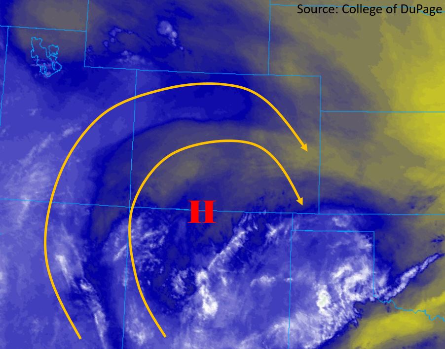
Moderate to heavy rainfall will return today over the Southeast Mountains and Raton Ridge, adding additional moisture to saturated soils. The high pressure ridge aloft continues to move its way to the east and is now centered over the CO/NM border (marked “H” in the water vapor imagery below). Mid and upper level flow on the backside of the high (yellow lines below) will bring in moisture from the southwest, providing chances for afternoon thunderstorms over the high country. A large region of surface high pressure over the Northern Great Plains today will provide cooler surface winds and moderate moisture advection to the eastern plains from the east-southeast. A small region of low pressure is expected to form over the San Luis Valley again this morning and into the early afternoon, pulling moisture up and over the Southeast Mountains from the Southeast Plains.
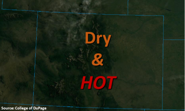
Morning and early afternoon cloud cover will keep temperatures cooler over the eastern plains, thus limiting instability this afternoon for potential thunderstorm growth. West of the Continental Divide, dry surface conditions and sunny skies this morning will confine thunderstorms to the high county, allowing another hot day over the valleys of the western slope. Upslope flow over the Front Range and Palmer Ridge will provide a chance for thunderstorms over the area. Storms may move over the Urban Corridor and Palmer Ridge this afternoon, but upper level steering flows out of the north-northeast at 15-20 mph will prevent storms from traveling far over the eastern plains.
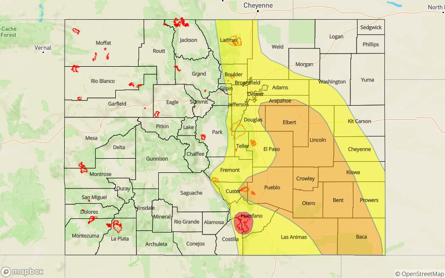
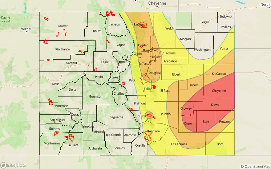
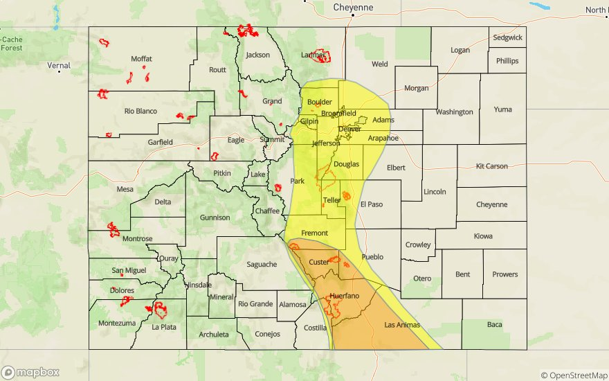
Today’s Flood Threat Map
For more information on today’s flood threat, see the map below. For Zone-Specific forecasts, scroll below the map.

Zone-Specific Forecasts:
Southeast Mountains, Raton Ridge, Front Range, Urban Corridor, Palmer Ridge, Northeast Plains and Southeast Plains:
Chances for afternoon thunderstorms are high again today over the Front Range, Urban Corridor, Southeast Mountains and Raton Ridge. Upper level moisture will return from the west today and combine with upslope flow from the east to provide lift over the Continental Divide. A Moderate threat has been issued for the Southeast Mountains and Raton Ridge, including the Hayden Pass, Junkins and Spring Creek burn areas. Chances for thunderstorms will begin around 1PM, but the primary threat will be from 4PM to 11PM. Max 1-2 hour rainfall rates between 1.5 inches and 1.75 inches are forecast over the areas of Moderate threat. Ground conditions are likely close to saturated due to moderate and heavy rain over the weekend, which greatly increases the chances for flash flooding, especially over recent burn areas. Threats include: flash flooding, debris flows, mud slides, flooding of small streams and rivers, and flooding of roadways.
Thunderstorms are forecast to begin over the Front Range around 1PM and travel eastward over the Urban Corridor between 3 and 4PM. 1-hour rainfall rates up to 1.5 inches are forecast over the Urban corridor, with 1-hour rainfall rates up to 1 inch over the Front Range. Heavy rain over the weekend enhances chances for flooding even with lower rainfall rates. Storms may additionally form over the Palmer Ridge mid-afternoon, but upper level winds and insufficient instability will limit the storms from traveling far to the east. Primary threats include: flooding of small rivers and stream, flooding of roadways and low laying intersections, and field ponding. The Northeast and Southeast Plains are not forecast to have severe weather due to cloud cover this morning. Small thunderstorms may travel over the Southeast Plains early this evening but max 1-hour rainfall rates are forecast to be 0.75 inches.
Primetime: 1PM to 11PM
Northwest Slope, Grand Valley, Northern Mountains, Central Mountains, Southwest Slope, San Juan Mountains and San Luis Valley
Afternoon thunderstorms are forecast over the high country today. Mid-level moisture will return throughout the day from the south-southwest, aiding upslope flow to produce thunderstorms. Convergence over the San Luis Valley will provide a chance for thunderstorms over the climatologically dry area. Max 1-hour rainfall rates up to 0.75 inches is forecast over the area. Thunderstorms are primarily forecast over the San Juan Mountains, Central Mountains and Northern Mountains, favoring the high elevations. Max 1-hour rainfall rates of 0.6 inches is forecast over these areas. Storms tracking near the 416 burn area could produce 0.5 inches in an hour, but flooding is unlikely. High temperatures up to 100°F are forecast over the Grand Valley and Southwest Slope again today.
Primetime: 12PM to 7PM