Issue Date: Wednesday, September 4th, 2019
Issue Time: 8:45AM MDT
— Flooding is NOT expected today
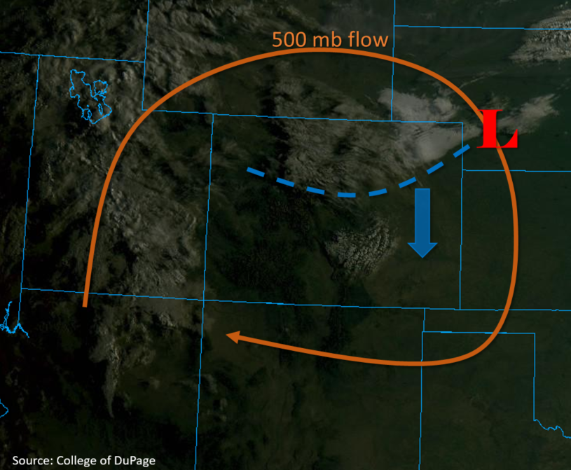
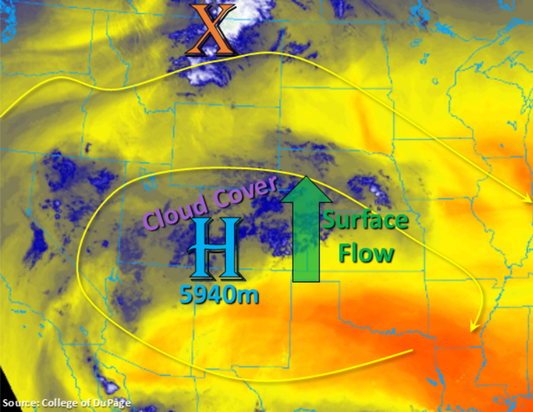
Temperatures will be back on the rise again today without a cold front to provide any relief from the heat. The one saving grace from hot temperatures will be the increased cloud cover over the state (areas of blue shading in the water vapor imagery below), which may keep some areas a couple of degrees cooler than they normally would be. For the majority of the state, the broken cloud cover is expected burn off significantly with a few hours of heating, which will allow some (limited) instability to build for another round of afternoon and evening storms. Similar pattern to yesterday with the 500mb high in place over the southwest corner of the state. This is pulling in several disturbances across the state from the west and southwest. Expecting another wave to travel though the flow this afternoon and help spark more widespread storm coverage over the mountains with a little activity spilling into the adjacent eastern plains (Palmer Ridge/Northeast Plains). Steering flow speed will be slow to moderate and direction will be westerly over the mountains with storms gaining a little bit of a southerly component over the eastern plains as they rotate around the high.
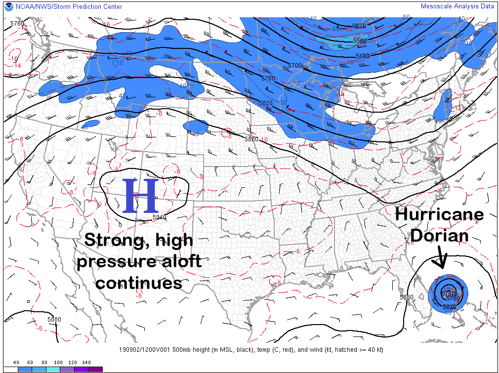
Not quite as much moisture to work with today with westerly flow aloft washing out moisture from west to east. This will act to decrease dew points a bit over western Colorado when compared to yesterday. Thus, high-based storms that are able to form will produce more wind and virga than measurable rainfall. Over eastern Colorado, surface winds will also be more southerly as the trough passes to the north (just west of the orange “X” below). PW was measured at 0.89 inches at Denver, but most of moisture was located in the mid and upper levels of the sounding. Thus, high-based storms today may produce brief, windy conditions. There is also a slight cap above 500mb, but not thinking it is strong enough to suppress convection over the immediate adjacent plains. A stronger cap is in place over the eastern plains and with instability decreasing by the time storms reach this area (sunset), storms are expected to dissipate quickly. Flooding is not forecast for storms that form today.
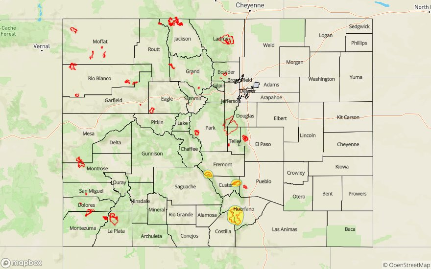
Today’s Flood Threat Map
For more information on today’s flood threat, see the map below. For Zone-Specific forecasts, scroll below the map.
Zone-Specific Forecasts:
Front Range, Central Mountains, San Juan Mountains, Urban Corridor, Northeast Plains, Palmer Ridge:
Best chance for measurable precipitation this afternoon over the mountains will be over the southern Front Range, San Juan Mountains and eastern Central Mountains. Brief winds and moderate rainfall will be possible with thunderstorms that from with max 1-hour rain rates up to 0.4 inches possible. Trailing storms may cause storm totals up to 0.6 inches along and near the Continental Divide. As storms move into the adjacent plains, they will have the best chance for survival along the elevated terrains of the Palmer Ridge. Max 1-hour rain rates up to 0.6 inches will be possible with rain rates decreasing to 0.25 inches/hour over the northern Urban Corridor. There is a slight chance for a storm to move into Weld County that forms over the Cheyenne Ridge, if the cap can break, max 1-hour totals up to 0.9 inches will be possible. However, there is less than a 30% chance of this happening. Flooding is not forecast and the main threats from storms today will be wind, lightning and isolated, moderate rainfall.
Primetime: 1PM to 11PM
Northwest Slope, Grand Valley, Southwest Slope, Northern Mountains, Southeast Mountains, San Luis Valley, Raton Ridge, Southeast Plains:
Expecting more cloud cover than rainfall over the Northern Mountains, Southeast Mountains and Raton Ridge. Should a storm be able to form, less than 0.05 inches of rainfall is anticipated. The Southeast Plains and San Luis Valley should be clear this afternoon with temperatures in the 90°Fs and 80°Fs, respectively. A little bit of cloud cover is likely over the Northwest/Southwest Slope and Grand Valley with the disturbances moving in from the west. Highs will still be able to reach the upper 80°Fs and 90°Fs over these western lower elevations with 70°Fs over the higher elevations.