Issue Date: 9/2/2019
Issue Time: 7:05 AM
NO FLOOD THREAT IS FORECAST TODAY.
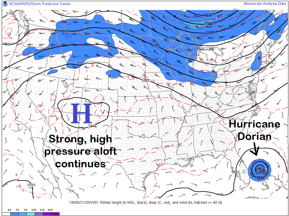
Record high temperatures fell yesterday, and more are likely to fall today, as the strong high pressure continues its grip on the region. Abundant sunshine and relatively little cloud cover will allow for maximum solar heating today, and the dry air will leave the state with very little chances for respite. The San Juan Mountains and Southeast Mountains will see a couple isolated, high-based storms develop during the afternoon/evening hours, but little (if any) rainfall will reach the surface. Instead, gusty winds and occasional cloud-to-ground lightning will be the main impacts. There is also a less than 10% chance, much like yesterday, of an isolated storm or two over the Palmer Ridge, and adjacent Northeast/Southeast Plains; most likely, it will be just a bit of late afternoon cloud development. Other than those two scenarios, I hope everyone enjoys the heat and sunshine, because that is what Mother Nature has in store for Colorado.
Today’s Flood Threat Map
For more information on today’s flood threat, see the map below. For Zone-Specific forecasts, jump below the map.


Zone-Specific Forecasts
Urban Corridor, Northeast Plains, Southeast Plains, Palmer Ridge, and Raton Ridge:
Sunny skies and hot temperatures will be the main weather story today. A couple isolated, high-based thunderstorms have a less than 10% chance to rumble over the Palmer Ridge and adjacent Northeast/Southeast Plains. IF a storm develops, the main impact will be a brief period of light-to-moderate rainfall (less than 0.20 inches/hour) and gusty winds.
Timing: 2 PM – 8 PM
Front Range, Southeast Mountains, Northern Mountains, Northwest Slope, Grand Valley, Central Mountains, San Luis Valley, San Juan Mountains, and Southwest Slope:
Abundant sunshine and near-record temperatures will rule the day across the vast majority of the area. A couple isolated, high-based thunderstorms will rumble over the San Juan Mountains and Southeast Mountains, but very little rainfall will make its way to the surface. Instead, the main impacts from any activity will be gusty winds and occasional cloud-to-ground lightning. Rain rates will be less than 0.10 inches/hour.
Timing: Noon – 9 PM