Issue Date: Monday, June 22nd, 2020
Issue Time: 9AM MDT
— Flooding is NOT expected today
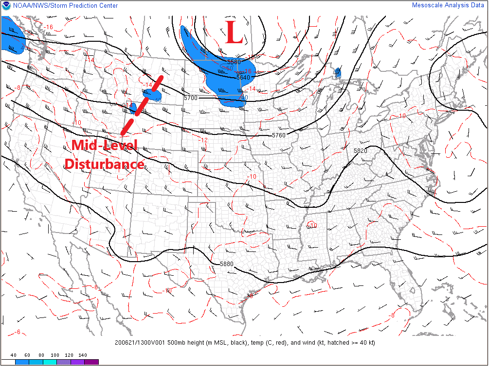
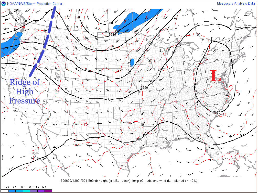
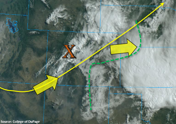
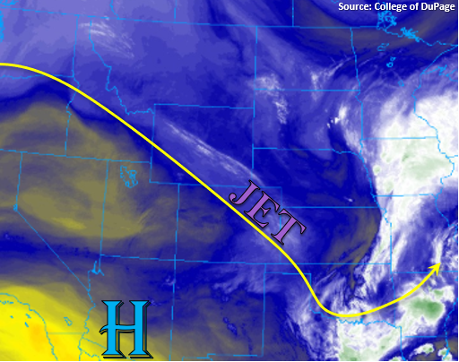
Northerly flow aloft will be in place over the state today, which will help keep highs a little cooler than they normally would be. Below you can see the mid-level moisture over the state, which is strongest over eastern Colorado. The 500mb High to our southwest is expected to strengthen, which will move the marked jet stream, over eastern Colorado, into Kansas/Nebraska throughout the day. Although it may look moist below, it is much drier at the surface with dew points around and below 30F over western Colorado. This should limit the precipitation chances over the area, but a couple high-based afternoon showers will still be possible over the western mountains near the Divide.
Dew points over eastern Colorado range from mid-40Fs (west) to mid-to-upper 50Fs (east), and it is expected that some of the surface moisture (west) will mix out throughout the day. There should be enough remaining moisture under the building ridge for some weak, high-based showers and thunderstorms to form over the Front Range, Palmer Ridge, and Southeast Mountains with afternoon, upslope flow. The highest coverage is expected to be over the southern Front Range/Palmer Ridge intersect with light rainfall forecast over the mountains/urban corridors and moderate rainfall possible over the Palmer Ridge. As storms move southeast with the steering flow, the will move into higher dew points over the Southeast Plains as a surface low is forecast to develop just south of that area in northern New Mexico. This will intensify the storms and may allow a weak, severe thunderstorm or two to form over the Southeast Plains (Baca and eastern Las Animas Counties). Rainfall rates are expected to remain below the 1.50 inch flood threat criteria, so flooding is not forecast. A couple light, lingering showers are possible tonight east of I-25 and south of I-70 as mid-level energy (shortwave) moves through the northwest flow.
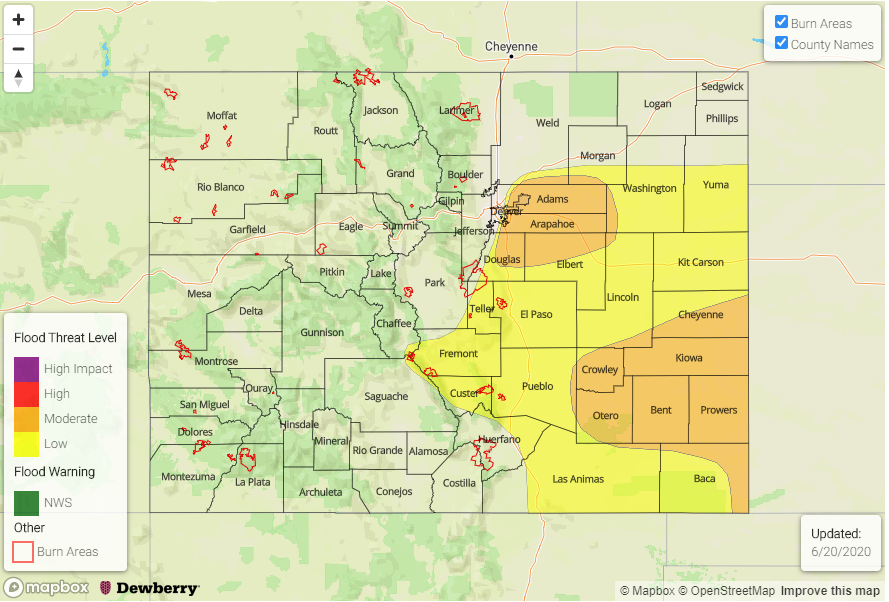
Today’s Flood Threat Map
For more information on today’s flood threat, see the map below. If there is a threat, hover over the threat areas for more details, and click on burn areas to learn more about them. For Zone-Specific forecasts, scroll below the threat map.

Zone-Specific Forecasts:
Southeast Mountains, Front Range, Palmer Ridge, Southeast Plains, Northeast Plains, & Raton Ridge:
It should remain dry over the Northeast Plains this afternoon due to storm motion and low dew points. Best moisture will be over the Southeast Plains, Raton Ridge, and Palmer Ridge. Therefore, moderate rainfall may be possible with max 1-hour rain rates up to 0.60 inches possible over the ridges. Over the far southeast corner, max 1-hour rain rates up to 1 inch will be possible with severe hail under the strongest cores and brief, gusty winds. Over the Front Range and immediate adjacent plains, totals will be closer to 0.25 inches under the stronger storms with lower rain rates for the Southeast Mountains. Therefore, flooding is not anticipated. Reminder that there may be a couple light, lingering overnight showers over the Southeast Plains.
Primetime: 1PM to 12AM
Central Mountains, San Juan Mountains, Northern Mountains, Northwest Slope, Grand Valley, San Luis Valley, & Southwest Slope:
Best chance for rainfall will be near the Divide over the Central and San Juan Mountains. Storms will most likely produce virga with the dry boundary layer promoting evaporation, but light rainfall could reach the ground over the San Juan Mountains. A Red Flag Warning has been issued for the Southwest Slope due to northwest winds in the 10 to 20 mph range this afternoon (gusts to 30) and relative humidity dropping into the teens. See NWS Grand Junction for the latest.