Issue Date: Thursday, June 11th, 2015
Issue Time: 9:00 AM MDT
Summary:
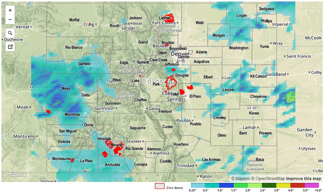
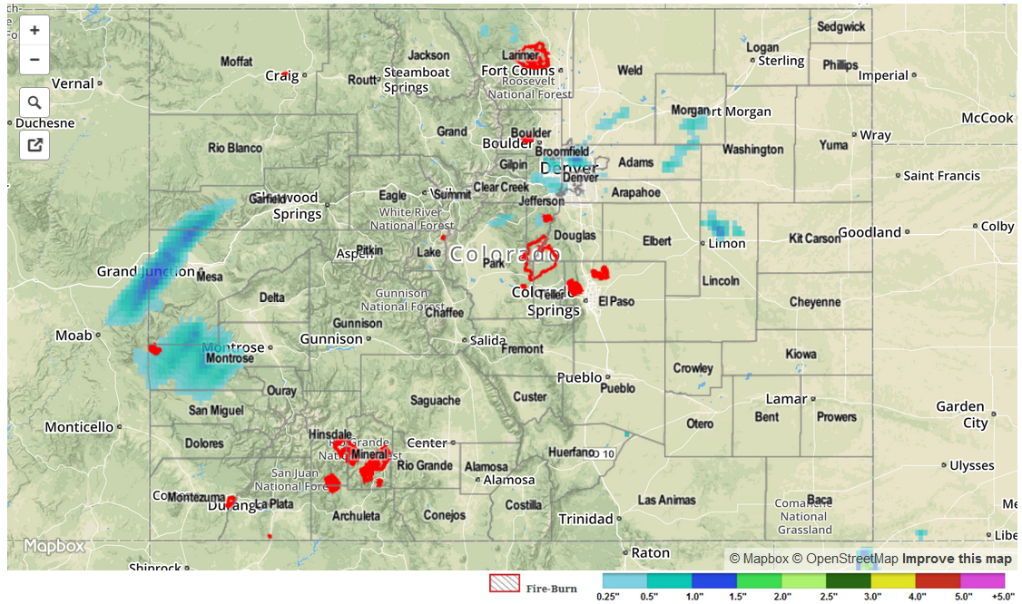
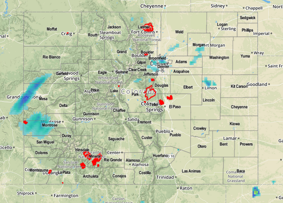
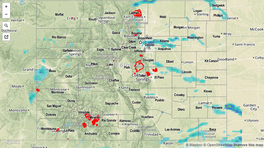
A disturbance slowly moving across the state coordinated multiple rounds of storm activity across most of Colorado. Over the southern half of the state, storms had to battle very dry air aloft to survive, which likely reduced rainfall rates. Twenty-four hour rain totals amounted to over an inch in Douglas, Mesa and La Plata counties as well as isolated areas in far eastern Colorado. Meanwhile, the highest hourly rain rates may have occurred with a batch of storms moving eastward off the higher terrain and into the Urban Corridor between 3 and 5 PM. One such storm passed over the sensor-rich Urban Drainage ALERT network, dumping about 0.9 inches of rain in less than an hour at two separate gauges.
In addition to the heavy rain, strong winds were reported in Cheyenne county and a funnel cloud was reported in El Paso county.
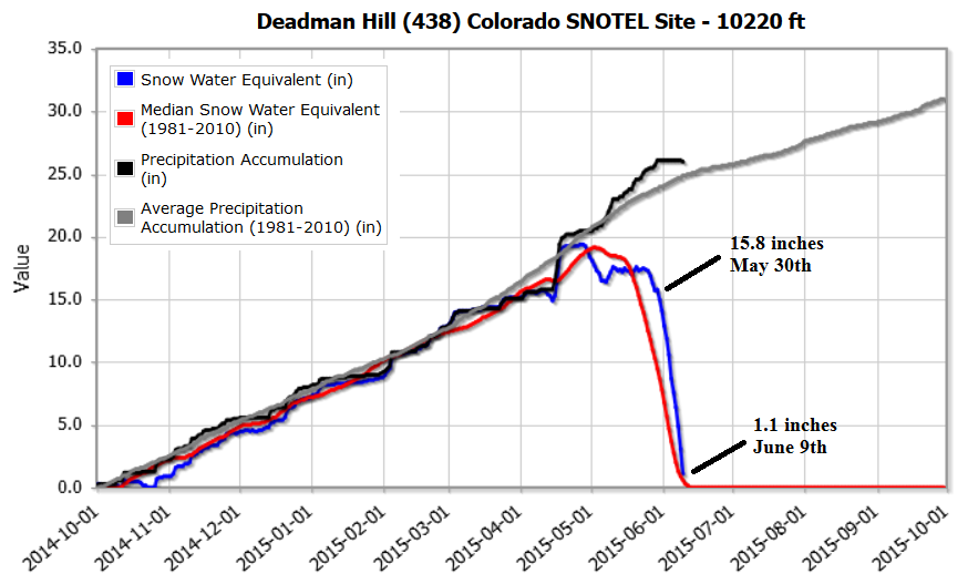
Meanwhile, the rapid snowmelt continued in the higher terrain. Elevations below 10,000 feet are essentially snow-free with the remaining snowpack retreating towards wooded, very high-elevation regions between 10,000 feet and the treeline.
No official flooding reports were received yesterday. For estimated rainfall in your area, be sure to check out the rainfall map below.