Issue Date: Monday, June 8th, 2015
Issue Time: 9:00 AM MDT
Summary:
FLOOD WARNINGS/ADVISORIES CONTINUE FOR PORTIONS OF THE CACHE LA POUDRE RIVER, SOUTH PLATTE RIVER, ARKANSAS RIVER, SOUTH BOULDER CREEK AND VARIOUS STREAMS AND RIVERS ACROSS WESTERN COLORADO DUE TO SNOWMELT AND RAINFALL RUNOFF.
Another day with precipitable water values running above average led to scattered showers and thunderstorms. A few severe storms were generated over the Northeastern and Southeastern Plains, producing hail up to 1 inch in diameter. These few severe reports indicating large hail came from Phillips and Baca Counties yesterday afternoon. Overall, the coverage of thunderstorms was down from the previous day, but heavy rain was still produced by stronger thunderstorms. Flash flooding was observed in the Denver Metro Area as a car was left stranded on the off-ramp from I-70W to I-25S. Additionally, flash flooding was observed in the Park Hill area of Denver, and other street flooding occurred at low-lying intersections.
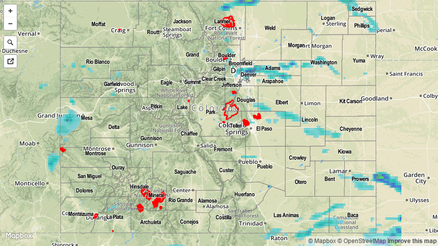
For a look at statewide rainfall totals, be sure and check out the radar-estimated Storm Total Precipitation map below.