Issue Date: Wednesday, June 10th, 2015
Issue Time: 9:10 AM MDT
Summary:
Pulses of energy from the upper-level system over California made their first appearance in Colorado on Wednesday. Most action was limited to west of the Divide where the atmosphere began to moisten up, allowing for showers and a few low-end thunderstorms. Fortunately, most rain rates were light and no flooding was reported.
East of the Divide, the presence of dew points in the 40s and 50s often signifies a heavy rainfall threat. However, the upper-level dynamics were just not conducive…yet! Nonetheless, a rogue batch of cells popped up over the I-70 corridor west of Denver in the late afternoon. As these cells moved eastward, where moisture was more plentiful, one of the cells managed to dump just under an inch of rain in an hour over Jefferson and Adams counties. Aside from nuisance street ponding, no problems were reported. The cells quickly fell apart towards sunset.
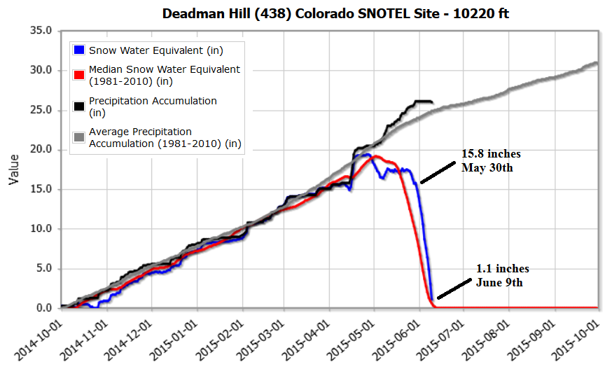
Switching topics a bit, we are deep into snowmelt season. This year’s melt-off has been gradual enough where serious flooding was thus far been avoided. There remain some flood advisories for mountain streams in the Front Range, Central Mountains and San Juans, These flooding concerns should ease in the very near future as the snowpack has drastically receded over the past week in all but the highest of elevations. For example, check out this impressive melting at the Deadman Hill SNOTEL site (data from USDA’s Natural Resources Conservation Service). That’s 14.7 inches of Snow Water Equivalent (or about 30 inches of snow depth) gone in just 10 days!
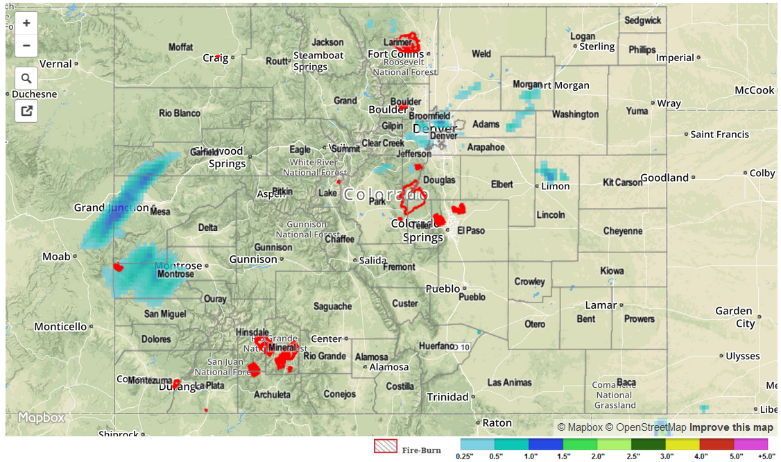
For estimated rainfall in your area, be sure to check out the rainfall map below.