STP 06-27-2015: High Pressure Expanded Across Colorado, Confined Most Activity to the High Country

Issue Date: Saturday, June 27th, 2015
Issue Time: 9:00 AM MDT

Summary:

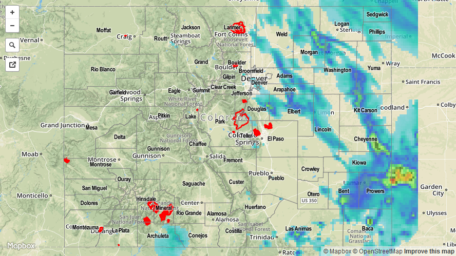
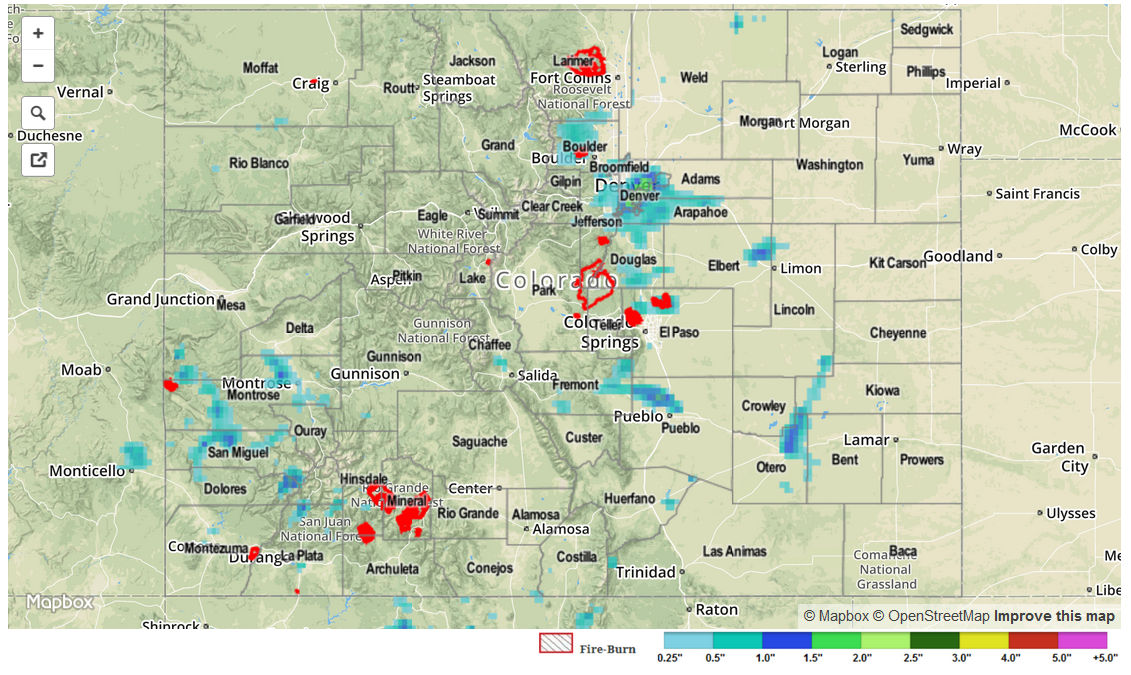
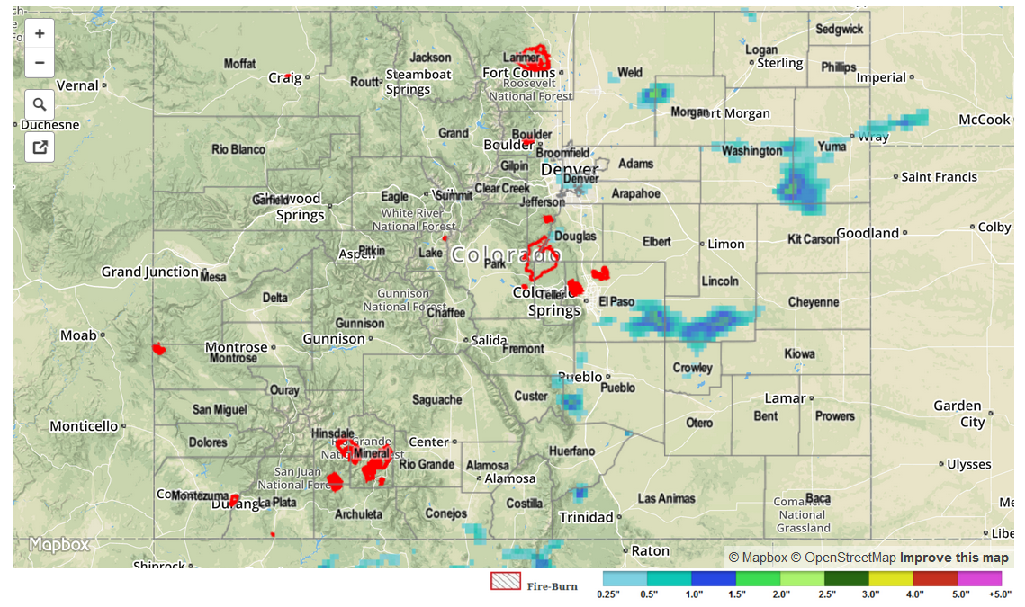
With upper-level high pressure building across the western US, thunderstorm activity across Colorado was suppressed a bit over previous days. As temperatures warmed up during the afternoon, isolated-to-widely scattered showers and thunderstorms were able to develop, impacting mainly the high country. A couple of thunderstorms found themselves over the I-25 corridor south of Highway 50, producing lightning, gusty winds, and brief heavy rain.

An Areal Flood Advisory was issued for Teller and portions of Fremont County during the evening as a relatively slow moving thunderstorm drifted across the area. There were no flash flood reports in the area, however, and no other flash flooding was reported yesterday. As far as severe storm reports are concerned, the only report came in from Custer County; 1 inch hail fell in Rosita around 6 PM.


Storm Total Precip Legend

STP 06-26-2015: One Hail Of A Day

Issue Date: 6/26/2015
Issue Time: 9:03AM

Active weather continued across the state on Thursday, as unseasonably high low-level moisture levels produced many a thunderstorm. Although there was plenty of heavy rainfall to go around (more on that later), the theme of Thursday was: hail. Almost every single strong thunderstorm deposited hail. By far the most menacing of the storms was the cell near Keenesburg that produced multiple reports of tennis ball size, or 2.5 inch diameter, hailstones. Many broken windows were reported, though perhaps Mother Nature spared us the worst with the storm traveling over relatively sparsely populated areas.

Heavy rainfall was also observed across many parts of the state. Thankfully, most of the heavy rainfall occurred in very short spells, on the order of 15-30 minutes due to a general lack of wind shear. The highest observed 24-hour totals came in from the Northeast and Southeast Plains were Kit Carson and Prowers counties received over 2 inches. However, short-term heavy rainfall also occurred over the San Juan mountains and the Grand Valley, where many locations picked up 0.25 to 0.75 inches over a matter of 15-45 minutes.

Meanwhile, without widespread rainfall, the very high river levels continue to slowly fall across the state. This morning, only one gage officially remained in Minor flood stage: the Arkansas River at La Junta.

No official reports of flash flooding were received yesterday. For estimated rainfall in your area, be sure to check out the rainfall map below.

06262015_STPImage
Storm Total Precip Legend

STP 06-25-2015: Active Day, But Especially So For Denver Metro

Issue Date: 6/25/2015
Issue Time: 9:05 AM

Storm coverage and intensity increased on Wednesday as upper-level southwesterly “return flow” provided better conditions for storm formation. Although most storms across the state were not overly impressive, with maximum rainfall anywhere between 0.5 and 1 inch, two particularly storms were noteworthy. First, a storm near Pueblo dumped torrential rain over a short period of time, leading to street flooding in the city. This storm also produced 1.75 inch hail west of town. Second, a very impressive storm blossomed over downtown Denver and produced very heavy rainfall, hail up to 1.5 inches and even prompted a tornado warning. This storm dumped around 2 inches per hour at a few Urban Drainage ALERT gages. Needless to say, this much water falling over a highly impervious area caused tremendous runoff resulting in many flash flood and flood reports just east of I-25 near downtown. Fortunately, the storm was very localized, with only about a 150 square mile area receiving over 1 inch of rain. Nonetheless, the impact was very strong. The highest 24-hour rain totals in the area were just northeast of downtown Denver. About a dozen 1+ inch reports were received across Boulder, Denver, Adams, Arapahoe and Jefferson counties.

Meanwhile, there was also action across the Divide in the San Juan mountains where many popcorn type thunderstorms dumped short-term, but heavy rainfall before dissipating. Although highest official 24-hr rainfall was only about 0.4 inches in the region, our radar estimated product suggests near 1 inch of rainfall fell over remote parts of Dolores and San Miguel counties.

For estimated rainfall in your area, be sure to check out the rainfall map below.

STP_snapshot_20150625

STP 06-24-2015: Storms Dot The Landscape Once Again

Issue Date: 6/24/2015
Issue Time: 8:55AM

Though conditions were not optimal for their development, thunderstorms took full advantage of the high moisture content in the low levels of the atmosphere on Tuesday. Storms formed mainly east of the Divide by mid-afternoon, and progressed farther eastward towards the late evening hours. As expected, most thunderstorm rainfall was quite light, generally 0.25 inches or less. However, a few storms were able to reach maturity and produce over 1 inch of rainfall. This was observed for several separate thunderstorms, covering Washington, Lincoln and Las Animas counties.

In addition to the rainfall, many storms produced hail. Most of the hail was pea-size to penny-size but one particularly strong cell in eastern El Paso County produced 1 inch hail.

Meanwhile, river levels continued to slowly subside as the snowpack is virtually all gone, except in deeply forested areas.

No flash flooding was reported yesterday. For estimated rainfall in your area, be sure to check out the rainfall map below.

STP_snapshot_20150624