Issue Date: 6/25/2015
Issue Time: 9:05 AM
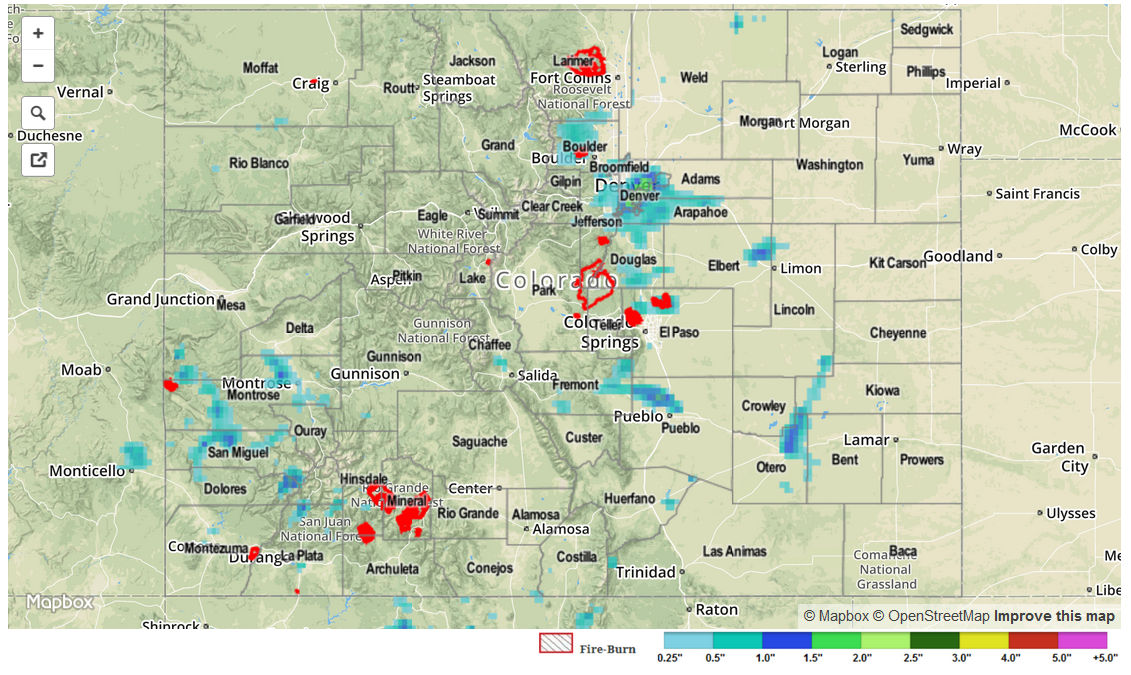
Storm coverage and intensity increased on Wednesday as upper-level southwesterly “return flow” provided better conditions for storm formation. Although most storms across the state were not overly impressive, with maximum rainfall anywhere between 0.5 and 1 inch, two particularly storms were noteworthy. First, a storm near Pueblo dumped torrential rain over a short period of time, leading to street flooding in the city. This storm also produced 1.75 inch hail west of town. Second, a very impressive storm blossomed over downtown Denver and produced very heavy rainfall, hail up to 1.5 inches and even prompted a tornado warning. This storm dumped around 2 inches per hour at a few Urban Drainage ALERT gages. Needless to say, this much water falling over a highly impervious area caused tremendous runoff resulting in many flash flood and flood reports just east of I-25 near downtown. Fortunately, the storm was very localized, with only about a 150 square mile area receiving over 1 inch of rain. Nonetheless, the impact was very strong. The highest 24-hour rain totals in the area were just northeast of downtown Denver. About a dozen 1+ inch reports were received across Boulder, Denver, Adams, Arapahoe and Jefferson counties.
Meanwhile, there was also action across the Divide in the San Juan mountains where many popcorn type thunderstorms dumped short-term, but heavy rainfall before dissipating. Although highest official 24-hr rainfall was only about 0.4 inches in the region, our radar estimated product suggests near 1 inch of rainfall fell over remote parts of Dolores and San Miguel counties.
For estimated rainfall in your area, be sure to check out the rainfall map below.