STP 08-18-2015: Strong-to-Severe Thunderstorms Produced Heavy Rain, Hail, Strong Winds, and a Couple Tornadoes

Issue Date: Tuesday, August 18th, 2015
Issue Time: 9:00 AM MDT

Summary:

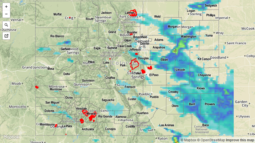
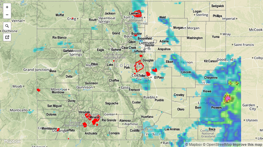
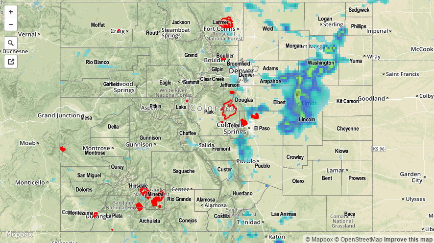
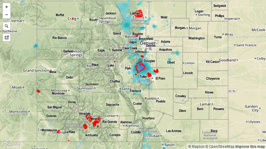
A robust shortwave trough moved overhead yesterday, bringing broad-scale support for thunderstorms to Colorado, especially for areas along and east of the Continental Divide. Instability from daytime heat, a surface cool front, moist upslope flow, and the dynamics from the trough all combined to create intense convection, with many thunderstorms quickly becoming strong-to-severe. A quick glance at storm reports from yesterday shows just how intense the thunderstorms were:

1.75 inch hail: 1 mile E of Crook (Logan)
1.50 inch hail: 4 miles WSW of Sedgwick (Sedgwick), Crook (Logan)
1.0 inch hail: 6 miles WSW of Wiggins (Weld), 4 miles N of Elizabeth (Elbert), 2 miles S of Pine Junction (Jefferson)

Tornado: 8 miles WNW of Last Chance (Adams), 5 miles SW of Kiowa (Elbert)

With the amount of moisture available, heavy rain attended all thunderstorms, but storm motions helped to mitigate the flood threat. The following heavy rain observations were reported to the local National Weather Service offices:

4 miles W of Lamar: 1.84 inches
7 miles N of Lamar: 2.00 inches
2 miles W of Las Animas: 1.10 inches
1 mile NE of La Junta: 1.35 inches

Flash flooding was observed in the following locations:

7 miles N of Lamar (Prowers County) – Many county roads flooded
La Junta (Otero County) – Highway 50 flooded

08182015_STPImage
Storm Total Precip Legend

STP 08-17-2015: Strong Thunderstorms Produced Heavy Rain, Hail, Strong Winds, and Even a Tornado

Issue Date: Monday, August 17th, 2015
Issue Time: 9:00 AM MDT

Summary:

Yesterday was quite the active finale for the weekend with scattered thunderstorms across the state, and stronger storms producing everything in the title of this discussion. West of the Continental Divide noticed a slight downtick in activity over previous days’, while east of the Divide had its most active day in a while. Northeast Colorado (including northern sections of the Front Range/Urban Corridor, as well as the Northeast Plains) saw a few severe thunderstorms, producing hail up to 1-1.5 inches in diameter, strong winds, and a tornado (4 miles ENE of Kersey, Weld County).

Due to the amount of moisture available, all thunderstorms invoked efficient precipitation processes, leading to locally heavy rainfall. While no flash flooding was reported, urban flooding in poor drainage areas was likely to have occurred under strong thunderstorms. A Flash Flood warning was issued for the High Park Burn Scar as heavy rain fell, but no flash flooding was observed/reported.

20150817_STPImage
Storm Total Precip Legend

STP 08-16-2015: Slow-Moving Thunderstorms Produced Locally Moderate-to-Heavy Rainfall

Issue Date: Sunday, August 16th, 2015
Issue Time: 9:00 AM MDT

Summary:

Underneath the upper-level ridge, residual moisture combined with daytime heating to produce scattered showers and thunderstorms. With weak steering winds aloft, storms moved slowly and were able to rain in one location for an extended period of time. CoCoRaHS observers reported the following precipitation totals:

Washington County: 1.10 inches
Lincoln County: 1.02 inches
Jefferson County: 0.89 inches
Clear Creek: 0.79 inches
Chaffee County: 0.59 inches

No flash flooding was reported yesterday, but it is likely that under the heaviest rain street/field ponding occurred. One severe storm report (60 mph thunderstorm wind gust) came in from 7 miles S Limon (Lincoln County). Please check the STP map below for a statewide look at yesterday’s precipitation.

20150816_STPImage
Storm Total Precip Legend

STP 08-15-2015: Mountain Thunderstorms were the Prominent Result Yesterday

Issue Date: Saturday, August 15th, 2015
Issue Time: 9:00 AM MDT

Summary:

The upper ridge centered over New Mexico left Colorado without upper-air support for thunderstorm activity yesterday. However, mountain convection was able to gather enough ingredients, namely daytime heat and residual moisture, to pop off scattered thunderstorms throughout the afternoon and evening. Moisture was sufficient for efficient precipitation processes, so brief moderate-to-heavy rainfall was experienced under thunderstorms. Slow storm motions exacerbated this result, allowing fairly good rainfall totals to add up. Due to sparse population over the higher terrain, the best look at rainfall totals is in the form of the radar-derived Storm Total Precipitation map below.

Adjacent lower elevations experienced isolated thunderstorms, as well, thanks to two results: 1) outflow boundaries from mountain convection providing low-level convergence, and 2) thunderstorms drifting off the higher terrain. For completeness, here are a couple of the higher rainfall totals from CoCoRaHS observers:

Jefferson County: 1.50 inches
Grand County: 1.34 inches
Park County: 0.98 inches
Boulder County: 0.86 inches
Larimer County: 0.81
El Paso County: 0.67 inches

No flash flooding was reported yesterday.

08152015_STPImage
Storm Total Precip Legend