Issue Date: Saturday, August 15th, 2015
Issue Time: 9:00 AM MDT
Summary:
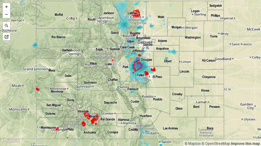
The upper ridge centered over New Mexico left Colorado without upper-air support for thunderstorm activity yesterday. However, mountain convection was able to gather enough ingredients, namely daytime heat and residual moisture, to pop off scattered thunderstorms throughout the afternoon and evening. Moisture was sufficient for efficient precipitation processes, so brief moderate-to-heavy rainfall was experienced under thunderstorms. Slow storm motions exacerbated this result, allowing fairly good rainfall totals to add up. Due to sparse population over the higher terrain, the best look at rainfall totals is in the form of the radar-derived Storm Total Precipitation map below.
Adjacent lower elevations experienced isolated thunderstorms, as well, thanks to two results: 1) outflow boundaries from mountain convection providing low-level convergence, and 2) thunderstorms drifting off the higher terrain. For completeness, here are a couple of the higher rainfall totals from CoCoRaHS observers:
Jefferson County: 1.50 inches
Grand County: 1.34 inches
Park County: 0.98 inches
Boulder County: 0.86 inches
Larimer County: 0.81
El Paso County: 0.67 inches
No flash flooding was reported yesterday.