STP 09-03-2015: Monsoon Disturbance Invaded SW Colorado, Mainly Dry East of the Mountains

Issue Date: Thursday, September 3rd, 2015
Issue Time: 9:00 AM MDT

Summary:

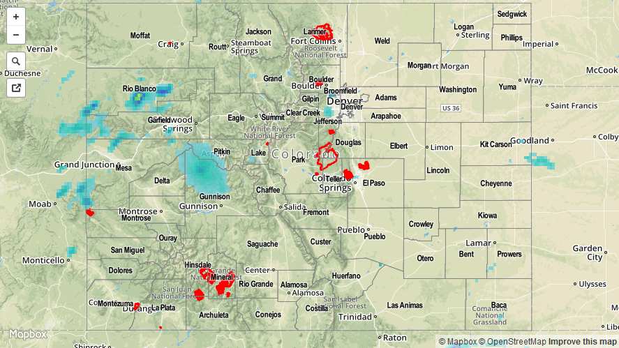
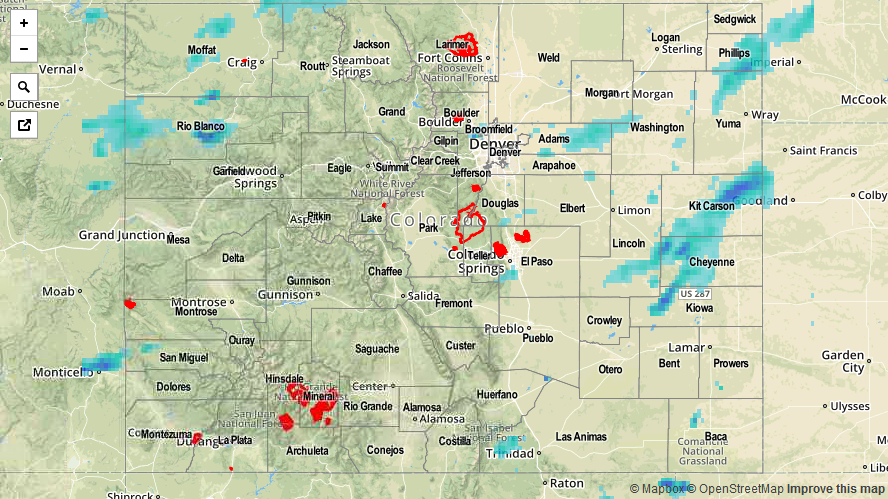
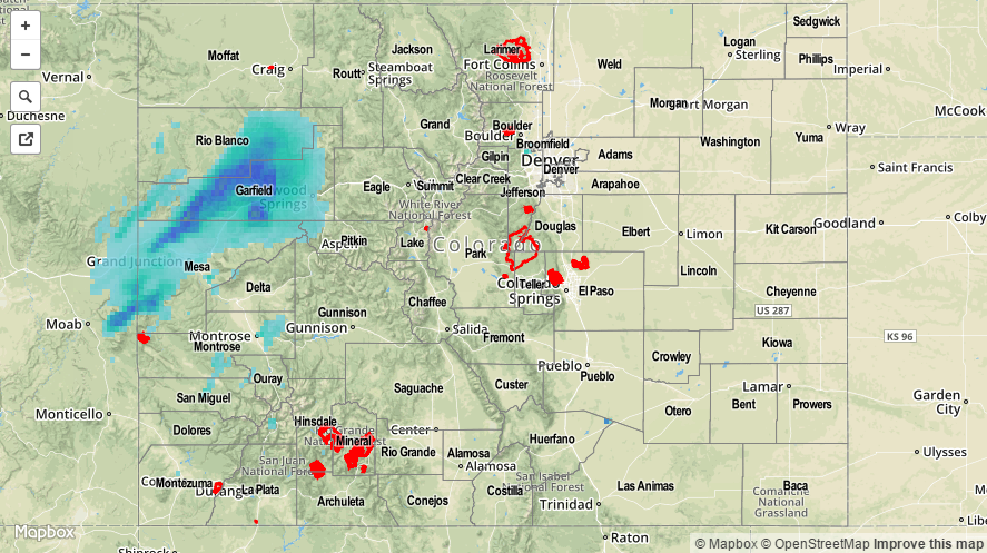
A slight push of moisture accompanied a weak monsoon disturbance yesterday afternoon and evening, bringing increased coverage of showers/thunderstorms to SW Colorado. Storms favored the higher terrain of the San Juan Mountains, Southwest Slope, and Grand Valley regions, but lower valleys received a few drops of rain as they drifted overhead. Activity continues this morning in those same regions, with generally light rain falling. East of the mountains, the environment stayed capped, leading to a mainly dry day with high temperatures that climbed well above average, once again. This morning, extensive cloud cover is in place across much of Colorado underneath the stream of monsoonal moisture.

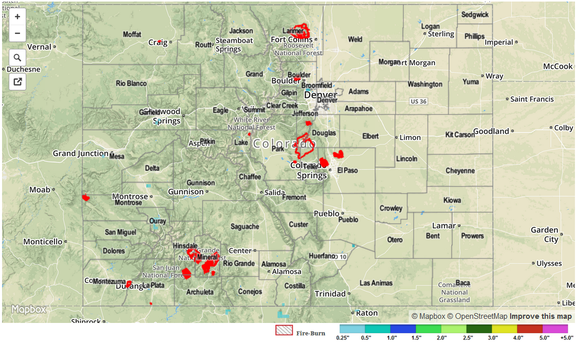
No flash flooding was reported yesterday. For a look at yesterday’s rainfall totals, be sure and check out the STP map below.

STP_snapshot_20150904

STP 09-02-2015: Moisture Less, Thunderstorms Less, Temperatures Remained Above-Average

Issue Date: Wednesday, September 2nd, 2015
Issue Time: 9:00 AM MDT

Summary:

Another day of above-average temperatures marked the beginning of Meteorological Fall, with thunderstorms taking a downtick from previous days’ thanks to lessening moisture/support. Thunderstorm coverage was best over and near the mountains where terrain could play a role in development. Additionally, scattered thunderstorms developed across the far Southeast Plains where a corridor of instability presented itself during the afternoon and evening. Overall, rain rates were generally light-to-moderate, and accumulations were typically between 0.05 and 0.25 inches.

No flash flooding was reported yesterday. Please be sure and check the STP map below for a statewide look at yesterday’s rainfall.

09022015_STPImage
Storm Total Precip Legend

STP 09-01-2015: Monsoonal Moisture Plume Remained Overhead

Issue Date: Tuesday, September 1st, 2015
Issue Time: 9:00 AM MDT

Summary:

Scattered showers and thunderstorms dotted Colorado yesterday as monsoonal moisture continued its influence across the state. With instability on the low end of the scale, most showers and thunderstorms were garden-variety, producing mainly light-to-moderate rainfall and gusty winds. A few stronger storms were able to develop along the Palmer Ridge/Urban Corridor, dropping locally moderate-to-heavy rain rates for brief periods of time, along with cloud-to-ground lightning. Most activity ended by 10 PM last night, with only a few isolated showers/weak thunderstorms continuing into the early morning hours.

No flash flooding was reported yesterday. Please be sure and check the STP map below for a statewide look at yesterday’s rainfall.

20150901_STPImageStorm Total Precip Legend

STP 08-31-2015: Upper-Ridge Slid East, Deep Moisture Returned in the Southwest Flow

Issue Date: Friday, May 1st, 2015
Issue Time: 9:00 AM MDT

Summary:

As the upper-level trough pushed across the Northwestern US, the upper-level ridge that had been overhead for a few days was nudged to the east. This allowed for moisture to make a return to the state, especially west of the Continental Divide. The IPW graph below shows the return of the moisture, pushing precipitable water values at Grand Junction to nearly 1.4 inches (!) last night. This, along with other environmental factors, allowed for widespread showers and thunderstorms to return to the High Country yesterday, spilling over into the Urban Corridor and Northeast Plains this morning.

IPW_08312015

Instability was on the low side yesterday, so thunderstorms were unable to produce heavy rainfall resulting in flash flooding. Instead, areas received persistent light-to-moderate rainfall, with a few brief bouts of locally heavy rain. For a look at statewide rainfall totals, be sure and check out the Storm Total Precipitation map below.

No flash flooding was reported yesterday.

20150831_STPImage
Storm Total Precip Legend