STP 05-05-2016: Warming and Drying Trend Continued

Issue Date: Thursday, May 5th, 2016
Issue Time: 9:00 AM MDT

Summary:

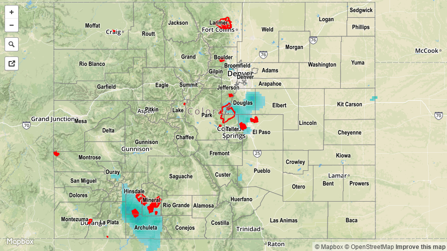
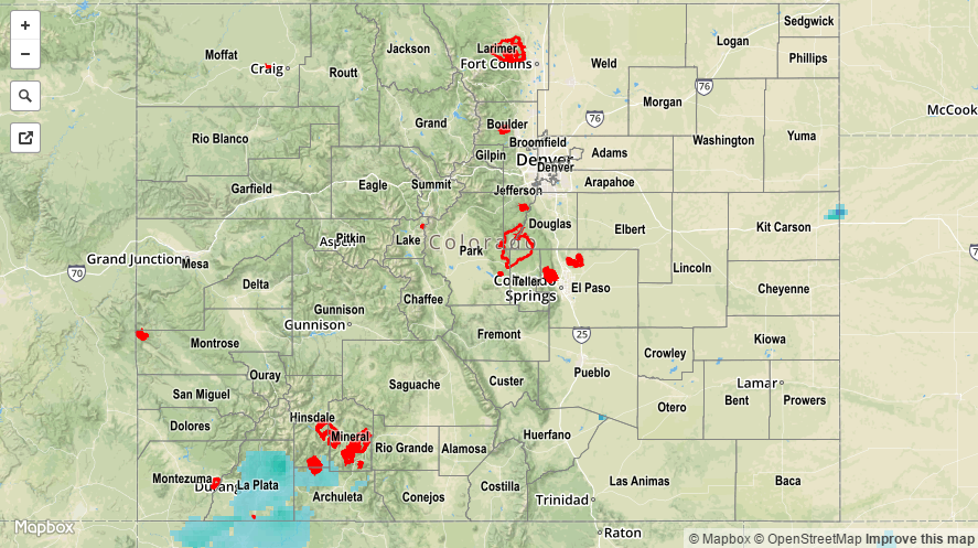
Today’s discussion will be short and sweet thanks to Mother Nature providing an overall fantastic day yesterday. Aside from a ribbon of moisture producing isolated showers over some of the higher peaks (which resulted in more wind than rain), the rest of the state sat under sunny skies. High temperatures warmed to average, or slightly above average, values and begged everyone to get outside and enjoy the day.

No flash flooding occurred yesterday.

20160505_STPImage
Storm Total Precip Legend

STP 05-04-2016: Pleasant Day Overall Across Colorado

Issue Date: Wednesday, May 4th, 2015
Issue Time: 9:00 AM MDT

Summary:

It is hard to argue with the weather that Mother Nature provided Colorado yesterday. The warming/drying trend kicked into high gear yesterday as surface high pressure shifted in from the west and upper-level ridging built overhead. Sun-drenched skies were in place across much of Colorado, with only a smattering of clouds, mainly across the High Country. Isolated showers accompanied some of the clouds across the Continental Divide and southwest mountains, but resulted in very little rainfall at the surface.

No flash flooding occurred yesterday.

20160504_STPImage
Storm Total Precip Legend

STP 05-03-2016: Slightly Warmer and Dryer, but Showers Remained

Issue Date: Tuesday, May 3rd, 2016
Issue Time: 9:00 AM MDT

Summary:

Surface high pressure and an approaching upper-level ridge helped bring a fairly quiet end to the recent cool, wet period. Scattered showers dotted the High Country, mainly south of I-70. The best rain/snow occurred across the San Juan Mountains and Southwest Slope regions thanks to the best overlap of moisture and lift. These showers came to an end around 10 PM last night.

East of the mountains, a weak frontal surge brought spotty, light showers to the Eastern Plains, Palmer Ridge, and Southeast Plains regions. This activity began yesterday evening, and slowly drifted south through the overnight/early morning hours. In fact, an area of light precipitation was ongoing across the far Southeast Plains this morning, but has since exited the state.

For a look at precipitation totals from the last 24 hours, please see the STP map below. No flash flooding occurred yesterday.

20160503_STPImage
Storm Total Precip Legend

STP 05-02-2016: Scattered Rain and Snow Showers Dotted the State

Issue Date: Monday, May 2nd, 2015
Issue Time: 9:00 AM MDT

Summary:

Another day of cool, unsettled weather was in place across Colorado yesterday. High temperatures yesterday were 10-20 degrees below average for the date, and freeze warnings continue this morning for portions of El Paso, Las Animas, and Huerfano counties. In general, the best rain/snow fell across the Southwest Slope and San Juan Mountains regions, thanks to the best overlap of moisture and large-scale lift. Additionally, upslope flow managed to bring a bit of enhanced precipitation to the Front Range, Urban Corridor, and Southeast Mountains regions. For a look at precipitation totals from the last 24 hours, please see the STP map below.

No flash flooding occurred yesterday.

20160502_STPImage
Storm Total Precip Legend