STP 06-10-2016: Warmer with Fewer Thunderstorms

Issue Date: Friday, June 10th, 2016
Issue Time: 9:00 AM MDT

Summary:

Upper-level ridging built overhead, beginning a warming/drying trend across the state. Temperatures were above average statewide, reaching 10-15 degrees above normal in some locations. Daytime heating worked on sufficient remaining moisture to produce isolated-to-scattered showers/thunderstorms over/near the higher terrain. Only one storm report was submitted; a 50 mph thunderstorm wind gust 2 miles WSW of Oxford (La Plata County).

Rainfall winners, according to CoCoRaHS observers (as of 7 AM MDT):

Fremont County: 0.47 inches
Park County: 0.38 inches
Larimer County: 0.35 inches
Boulder County: 0.29 inches

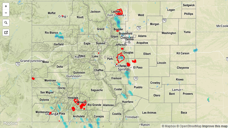
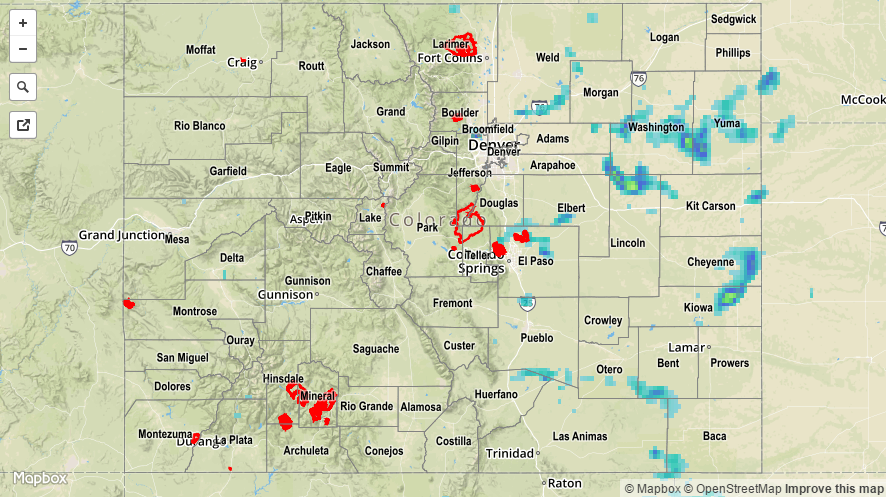
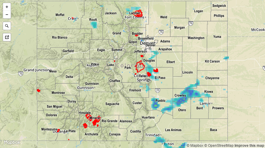
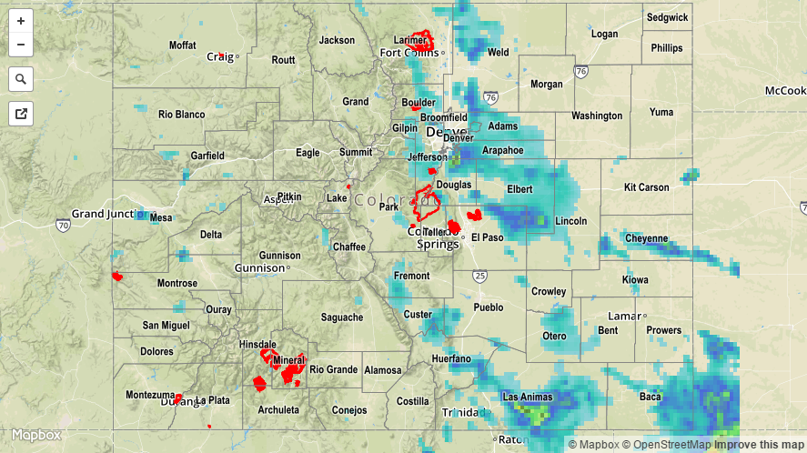
No flash flooding occurred yesterday. Please refer to the STP map below for a statewide look at 24-hour precipitation.

20160610_STPImage
Storm Total Precip Legend

STP 06-09-2016: Another Day of Scattered Showers and Thunderstorms

Issue Date: Thursday, June 9th, 2016
Issue Time: 9:00 AM MDT

Summary:

A weak upper disturbance slowly drifted across the state yesterday, providing another period of unsettled weather. Instability and wind shear were less than previous days, producing tamer, loosely organized convection. Rain rates were much less than previous days, and no flash flooding issues were observed/reported.

Rainfall winners, according to CoCoRaHS observers (as of 7 AM MDT):

El Paso County: 0.49 inches
Larimer County: 0.40 inches
Cheyenne County: 0.22 inches
Eagle County: 0.19 inches

Please refer to the STP map below for a statewide look at 24-hour precipitation.

20160609_STPImage
Storm Total Precip Legend

STP 06-08-2016: Isolated-to-Scattered Thunderstorms Brought Bouts with Hail, Heavy Rain

Issue Date: Wednesday, June 8th, 2016
Issue Time: 9:00 AM MDT

Summary:

As the upper-level wave continued its slow trek across the region, it provided support for another day of isolated-to-scattered showers and thunderstorms, mainly along/east of the Continental Divide. Low-level upslope flow reinforced moisture, while daytime heating increased instability, leading to the production of a few strong-to-severe thunderstorms that produced rounds of heavy rain and hail. Douglas, El Paso and Pueblo counties took the brunt of the severe storms during the afternoon/evening. For southwestern Colorado, drier air worked in from the west-southwest, leading to mostly sunny skies and mainly dry conditions. For the rest of the High Country, isolated showers/weak thunderstorms dotted the higher terrain.

Severe storm reports from local NWS Offices:

2.0 inch hail: 2 miles WSW of Pueblo West

1.75 inch hail: 1 mile WNW of Colorado Springs

1.25 inch hail: 2 miles NE of Security, 2 miles N of Security

1.0 inch hail: 8 miles NE of Colorado City, 9 miles SSW of Pueblo Reservoir, 7 miles E of Colorado City, 4 miles S of Colorado Springs, Parker

Heavy ponding was reported in fields 7 miles E of Colorado City (Pueblo County). Please refer to the STP map below for a statewide look at 24-hour precipitation.

20160608_STPImage
Storm Total Precip Legend

STP 06-07-2016: Strong-to-Severe Thunderstorms Dropped Heavy Rain, Hail

Issue Date: Tuesday, June 7th, 2016
Issue Time: 9:00 AM MDT

Summary:

Upslope flow, rising temperatures, and upper-level support helped kick off scattered showers and thunderstorms yesterday. More than a couple of the thunderstorms reached severe criteria, and the strongest produced hail and heavy rain. In fact, heavy rain to the tune of 0.77 inches/15 minutes was reported 1 mile WNW of Walsenburg (Huerfano County), and 1.70 inches of rain was reported 7 miles NNE of La Veta (Huerfano County). Northern portions of Douglas County received the most rainfall compared to the rest of the state, as a slow-moving thunderstorm dropped hail and heavy rain for an extended period of time. This lead to the issuance of an Urban and Small Stream Flood Advisory for the area.

Severe storm reports from local NWS Offices:

Thunderstorm Wind Gust (56 mph): Grand Junction Regional Airport

1.75 inch hail: Highlands Ranch

1.50 inch hail: 2 miles WSW of Highlands Ranch

1.0 inch hail: SSE of Highlands Ranch, 4 miles NW of Boulder, 4 miles NE of Greenland, 1 mile NE of Estes Park

Rainfall winners, according to CoCoRaHS observers (reports as of 7:00 AM MDT):

Douglas County: 2.50 inches
El Paso County: 1.45 inches
Baca County: 0.94 inches
Arapahoe County: 0.88 inches

Several Urban and Small Stream Flood Advisories were issued yesterday. Please refer to the STP map below for a statewide look at 24-hour precipitation.

20160607_STPImage
Storm Total Precip Legend