Issue Date: Wednesday, June 8th, 2016
Issue Time: 9:00 AM MDT
Summary:
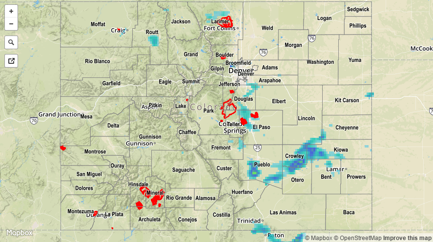
As the upper-level wave continued its slow trek across the region, it provided support for another day of isolated-to-scattered showers and thunderstorms, mainly along/east of the Continental Divide. Low-level upslope flow reinforced moisture, while daytime heating increased instability, leading to the production of a few strong-to-severe thunderstorms that produced rounds of heavy rain and hail. Douglas, El Paso and Pueblo counties took the brunt of the severe storms during the afternoon/evening. For southwestern Colorado, drier air worked in from the west-southwest, leading to mostly sunny skies and mainly dry conditions. For the rest of the High Country, isolated showers/weak thunderstorms dotted the higher terrain.
Severe storm reports from local NWS Offices:
2.0 inch hail: 2 miles WSW of Pueblo West
1.75 inch hail: 1 mile WNW of Colorado Springs
1.25 inch hail: 2 miles NE of Security, 2 miles N of Security
1.0 inch hail: 8 miles NE of Colorado City, 9 miles SSW of Pueblo Reservoir, 7 miles E of Colorado City, 4 miles S of Colorado Springs, Parker
Heavy ponding was reported in fields 7 miles E of Colorado City (Pueblo County). Please refer to the STP map below for a statewide look at 24-hour precipitation.