STP 07-20-2016: Monsoonal Moisture Kept the Faucet Turned On

Issue Date: Wednesday, July 20th, 2016
Issue Time: 9:00 AM MDT

Summary:

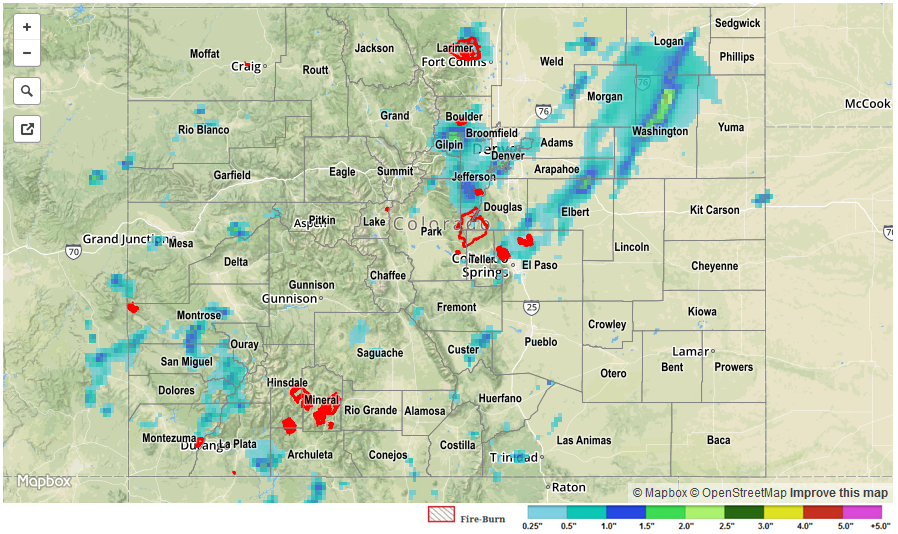
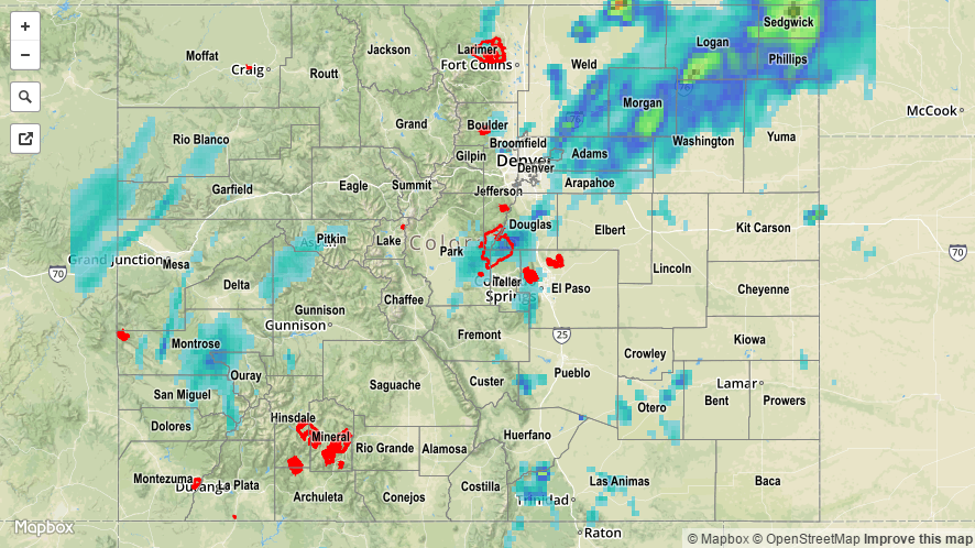
A strong upper-level high over the south-central US and an upper-level low spinning off the coast of the Pacific NW kept Colorado firmly underneath southwest flow aloft. This continued to supply the atmosphere overhead with plenty of moisture, especially over and near the High Country. Storms developed initially over the mountains, moving generally to the northeast with the mean flow, leaving most of southeast Colorado dry. Locally heavy rain fell underneath stronger storms, and led to the issuance of a few flood advisories/flash flood warnings. Flash flooding was reported yesterday, and those reports are as follows:

Extensive street flooding, some at depths of over 1 foot, along with numerous impassable roadways and intersections, was reported across metro Denver.
2 miles to the WSW of Denver, Santa Fe Drive and Iowa Avenue were impassable under a foot of water.

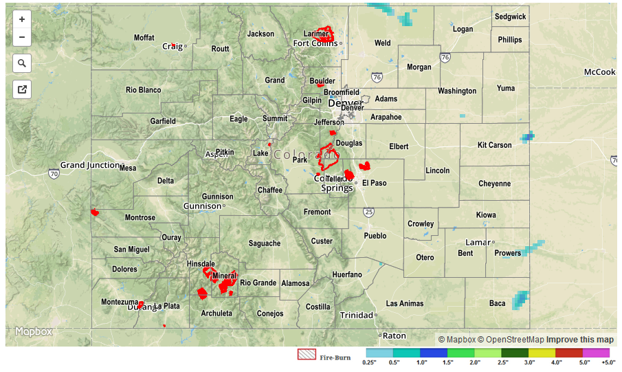
Unfortunately, one fatality from lightning was reported in Arvada, and another person was struck (and in critical condition) at the El Paso County Fair in Calhan. For a complete look at 24-hour precipitation totals, please take a look at the Storm Total Precipitation map below.

STP_20160720

STP 07-19-2016: Scattered Thunderstorms Rumbled, a Few were Strong/Severe

Issue Date: Tuesday, July 19th, 2015
Issue Time: 9:00 AM MDT

Summary:

It was an active period across much of the state yesterday as monsoonal moisture made a significant push into Colorado around a strong ridge centered over Texas. Precipitable water values increased steadily throughout the day and night, reaching above 1 inch at all of the four normal reporting stations (Grand Junction, Pueblo, Boulder, and Schriever AFB). Scattered showers/thunderstorms continued throughout the night across the High Country and Western Slope, with activity ongoing this morning. For eastern Colorado, a few of the storms were strong/severe, producing periods of heavy rain, strong winds, and hail. Storm reports from yesterday’s activity are as follows:

67 mph Thunderstorm Wind Gust: Holyoke (Phillips County)
64 mph Thunderstorm Wind Gust: 8 miles S of Holyoke (Phillips County)
59 mph Thunderstorm Wind Gust: Akron (Washington County)
Thunderstorm Wind Damage (Large tree branches down along 10th street, tree down at 10th and 33rd intersection): 2 miles NNE of Greeley (Weld County)
1.75 inch hail: 2 miles NNE of Greeley (Weld County)
1.25 inch hail: 1 mile N of Greeley (Weld County)

No flash flooding was reported, although localized street/field ponding and flooding likely occurred underneath strong thunderstorms. For a more complete look at 24-hour precipitation totals, please take a look at the Storm Total Precipitation map below.

20160719_STPImage
Storm Total Precip Legend

STP 07-18-2016: Multiple Rounds Of Storms Rumble Across The Plains

Issue Date: Monday, July 18, 2016
Issue Time: 9:25AM MDT

Plenty of deep moisture, originally being confined to northeast CO, was advected westward on Sunday resulting in scattered thunderstorm activity for many areas up and down the Northeast and Southeast Plains. One particularly strong storm moved southeast out of Wyoming during the mid-afternoon, creating up to 2 inch hail and straight-line winds gusts up to 73 mph. A brief tornado warning was hoisted for this storm, though it appeared to be “downdraft” driven by this point in its life cycle. This storm also prompted several flash flood warnings for up around 2 inches of rain per hour. However, no official flooding reports were received as of this morning. Numerous additional severe thunderstorms popped up and moved northeast (that’s right, northeast, while the storms farther north moved southeast) and caused short-term heavy rainfall up to 1.25 inches, hail up to 1.5 inches and wind gusts up to 60 mph.
Later in the evening, strong outflow boundaries from the earlier storms were pushed upslope across the South Platte River valley resulting in numerous additional storms from just east of the Urban Corridor. Short-term heavy rainfall, up to 1.5 inches per hour prompted several flash flood warnings. However, just like with the earlier storms, no flood reports were received thus far.
Although official rainfall totals (CoCoRaHS + COOP) only showed totals up to 1.25 inches, it is very likely that higher values were observed between rain gages. However, note that many rainfall estimates for the Northeast Plains were contaminated by hail and are likely much higher than what actually accumulated at the surface. For specific rainfall estimates in your area, check out our zoomable Storm Total Precipitation map below.
Lastly, wildfire activity continued across the higher terrain and western slope. The most threatening fire as of this morning is the 16,350 acre Hayden Pass fire in Fremont County which is only 30% contained thus far. Check out the #COfire thread on Twitter for real-time updates.


Storm Total Precip Legend

STP 07-17-2016: Hot, Windy, and Mostly Dry Statewide

Issue Date: Sunday, July 17th, 2017
Issue Time: 9:25AM MDT

Drying, originating from the mid and upper-levels of the atmosphere eventually made it to the surface and provided mostly sunny and very hot weather across most of the state. High temperatures cracked 100F across almost all valley locations with 90F+ seen even at locations above 7,000 feet (for example, Monument Hill). Deep vertical mixing of the dry atmosphere brought down higher wind speeds from the overlying jet streak. Gusts up to 40 mph were common during the mid to late afternoon hours, which made for a pleasant breeze amidst the heat. Across the Northeast Plains and Southeast Plains, some residual morning moisture hung around long enough to let isolated thunderstorms to pop up. Max one hour rainfall up to 0.8 inches occurred under the strongest region of the storm, along with wind gusts over 60 mph. Hail of 0.88 inches was reported with the cell in far southeast CO, prompting a brief severe thunderstorm warning.

Switching topics to the dry side of things, the Blair, Hayden Pass and Beaver Creek fires continue to burn this morning, with containment at or below 25%. Fortunately, wetter conditions finally look like they are around the corner (see our latest Flood Threat Outlook).

There were no official flooding reports yesterday. For specific rainfall estimates in your area, check out our Storm Total Precipitation map below.

STP_20160717