STP 08-05-2016: Monsoonal Moisture Continues To Deliver Widespread Rainfall

Issue Date: Friday, August 5th, 2016
Issue Time: 9:00AM MDT

Summary

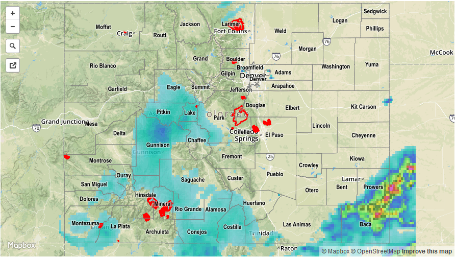
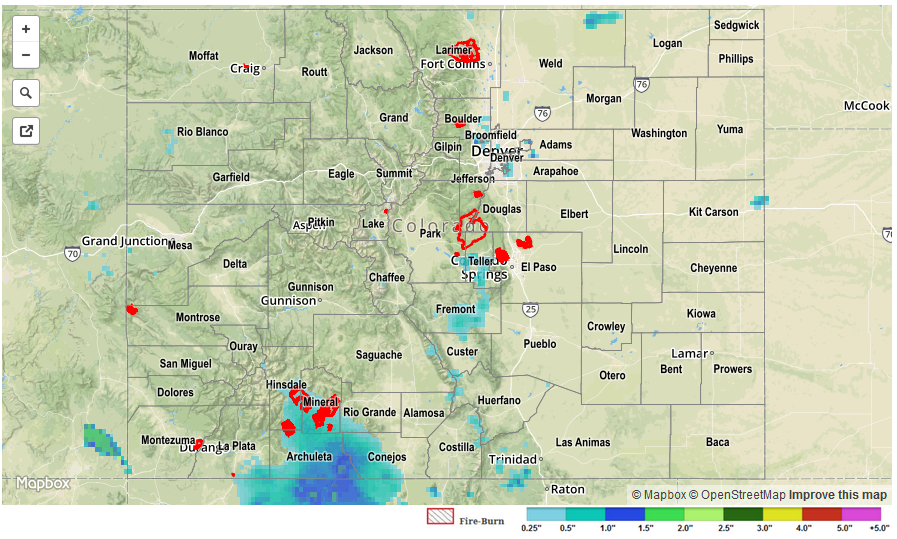
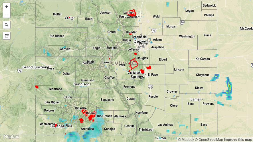
Very high moisture content provided by an aging monsoon surge helped to produce widespread showers and thunderstorms across southwest, central and southeast Colorado on Thursday. Yesterday’s precipitable water value at Grand Junction peaked at just over 1.4 inches, which exceeds the 95th percentile for early August. Scattered showers, ongoing in the morning, quickly gained in coverage and intensity with the still-strong August heating. Although rain intensities were generally reduced compared to Thursday, many 24-hour total observations were in the 0.5 to 1.0 inch range though higher values were assuredly seen between gages. An observation in La Plata County noted a 15-minute rainfall of 0.57 inches. Numerous flood advisories and warnings were hoisted over the Grand Valley and Southwest Slope for flash flooding though no official reports were received this morning.

Meanwhile, over the Divide, even heavier rainfall rates were seen over the Southeast Plains where up to 3 inches likely occurred in rural parts of Baca County. Two areal flood advisories were hoisted for this region during the afternoon and evening hours. A severe thunderstorm warning was also issued, though no hail/wind reports were received as of this morning.

Overall, the last three day stretch has resulted in widespread areas receiving over 1 inch of rainfall, with up to 6 inches of rainfall observed for isolated parts of southwest and southeast Colorado. The excellent news is that the rainfall fell in relatively steady fashion, which as many residents know, is never a guarantee for our state.

For rainfall estimates specific to your area, check out our Storm Total Precipitation map below.

STP_20160805
Storm Total Precip Legend

STP 08-04-2016: Deep Moisture Enhanced Rainfall

Issue Date: Thursday, August 4th, 2016
Issue Time: 9:00 AM MDT

Summary:

Monsoonal moisture continued its influx from the south/southwest, providing the fuel for efficient rainfall from showers and thunderstorms. IPW values increased to near 1.4 inches at Grand Junction yesterday, highlighting just how deep the moisture was. The higher terrain of the Southwest Slope took on the most coverage of showers/thunderstorms, with radar estimating more than 1.5 inches of rain across portions of Montrose and Dolores counties. East of the mountains, isolated-to-scattered showers/thunderstorms dotted locations along/near the mountains, with locations further east remaining dry due to capping aloft.

No flash flooding was reported. For a statewide look at 24-hour precipitation totals, please take a look at the Storm Total Precipitation map below.

STP_20160804

STP 08-03-2016: Streak of Unsettled Days Continued

Issue Date: Wednesday, August 3rd, 2016
Issue Time: 9:00 AM MDT

Summary:

Monsoonal moisture continued its stay over Colorado, producing isolated-to-scattered showers/thunderstorms over the High Country and Western Slope. As far as western Colorado is concerned, the Southwest Slope and San Juan Mountains received the best coverage of rainfall. Most showers/storms were garden variety, producing mainly gusty winds and light-to-moderate rainfall. For eastern Colorado, upslope flow transported low-level moisture westward, and allowed for scattered showers/thunderstorms to develop across the area. The strongest storms over the day occurred over the Northeast Plains, Palmer Ridge, and Southeast Plains, producing locally heavy rain, strong winds, and hail. Storm reports from eastern Colorado include:

59 mph thunderstorm wind gust: Fort Morgan Airport (Morgan County)
1 inch hail: 6 miles SSE of Greeley (Weld County)
1.49 inches of heavy rain (2 hour total): 8 miles SSE of Blende (Pueblo County)

No flash flooding was reported. For a statewide look at 24-hour precipitation totals, please take a look at the Storm Total Precipitation map below.

20160803_STPImage
Storm Total Precip Legend

STP 08-02-2016: Another Day of Isolated-to-Scattered Showers/Thunderstorms

Issue Date: Tuesday, August 2nd, 2016
Issue Time: 9:00 AM MDT

Summary:

Monsoonal moisture remained over southern Colorado, but was largely kept at bay by the influx of drier air across northern Colorado. IPW values peaked over southern and western Colorado during the late afternoon/evening, coinciding with the heaviest reported rainfall of the day. The following reports all come from La Plata County:

Pea-sized hail mixed with heavy rain: 1 mile SSW of Durango (3:05 PM)
Pea-sized hail and 0.65 inches of heavy rain in15 minutes: 5 miles WSW of Durango (3:18 PM)
1.25 inches of rain in 25 minutes: 5 miles ESE of Hesperus (4:54 PM)

Most other showers/thunderstorms were garden variety, producing mainly gusty winds and light-to-moderate rainfall. No flash flooding was reported. For a statewide look at 24-hour precipitation totals, please take a look at the Storm Total Precipitation map below.

20160802_STPImage
Storm Total Precip Legend