Issue Date: Thursday, August 4th, 2016
Issue Time: 9:00 AM MDT
Summary:
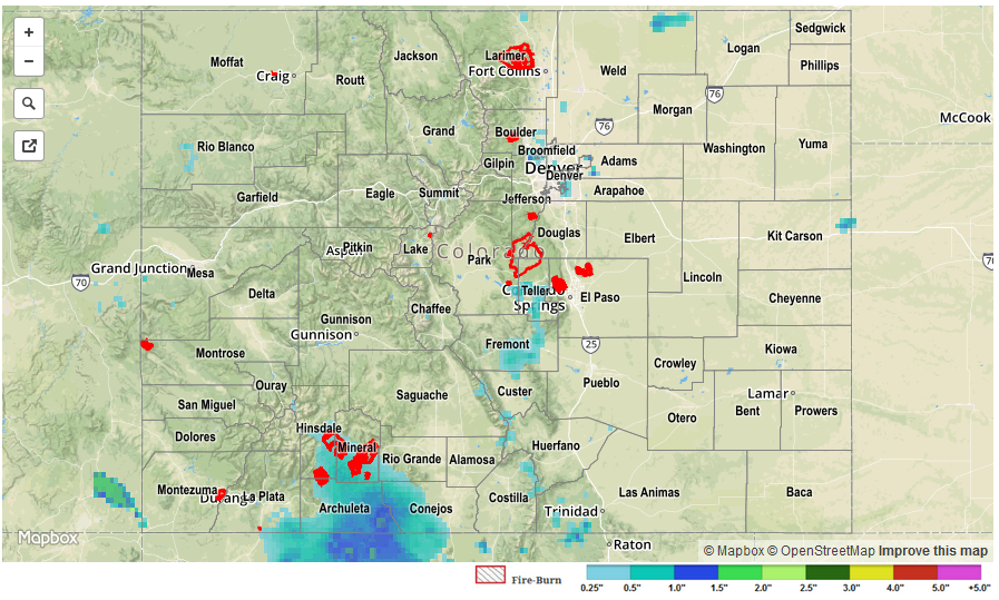
Monsoonal moisture continued its influx from the south/southwest, providing the fuel for efficient rainfall from showers and thunderstorms. IPW values increased to near 1.4 inches at Grand Junction yesterday, highlighting just how deep the moisture was. The higher terrain of the Southwest Slope took on the most coverage of showers/thunderstorms, with radar estimating more than 1.5 inches of rain across portions of Montrose and Dolores counties. East of the mountains, isolated-to-scattered showers/thunderstorms dotted locations along/near the mountains, with locations further east remaining dry due to capping aloft.
No flash flooding was reported. For a statewide look at 24-hour precipitation totals, please take a look at the Storm Total Precipitation map below.