Issue Date: Friday, May 12th, 2017
Issue Time: 10:10 AM MDT
Summary:
The low pressure system that resulted in an eventful couple of days finally exited to the east of Colorado yesterday morning. However, “wrap-around” precipitation still resulted in a wet start to the day for portions of eastern Colorado. This rainfall was generally light, but was persistent enough to result in a few tenths of an inch of rain in some locations. The rain and clouds cleared out through the afternoon and evening hours, resulting in a fairly pleasant day/night for much of the state.
According to CoCoRaHS observers, the big winners from yesterday’s rainfall include:
Kit Carson County: 0.80 inches
Baca County: 0.50 inches
Prowers County: 0.50 inches
Cheyenne County: 0.41 inches
Kiowa County: 0.20 inches
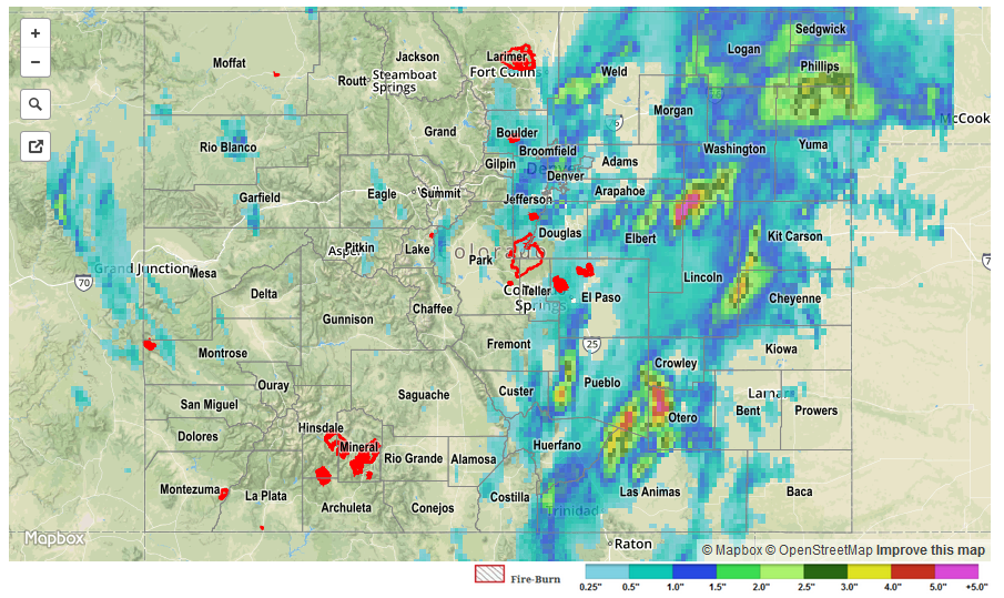
For a statewide look at 24-hour precipitation totals, please take a look at the Storm Total Precipitation map below.
![]()