Issue Date: Thursday, May 11th, 2017
Issue Time: 10:30 AM MDT
Summary:
Showers and thunderstorms were active across Colorado on Wednesday, mainly east of the Continental Divide. In particular, the Southeast Mountains, Southeast Plains, and Raton Ridge were soaked with the heaviest rainfall, with gage-adjusted radar estimates greater than 3 inches in some locations (see STP map below). Flash flooding was reported in Pueblo County (9 miles NNE of Beulah, 3 miles N of Beulah, and 1 mile N of Buelah) and in Cheyenne County (7 miles N of Cheyenne Wells).
According to CoCoRaHS observers, the big winners from yesterday’s rainfall include:
Crowley County: 3.50 inches
Pueblo County: 3.21 inches
Huerfano County: 2.05 inches
Otero County: 1.97 inches
Costilla County: 1.90 inches
Prowers County: 1.88 inches
Cheyenne County: 1.80 inches
For a statewide look at 24-hour precipitation totals, please take a look at the Storm Total Precipitation map below.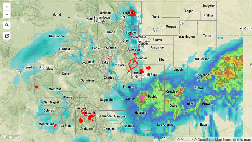
![]()