Issue Date: Sunday, September 17, 2017
Issue Time: 10:20 AM MDT
Summary:
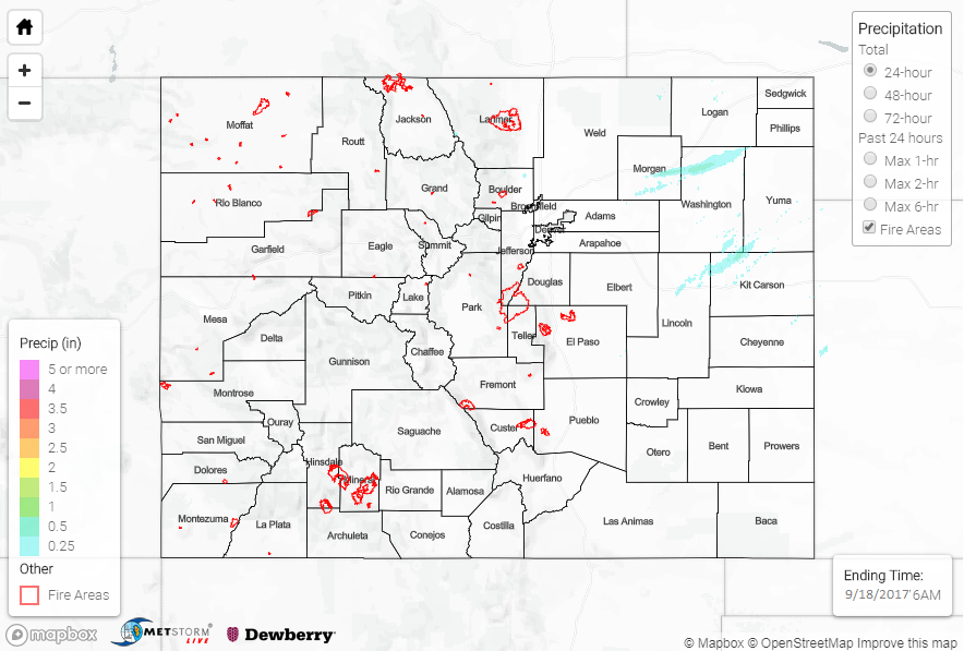
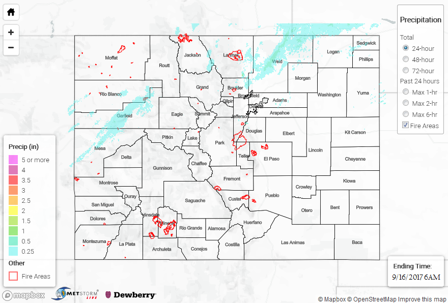
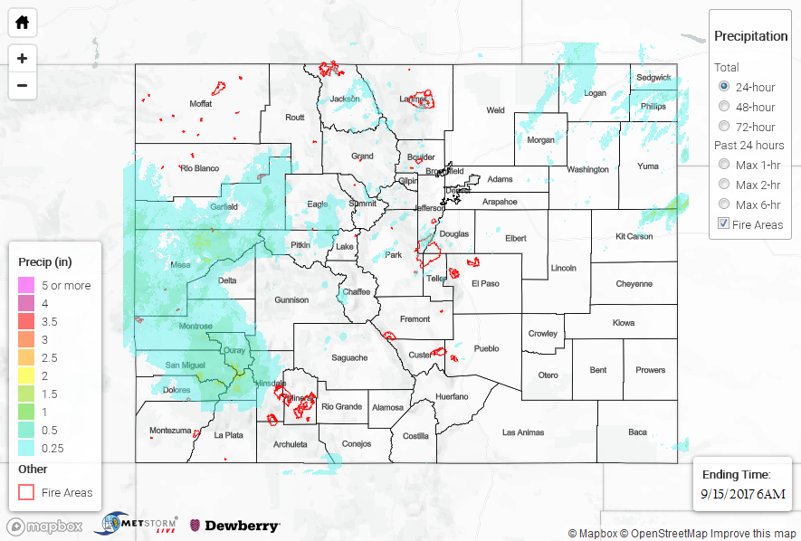
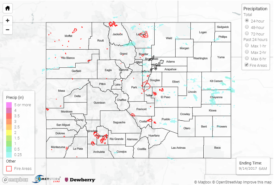
Subsident air followed the trough axis swinging across the state yesterday, leading to a much drier day overall. Only a few showers and a couple thunderstorms were able to develop yesterday, with much of the activity in the higher elevations resulting in light rain/snow showers. During the evening and overnight hours, a few weak showers/thunderstorms developed over the Northeast Plains, Palmer Ridge, and Southeast Plains. This activity generally produced between 0.05-0.15 inches of rain with a few locally higher amounts.
Flash flooding was not reported on Friday. For a look at precipitation estimates in your area, please see our State Precipitation Map below.
Click Here For Map Overview
Note: We have identified a possible underestimation in QPE over the southwest part of the state. We are working to on this issue, and will provide an update as soon as possible.