Issue Date: Thursday, September 14, 2017
Issue Time: 11AM MDT
Summary:
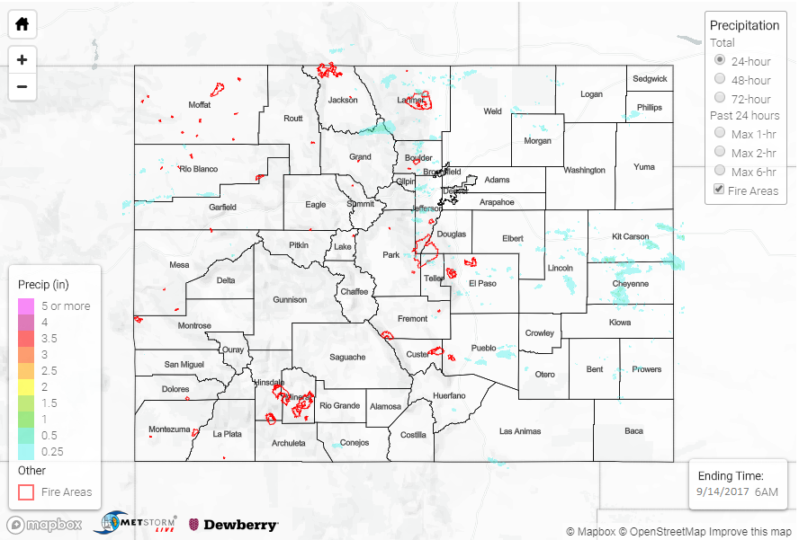
Last day with the ridge dominating the Colorado weather pattern. Westerly flow associated with ridge helped mix out even more of the low-level moisture at the surface. Dew points over the eastern plains were in the mid-40s again yesterday with isolated dew points in the low 50s further east. Storm formation yesterday was most abundant over the Front Range, Northern Mountains and Palmer Ridge with more isolated showers over the Southeast Mountains. SE storm movement around the ridge was a bit faster than the previous days. This faster storm motion paired with low surface moisture, limited the 24-hr rainfall totals and produced gusty winds.
The highest storm totals over the mountains were associated with a storm that formed in Grand County. Radar estimates were around 0.5 inches. Storms also formed along a line of convergence associated with the higher terrain of the Palmer Ridge. Radar estimated 1-hr rain rates over Kit Carson and Cheyenne County at 1 inch. A CoCoRaHS station in the area recorded up to 0.65 inches. As expected, these storms produced gusty winds due to the inverted-V atmospheric profile. Burlington airport reported a gust of 26 mph around 3PM yesterday.
There was no flooding reported Wednesday. For rainfall estimates in your area, take a look at the State Precipitation Map below.
Click Here For Map Overview
Note: We have identified a possible underestimation in QPE over the southwest part of the state. We are working to on this issue, and will provide an update as soon as possible.