SPM 05-09-2019: Snow, Rain and Cold Temperatures Produce Snow across most of Colorado

Issue Date: Thursday, May 9th, 2019
Issue Time: 9:05AM MDT

Summary:

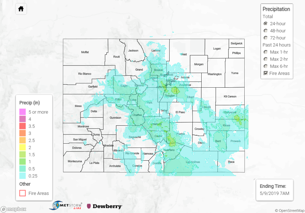
Winter continued yesterday with rain, snow and rain turning to snow overnight. Mid-level energy and a passing cold front helped the crossover from rain to snow occur during the afternoon hours. The cold, northerly winds and nightfall dropped the freezing level below 6K feet, so there were snow reports in the Urban Corridor this morning. However, not much was sticking to the ground. Rainy conditions once again started the day over the eastern plains. Radar indicates up to 1.5 inches fell. An impressive 1.75 inches fell in 3 hours over Beulah. The highest snow report was in Westcliffe where 12 inches fell.

It has been quite the cool, wet start to spring, but after last year, this moisture is welcomed. I’ll leave this SPM with a little trivia. What was the latest date of measurable snow in Denver? Click here for the answer.

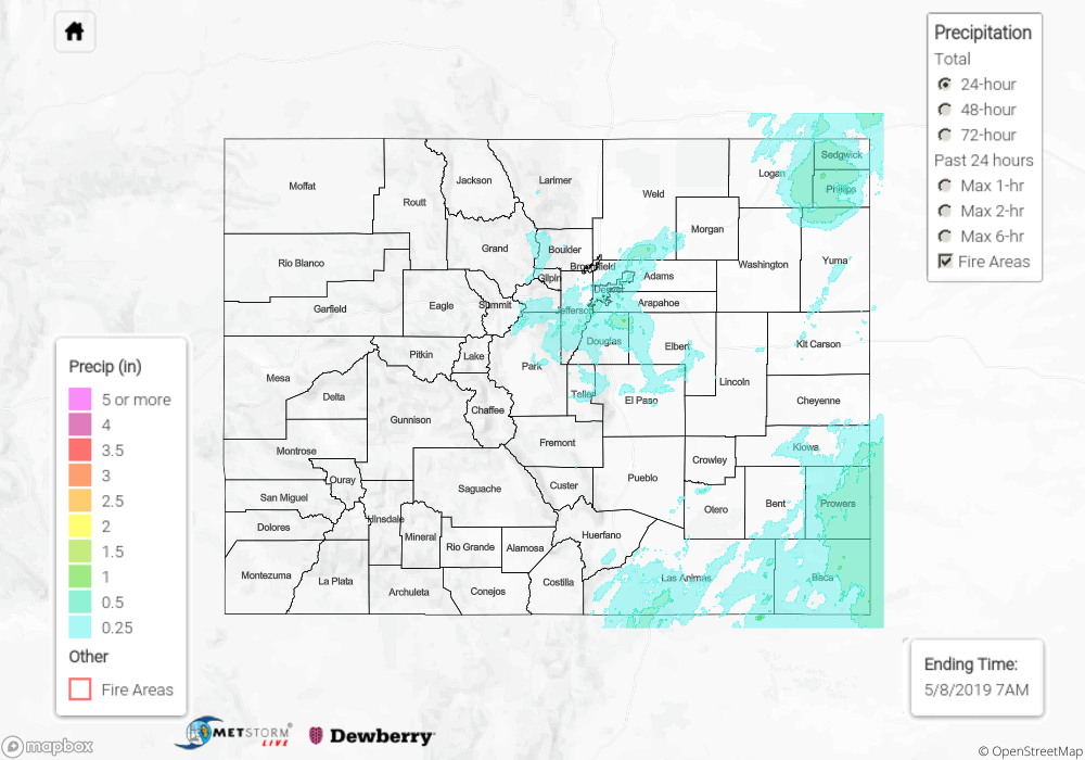
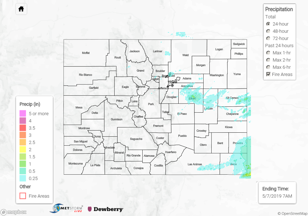
To see precipitation totals over in your neighborhood on Wednesday, scroll down to the State Precipitation Map below. Note the 4 inches in Parker is another error this morning.

Click Here For Map Overview

The map below shows radar-estimated, rainfall gage-adjusted Quantitative Precipitation Estimates (QPE) across Colorado. The map is updated daily during the operational season (May 1 – Sep 30) by 11AM. The following six layers are currently available: 24-hour, 48-hour and 72-hour total precipitation, as well as maximum 1-hour, 2-hour and 6-hour precipitation over the past 24 hour period (to estimate where flash flooding may have occurred). The 24-hour, 48-hour and 72-hour total precipitation contain bias corrections that are not disaggregated into the hourly estimates, so there will likely be some differences. The accumulation ending time is 7AM of the date shown in the bottom right corner. Also shown optionally are vulnerable fire burn areas (post 2012), which are updated throughout the season to include new, vulnerable burn areas. The home button in the top left corner resets the map to the original zoom.

SPM 05-08-2019: Showers and Thunderstorms Continued on Tuesday with the Approaching Low

Issue Date: Wednesday, May 8th, 2019
Issue Time: 9:40AM MDT

Summary:

The low begin to move eastward and stayed just south of Colorado yesterday. This provided lift for some widespread shower activity and a cloudy/foggy start to the morning. Dense fog was present throughout the day near the Colorado and Kansas border. By the time the lift had moved over the Front Range, not quite enough daytime heating had occurred due to the heavy cloud cover in the morning, so multiple rounds of showers kept instability low and prevented organized storms along the Urban Corridor. Decent accumulations and beneficial rainfall occurred with radar indicating widespread values of 0.4 to 0.5 inches and up to 1 inch in southern Weld County. Another wave moved through southeastern Colorado, which triggered storms along the Southeast Mountains and Raton Ridge. Max 1-hr rain rates up to 0.5 inches were realized with a 24-hr total of 0.7 inches reported by a CoCoRaHS station in Baca County. Lastly, some late night convection occurred over the northeast corner of the state. CoCoRaHS in the area indicate this produced as much as 1.3 inches in Phillips County. No severe storms or flooding were reported yesterday.

To see precipitation totals over in your neighborhood on Tuesday, scroll down to the State Precipitation Map below. Note the 2.5 inches near Parker is an error. Totals in this area were between 0.4 and 0.5 inches (ALERT).

Click Here For Map Overview

The map below shows radar-estimated, rainfall gage-adjusted Quantitative Precipitation Estimates (QPE) across Colorado. The map is updated daily during the operational season (May 1 – Sep 30) by 11AM. The following six layers are currently available: 24-hour, 48-hour and 72-hour total precipitation, as well as maximum 1-hour, 2-hour and 6-hour precipitation over the past 24 hour period (to estimate where flash flooding may have occurred). The 24-hour, 48-hour and 72-hour total precipitation contain bias corrections that are not disaggregated into the hourly estimates, so there will likely be some differences. The accumulation ending time is 7AM of the date shown in the bottom right corner. Also shown optionally are vulnerable fire burn areas (post 2012), which are updated throughout the season to include new, vulnerable burn areas. The home button in the top left corner resets the map to the original zoom.

SPM 05-07-2019: Uptick in Afternoon and Evening Showers and Thunderstorms

Issue Date: Tuesday, May 7th, 2019
Issue Time: 10:40AM MDT

Summary:

Some low clouds and fog to start the day over eastern Colorado with moisture return behind a cold front. The California low started to move inland yesterday, which brought some upper level support for afternoon storms. Mid and upper level energy and the return of low level moisture helped increase showers and thunderstorms over the northern high terrains yesterday afternoon. As storms moved into the adjacent plains during the afternoon hours, they did not produce much (if any) rainfall until they reached they reached the plains. A handful of Severe Thunderstorm Warnings were issued with the main action over the Southeast Plains and Palmer Divide. Half dollar sized hail (1.25 inch) was reported near Limon and a 68 mph gust was recorded near Springfield. The highest 24-hr storm totals were over Elbert County were 1.5 inches fell and Baca County where 2 inches were reported over the far southeast corner. Dense fog began in the evening and has continued through this morning.

With continuous upslope flow and a moist, decently unstable environment, another set of storms moved off of the mountains during the early evening hours and rolled into the Urban Corridor. These storms brought rainfall totals for the 24-hr period anywhere between 0.05 and 0.75 inches. Copious pea sized hail was also reported in North Denver. Light showers continued through this morning against the foothills with dense fog being reported over the mountains and eastern half of the state. Flooding was not reported yesterday.

To see precipitation totals over in your area, scroll down to the State Precipitation Map below.

Click Here For Map Overview

The map below shows radar-estimated, rainfall gage-adjusted Quantitative Precipitation Estimates (QPE) across Colorado. The map is updated daily during the operational season (May 1 – Sep 30) by 11AM. The following six layers are currently available: 24-hour, 48-hour and 72-hour total precipitation, as well as maximum 1-hour, 2-hour and 6-hour precipitation over the past 24 hour period (to estimate where flash flooding may have occurred). The 24-hour, 48-hour and 72-hour total precipitation contain bias corrections that are not disaggregated into the hourly estimates, so there will likely be some differences. The accumulation ending time is 7AM of the date shown in the bottom right corner. Also shown optionally are vulnerable fire burn areas (post 2012), which are updated throughout the season to include new, vulnerable burn areas. The home button in the top left corner resets the map to the original zoom.

SPM 05-06-2019: Beautiful Day for Cinco de Mayo Celebrations

Issue Date: Monday, May 6th, 2019
Issue Time: 9:20AM MDT

Summary:

A gorgeous Cinco de Mayo with high temperatures reaching 80°F over the eastern plains and Grand Junction area. High temperatures in the mountains were in the 40-50°F range. To see the 24-hr maximum temperature over your area, see the MesoWest map below. A weak shortwave and slight increase in moisture produced some light rainfall over the mountains in the late afternoon with the best coverage over the northern Central Mountains and Northern Mountains. Totals were mostly under 0.1 inches though a couple isolated areas received 0.1 inches in Garfield County. Elsewhere, broken cloud cover helped provide some shade from the heat. A gust of 59 mph was reported at Trinidad Airport in Las Animas. Flooding was not reported yesterday.

To see precipitation totals over in your area, scroll down to the State Precipitation Map below.

Click Here For Map Overview

The map below shows radar-estimated, rainfall gage-adjusted Quantitative Precipitation Estimates (QPE) across Colorado. The map is updated daily during the operational season (May 1 – Sep 30) by 11AM. The following six layers are currently available: 24-hour, 48-hour and 72-hour total precipitation, as well as maximum 1-hour, 2-hour and 6-hour precipitation over the past 24 hour period (to estimate where flash flooding may have occurred). The 24-hour, 48-hour and 72-hour total precipitation contain bias corrections that are not disaggregated into the hourly estimates, so there will likely be some differences. The accumulation ending time is 7AM of the date shown in the bottom right corner. Also shown optionally are vulnerable fire burn areas (post 2012), which are updated throughout the season to include new, vulnerable burn areas. The home button in the top left corner resets the map to the original zoom.