Issue Date: Friday, September 18th, 2020
Issue Time: 8:45AM MDT
— Flooding is NOT expected today
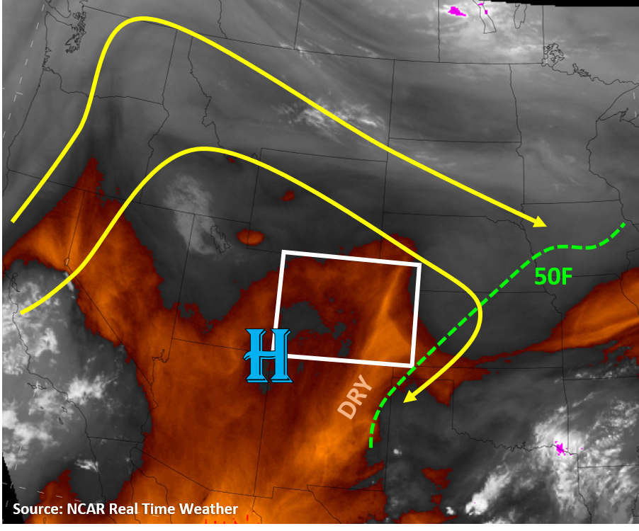
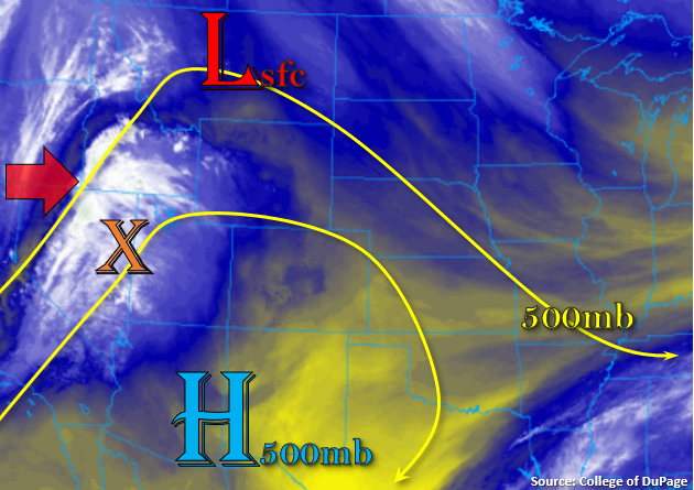
Finally, a little bit of change to talk about in regard to the weather pattern. The 500mb ridge and associated High have started to be pushed south with the incoming trough off the west coast (red arrow). The center of upper Low will start to move onshore and into the Pacific Northwest throughout the day, and upper level lift (orange “X”) out in front of the trough will bring increasing cloud cover to the state from west to east beginning later this afternoon. The Salt Lake City sounding is showing most of the moisture in the mid and upper atmosphere and measuring PW at 0.36 inches. This translates to no rainfall for the state with this first wave of energy, especially with the large dew point depression.
As the trough approaches and the pressure gradient tightens, surface winds are anticipated to increase over the northwest corner of the state. Additionally, a lee surface Low is expected to develop to our north, which will increase south and southwesterly winds over eastern Colorado this afternoon. This may cause some elevated fire conditions, particularly over the Northwest Slope.
Today’s Flood Threat Map
For more information on today’s flood threat, see the map below. If there is a threat, hover over the threat areas for more details, and click on burn areas to learn more about them. For Zone-Specific forecasts, scroll below the threat map.

Zone-Specific Forecasts:
Grand Valley, San Luis Valley, Northwest Slope, Southwest Slope, San Juan Mountains, Northern Mountains, & Central Mountains:
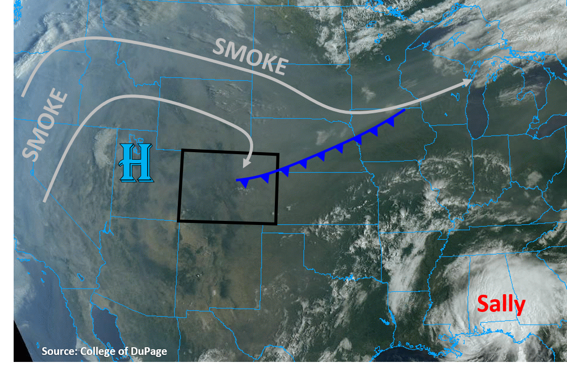
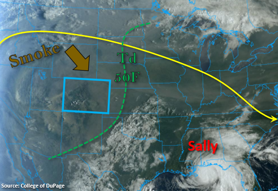
Expect an increase in southwest and westerly winds over the northwest corner of the state this afternoon. Winds are expected to be in the 12 to 18 mph range with gusts up to 25 mph possible. With relative humidity values dropping into the single digits, elevated fire weather is anticipated. Afternoon temperatures are expected to be similar to yesterday, so still 4F to 8F above average for this time of year. As the Low approaches, upper level cloud cover will increase this afternoon into this evening, but no rainfall is anticipated. Not much change in the near surface or upper level smoke levels when compared to yesterday.
Southeast Mountains, Front Range, Urban Corridor, Palmer Ridge, Raton Ridge, Northeast Plains, & Southeast Plains:
The lee cyclone to our north will produce south and southwesterly winds across the eastern plains this afternoon in the 10 to 15 mph range. Slightly higher winds are forecast over the Southeast Plains with gusts up to 25 mph possible. Similar story to yesterday in regard to the high temperatures. Still well above normal for this time of year, especially over the Northeast Plains (~10F above normal). Expect increasing upper level cloud cover late this afternoon and into the overnight hours, which will help a bit with the heat and may keep overnight lows slightly higher. No rainfall is forecast due to the dry surface layer, but virga storms could produce some brief wind. The HRRR smoke model is showing a decrease in near surface smoke by this afternoon, but not much change in the upper level smoke. Please, follow your local NWS office for the latest on Air Quality Alerts issued for your area.