Issue Date: Thursday, September 17th, 2020
Issue Time: 09:35AM MDT
— Flooding is NOT expected today
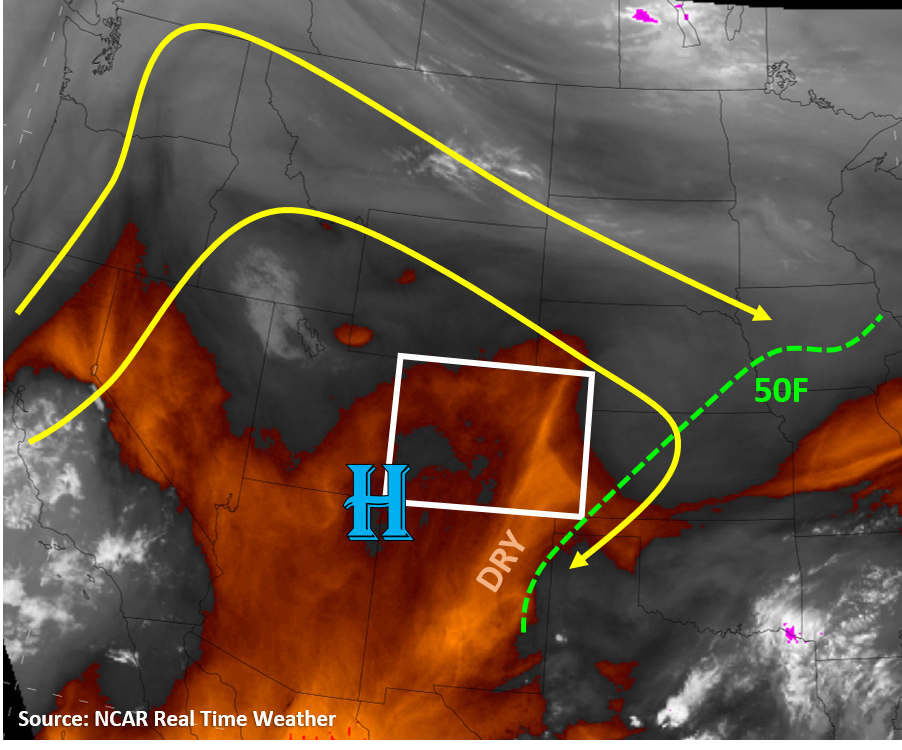
Just like a broken record, today will mainly be a repeat of the previous days this week as it will mainly stay dry across the state. Colorado remains on the east side a high pressure ridge with weak west/northwest steering flow (see image below). The only chance for seeing some light measurable rainfall will be due to diurnal mountain slope flows initiating clouds and maybe a couple light showers over the higher terrains. The southern mountains once again have the highest chances of seeing a few high-elevation raindrops. However, it looks like some increased cloud-cover is expected for the Front Range, but no rainfall is expected. Moisture remains limited across the state as the Grand Junction and Denver soundings only contain 0.34 and 0.42 inches of precipitable water, respectively. Most of this moisture seems to be in the lower half of the atmosphere (boundary layer) according to soundings, but surface dew points are only in the 20Fs and 30Fs across the mountain regions and in the 40Fs across the plains. Dry air and a strong inversion at the top of the boundary layer will make it difficult for storms to fire across the state. The water vapor satellite image below shows some drier air, and likely stronger inversion, is situated over eastern Colorado this morning (see image below). Temperatures will be warmer today for the plains regions, pushing slightly above average into the mid 80Fs for most locations. No flooding is expected today.
Unfortunately, smoke and haze will remain in the air across Colorado today. The highest concentrations of smoke will be over the eastern plains regions, where an Air Quality Alert remains in place today. Check out your local NWS office for more information. There will likely continue to be some local smoke being produced from the Middle Fork, Williams Fork, and Cameron Peak wildfires in the state as the dry and warm weather will favor more active fire activity. However, winds are not expected to be strong today, so fire activity should be limited.
Today’s Flood Threat Map
For more information on today’s flood threat, see the map below. Hover over the threat areas for more details, and click on burn areas to learn more about them. For Zone-Specific forecasts, scroll below the threat map.

Zone-Specific Forecasts:
Northeast Plains, Urban Corridor, Palmer Ridge, Raton Ridge, & Southeast Plains:
Warmer temperatures (80Fs) and continued smoke will impact the area today. An elongated surface low pressure region will extend from southwest to northeast over the northern half of the plains regions, which will set up a convergence boundary over the Palmer Ridge and Northeast Plains regions today. This could be the focus for a few clouds to form, but a strong cap will likely keep storms from developing. Additionally, daytime heating will mix out some of the higher 40Fs dew points, so moisture will be limited. No flooding is expected today.
Grand Valley, Northwest Slope, Northern Mountains, Front Range, Central Mountains, Southwest Slope, San Juan Mountains, Southeast Mountains, & San Luis Valley:
Daytime heating will allow up-mountain flow today and some clouds and a few showers to form near mountaintops and ridgelines. The southern San Juan Mountains have the highest (although still low) chances of seeing measurable rainfall from a light shower, but total accumulations should stay below 0.1 inches and confined to the higher elevation locations due to plenty of sub-cloud evaporation. The Front Range should see an increase in fair weather clouds, but rainfall is not expected. Any showers that form today could create some wind gusts up to 30 mph due to plenty of sub-cloud evaporation, but these winds are not likely over the active wildfires in the state. No flooding is expected.