Issue Date: 5/27/2015
Issue Time: 10:33 AM
A LOW FLOOD THREAT CONTINUES FOR PORTIONS OF THE CACHE LA POUDRE/SOUTH PLATTE RIVER, AND PORTIONS OF THE ARKANSAS RIVER.
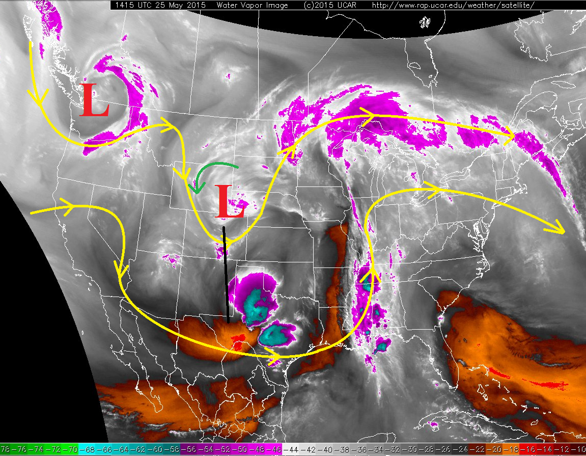
The broad-scale picture that the water vapor imagery (below) shows will help to define the forecast for today. The upper-level low (marked by the red “L”) will continue to dig to the south-southeast, placing Colorado under west-southwest flow for today. The water vapor imagery shows that the best mid-level moisture will remain to the south and north of Colorado, leading to a decrease in precipitable water values. Additionally, the westerly flow will mix down to the surface, eroding surface dewpoints and limiting the coverage/intensity of thunderstorms over most of the state. Expect the number of showers and thunderstorms to be slightly less than yesterday over and near the mountains.
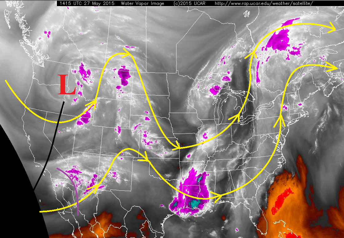
The exception to all of this, of course, will be near the CO/KS border, where dewpoints just east of a developing dryline will remain in the upper 40s/low 50s. Furthermore, the dryline will provide support for strong-to-severe thunderstorms to develop, and this is where the heaviest rain of the day will be found, along with the possibility for large hail (> 1 inch), damaging wind gusts (> 60 mph), and an isolated tornado or two.
Finally, the last feature in the water vapor imagery to be discussed is a remnant upper-level low (marked by the purple line). This remnant low will transition into a shortwave trough and slide into western Colorado overnight tonight. This will likely keep a few showers/weak thunderstorms going until after midnight over the mountains.
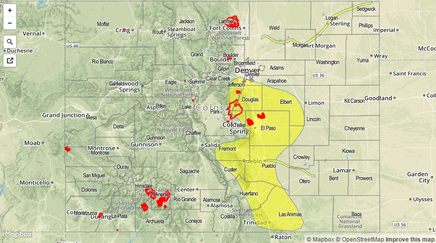
Today’s Flood Threat Map
For more information on today’s flood threat, see the map below (hover over threat areas for more details). For Zone-Specific forecasts, jump below the map.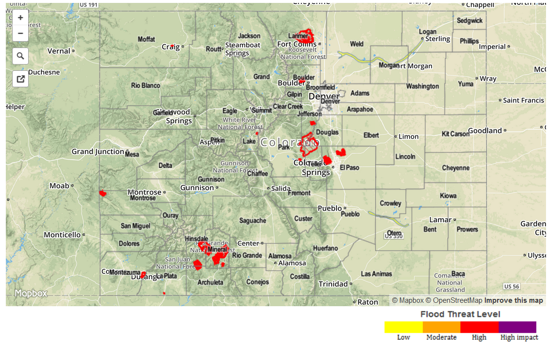
Zone-Specific Forecasts
Front Range and Urban Corridor:
Isolated-to-scattered showers and thunderstorms expected this afternoon and evening, producing mainly gusty winds and light-to-moderate rain. Rain rates will generally be in the 0.2-0.4 inches/hour range, but a stronger thunderstorm will hold the potential for 0.5-1.0 inches/hour. However, drying of the lower levels will discourage those maximum rates from being realized at the surface.
Timing: Noon – 8 PM
Palmer Ridge, Southeast Plains and Northeast Plains:
These are the regions of interest today, mainly east of the 104th meridian, particularly for strong-to-severe thunderstorms developing this afternoon and evening. West of the 104th meridian, showers and thunderstorms will be weak and isolated; east of the 104th meridian and near the CO/KS border, the environment will be favorable for the development of a few strong-to-severe thunderstorms. Maximum rain rates under these storms will be 1.5-2.5 inches/hour, but storm motions will limit any flash flooding potential.
Timing: 2 PM – 11 PM
Southeast Mountains and Raton Ridge:
Isolated showers and thunderstorms are on tap, resulting in rain rates in the 0.2-0.4 inch/hour range. High temperatures will continue their trend upward towards “normal” for this time of year.
Timing: 1 PM – 7 PM
Northern Mountains, Northwest Slope, Central Mountains, San Juan Mountains, Grand Valley, San Luis Valley, and Southwest Slope:
Scattered showers and thunderstorms, slightly fewer than yesterday, are expected across these regions. Rain rates will generally be in the 0.2-0.4 inches/hour range, but a stronger thunderstorm over the San Juan Mountains will hold the potential to produce 0.3-0.6 inches/hour.
Timing: 11 AM – 9 PM, with a few showers and thunderstorms continuing until after midnight.