Issue Date: 5/4/2016
Issue Time: 9:35 AM
NO FLOOD THREAT IS FORECAST.
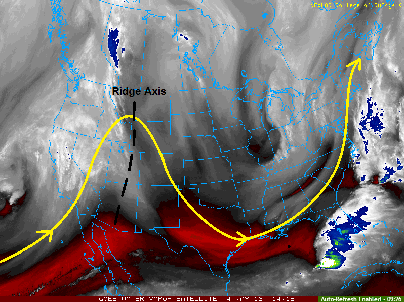
High pressure at the surface and upper-level ridging overhead will leave today beautiful across Colorado. Sun-drenched skies will allow temperatures to climb to values slightly higher than yesterday statewide, offering the perfect excuse to eat lunch outside or perhaps leave the office just a little early to enjoy the conditions. There just simply is not much to dislike about today’s forecast.
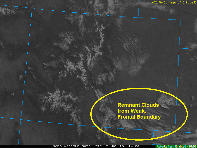
It would not be a Colorado spring forecast, however, if we did not discuss at least the isolated risk of showers/weak thunderstorms over the High Country. A narrow ribbon of moisture is expected to shift into southwestern and central Colorado this afternoon. This moisture, combined with sufficient daytime heating, will allow for a couple brief showers/weak thunderstorms to develop. Activity is expected to be elevated, and will result in more wind than rain. For more specifics, see the region-specific discussions below.
Today’s Flood Threat Map
For more information on today’s flood threat, see the map below (hover over threat areas for more details). For Zone-Specific forecasts, jump below the map.

Zone-Specific Forecasts
Urban Corridor, Southeast Plains, Palmer Ridge, Raton Ridge, and Northeast Plains:
Sunny and warm, with high temperatures in the 70s for the lower elevations, and in the mid-to-upper 60s for the higher elevations of the Palmer Ridge and Raton Ridge. Overnight, the skies will remain clear with lows in the 40s.
Northern Mountains, Northwest Slope, Front Range, Southeast Mountains, and San Luis Valley:
Mostly sunny and warm will be the main weather story today, with high temperatures in the 50s and 60s for mountain valleys and in the 40s for the higher elevations. An isolated shower/weak thunderstorm or two cannot be ruled out over the higher terrain, mainly south of I-70. Activity will elevated, resulting in more wind than rain. Rain rates will be less than 0.15 inches/hour.
Timing: 1 PM – 9 PM
Grand Valley, Central, Mountains, San Juan Mountains and Southwest Slope:
Plenty of sunshine and warmth are in the forecast today, especially for valley locations. Over the higher peaks, there will be a couple isolated showers/weak thunderstorms this afternoon and evening, but nothing significant. Rain rates will be less than 0.15 inches/hour everywhere except the San Juan Mountains region, where better moisture will push maximum rain rates to 0.25 inches/hour.
Timing: 11 AM – 8 PM