Issue Date: Friday, June 17th, 2016
Issue Time: 10:28AM MDT
— Low flood threat for Urban Corridor, Northeast Plains and Palmer Ridge
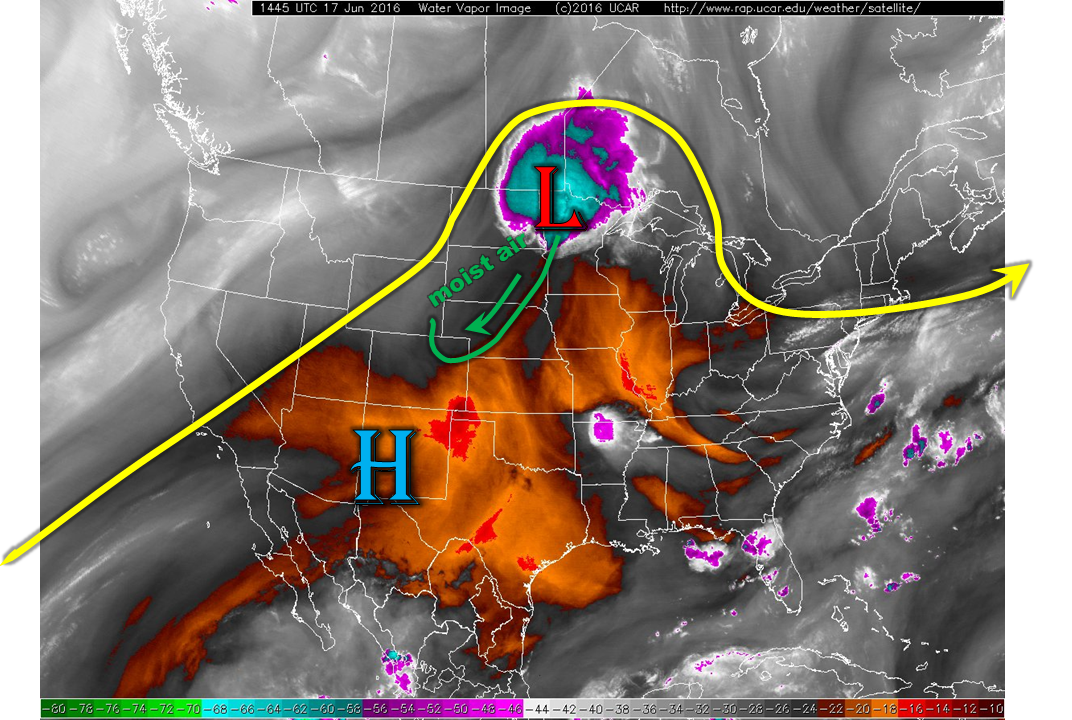
As seen in the water vapor image, below, the ridge that has been an on and off staple for the past few weeks continues to hold across the Rocky Mountains states. However, a low pressure system is found over the eastern Dakotas that is leading a cool, moist front southward and eastward. This front has already arrived in northeast CO in the form of higher low-level moisture. However, the brunt of the deeper moisture, possibly associated with an organized outflow boundary from this afternoon’s expected convection across the Great Plains, will arrive in the later afternoon and evening hours. Thus, a few isolated heavy rainfall storms will be possible, first during the late afternoon near the Kansas border and then farther west across the northern Palmer Ridge and surrounding areas. A Low flood threat has been issued.
For all other areas, another warm and dry day is expected with ample sunshine. We have removed the riverine flood threat today as all snowmelt-related runoff has now peaked with streams receding. Meanwhile, the wildfire threat continues along and west of the Continental Divide today.
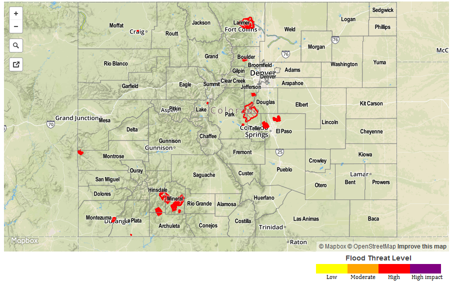
Today’s Flood Threat Map
For more information on today’s flood threat, see the map below (hover over threat areas for more details). For Zone-Specific forecasts, scroll below the map.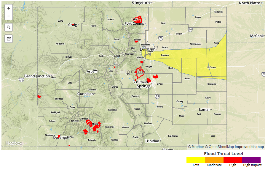
Zone-Specific Forecasts:
Urban Corridor, Northeast Plains, Palmer Ridge:
Sunny early then becoming partly cloudy with isolated to scattered storms along the Kansas border. Max 1 hour rain rates up to 2.0 inches possible, leading to isolated field and roadway flooding. Later in the evening and into the overnight hours, isolated to scattered storms are possible across the Palmer Ridge with rain rates up to 1.6 inches per hour. Urban street flooding and field flooding is possible from these. A Low flood threat has been issued for parts of the area.
Primetime: 3PM to 8PM along the Kansas border, and 6PM to 4AM farther west
Southeast Plains, Southeast Mountains, Raton Ridge, San Juan Mountains, San Luis Valley, Central Mountains, Front Range, Northern Mountains, Grand Valley, Northwest Slope, Southwest Slope:
Sunny and hot with low elevation locations in the southeast approaching 100F once again. A wildfire threat continues west of the Continental Divide. A Red Flag warning is in effect for parts of the state. Keep informed through local National Weather Service forecasts. Flooding is not expected today.