Issue Date: 6/15/2016
Issue Time: 9:17 AM
A LOW FLOOD THREAT CONTINUES FOR PORTIONS OF THE GREEN RIVER IN WEST CENTRAL MOFFAT COUNTY, THE CACHE LA POUDRE RIVER IN LARIMER COUNTY AND WELD COUNTY, AND THE SOUTH PLATTE RIVER IN WELD COUNTY.
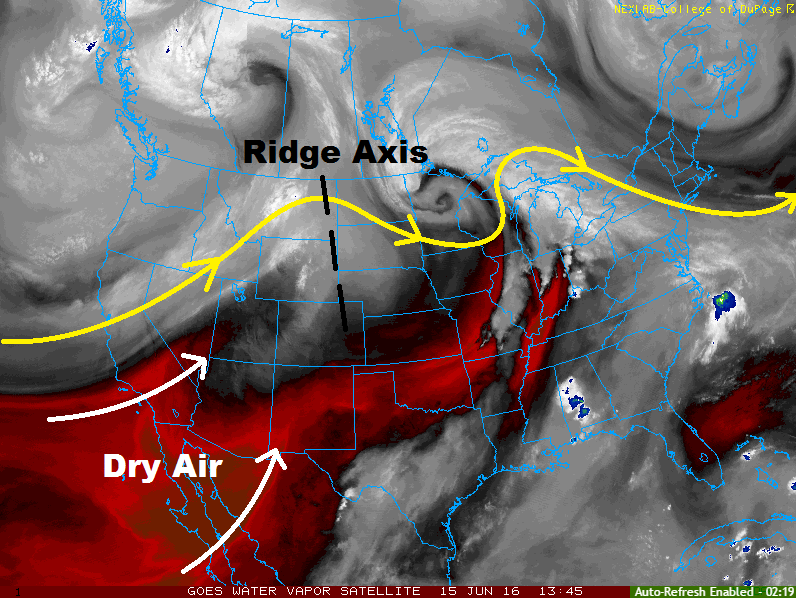
The water vapor image below tells the weather story of the day, and it sure is a short story. Upper-level ridging will continue to build across the central US, and deep southwesterly flow aloft will continue to pull hot, dry air into Colorado. With this setup in place, there is no chance of precipitation and only a few high clouds will scrape northern Colorado where there is *slightly* better moisture.
Gusty winds will accompany the hot and dry conditions, especially across western Colorado. Low-level relative humidity values will be critically low, with widespread values less than 15%. Due to this, Red Flag Warnings have been issued for areas along and near the western CO border. Stay tuned to the local National Weather Service offices to find out the exact area under the Red Flag Warning, and for updates on any changing fire weather conditions.
Today’s Flood Threat Map
For more information on today’s flood threat, see the map below (hover over threat areas for more details). For Zone-Specific forecasts, jump below the map.

Zone-Specific Forecasts
Urban Corridor, Northeast Plains, Palmer Ridge, Raton Ridge, and Southeast Plains:
Hot, sunny, and dry is the weather story of the day. Temperatures will be in the upper 80s and 90s for most areas, with a few locations reaching near 100 F in the Arkansas River Valley.
Front Range, Northern Mountains, Northwest Slope, Central Mountains, Grand Valley, Southeast Mountains, Southwest Slope, San Juan Mountains, and San Luis Valley:
Much like the other regions above, today will be sunny, dry, and hot across the area. Red Flag Warnings have been issued for portions of the Northwest Slope, Grand Valley, Central Mountains, Southwest Slope, and San Juan Mountains.