Issue Date: 8/28/2016
Issue Time: 10:15 AM
A LOW FLOOD THREAT IS FORECAST TODAY FOR PORTIONS OF THE NORTHWEST SLOPE, NORTHERN MOUNTAINS, CENTRAL MOUNTAINS, GRAND VALLEY, SOUTHWEST SLOPE, SAN JUAN MOUNTAINS, FRONT RANGE, SOUTHEAST MOUNTAINS, URBAN CORRIDOR, PALMER RIDGE, RATON RIDGE, NORTHEAST PLAINS, AND SOUTHEAST PLAINS.
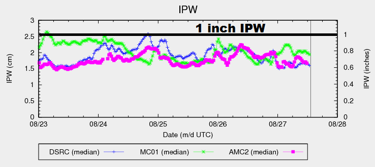
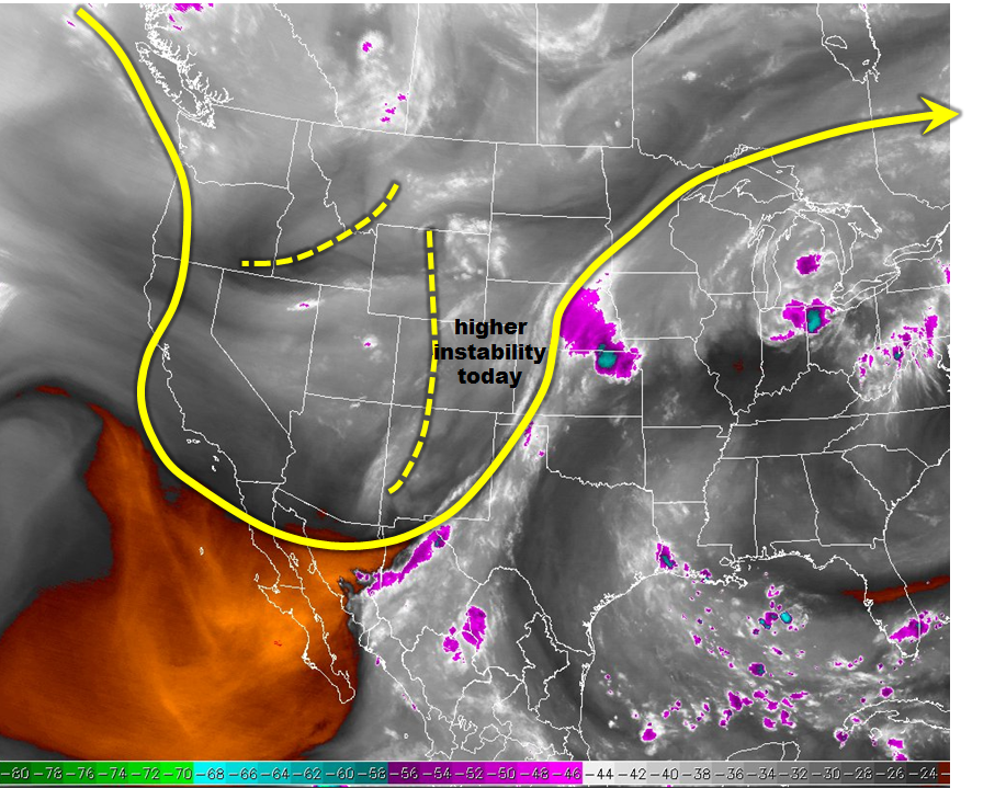
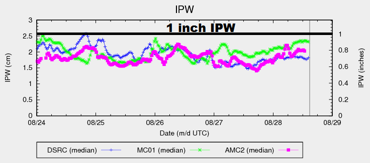
Another unsettled period is expected as an upper-level low shifts eastward out of the 4-corners region and into northern New Mexico. This will provide favorable dynamics for the production of isolated-to-scattered showers/storms across much of Colorado. Much like yesterday, the higher terrain and western slope will see the best coverage, while areas east of the mountains remain in the isolated-to-widely scattered category. A slight increase in moisture (shown well in the chart below), as well as an uptick in instability, will provide a bit more fuel for today’s thunderstorms, keeping the threat of heavy rain in the forecast for areas south of I-70. Even so, the flood threat remains on the low end of the scale, thanks to weak wind shear keeping storm organization/maintenance limited. Most activity will come to an end around 10-11 PM, with a few showers/storms continuing into the overnight and early morning hours thanks to favorable dynamics aloft.
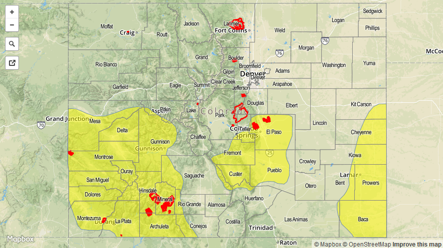
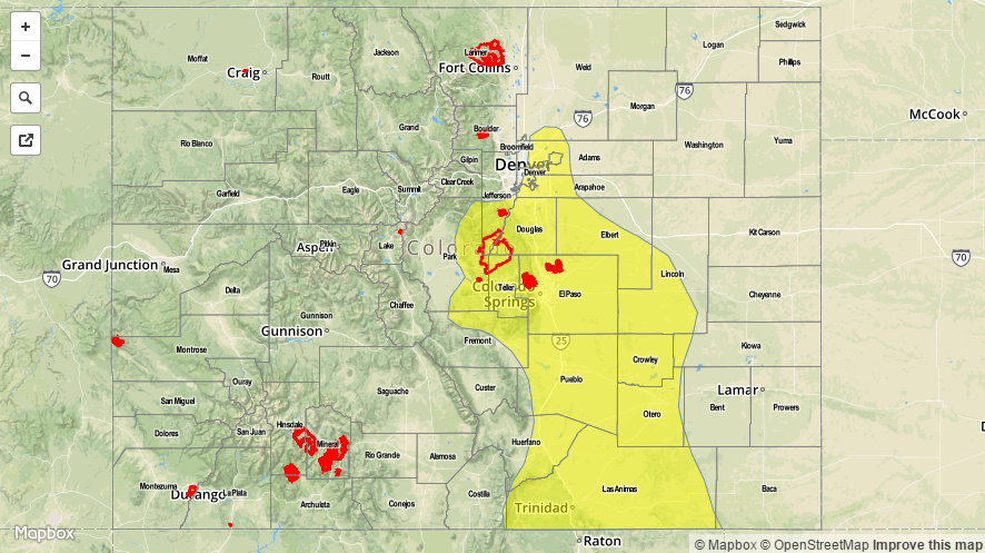
Today’s Flood Threat Map
For more information on today’s flood threat, see the map below (hover over threat areas for more details). For Zone-Specific forecasts, jump below the map.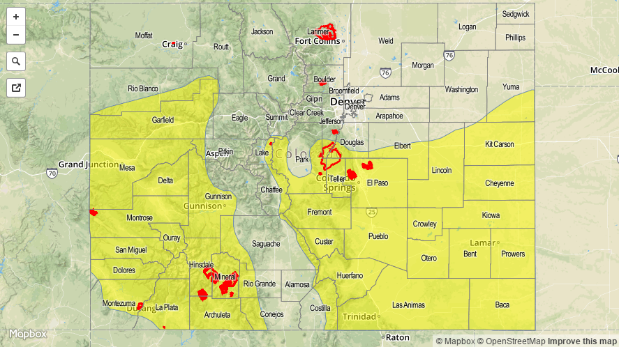

Zone-Specific Forecasts
Northeast Plains, Urban Corridor, Palmer Ridge, Southeast Plains, and Raton Ridge:
Isolated-to-widely scattered showers/thunderstorms expected, with the best coverage near the mountains, along the preferred terrain of the Palmer Ridge and Raton Ridge, and across the far Southeast Plains. Most will be garden variety, but a couple will become strong-to-marginally severe, producing bouts with heavy rain, small hail, and strong winds. Maximum rain rates are as follows:
Northeast Plains: 1.5-2.0 inches/hour
Southeast Plains: 1.8-2.5 inches/hour
Urban Corridor, Palmer Ridge, and Raton Ridge: 0.8-1.2 inches/hour
Timing: 1 PM – 11 PM, with a few lingering showers/storms into the early morning hours
Front Range, Southeast Mountains, Northern Mountains, Northwest Slope, Grand Valley, Central Mountains, San Juan Mountains, Southwest Slope, and San Luis Valley:
Scattered showers and thunderstorms are expected, with most being garden variety. Better daytime heating today, as compared to yesterday, will bring about a couple more thunderstorms capable of locally heavy rainfall. Maximum rain rates will be:
Northwest Slope, Northern Mountains, and Central Mountains: 0.6-1.0 inches/hour
Grand Valley, Southwest Slope, San Juan Mountains, San Luis Valley, Front Range, and Southeast Mountains: 0.8-1.2 inches/hour
Timing: 11 AM – 9 PM, with a few lingering showers/weak thunderstorms into the early morning hours