Issue Date: Wednesday, June 28th, 2017
Issue Time: 11AM MDT
— Flooding is NOT expected today
— Extreme fire danger for western Colorado
There will continue to be contrasting weather stories across our state today, where the weather never ceases to amaze. Regarding rainfall chances, a marginal amount of low-level moisture will hold on during the afternoon and evening hours along the KS/NE borders, which combined with favorable shear profiles could produce severe storms. Large hail, gusty winds and a tornado threat will be in the realm of possibilities today. Very short-duration heavy rainfall will be possible, but flooding is NOT expected.
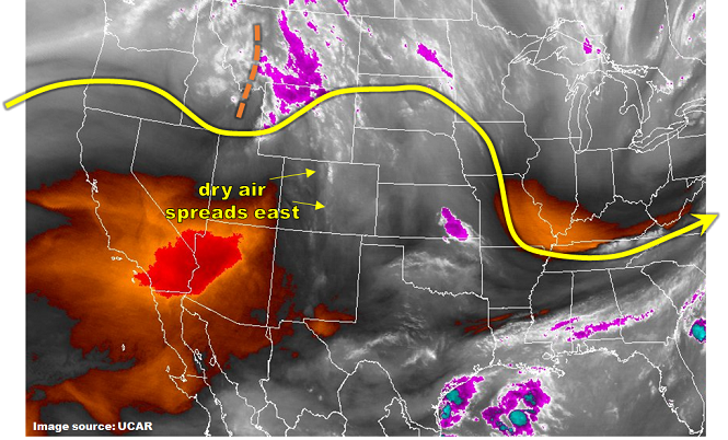
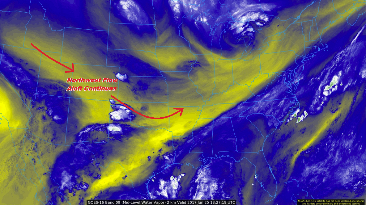
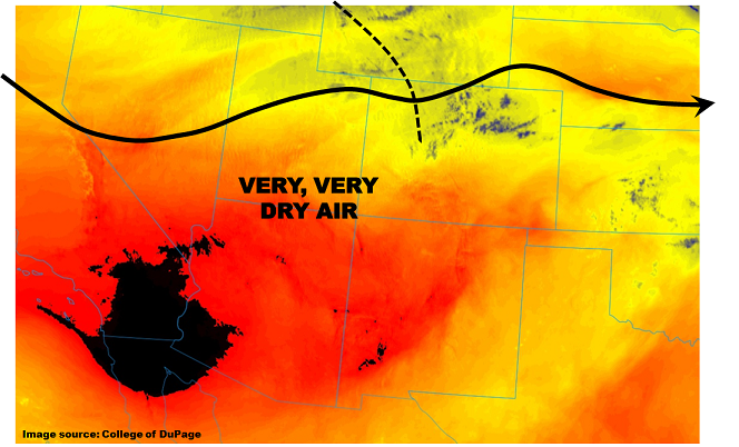
Perhaps the bigger story, however, will be the extreme fire danger in the western part of the state where low relative humidity (see water vapor image below), gusty winds and hot temperatures will create a dangerous situation for spreading fires. Hikers/campers – please be cautious.
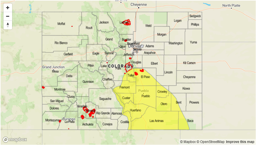
Today’s Flood Threat Map
For more information on today’s flood threat, see the map below (hover over threat areas for more details). For Zone-Specific forecasts, scroll below the map.

Zone-Specific Forecasts:
Northeast Plains, Southeast Plains:
Partly cloudy with isolated to scattered thunderstorms possible after noon. Max 30 minute rainfall up to 0.8 inch and max 1-hour rainfall up to 1.2 inches will be just under flood intensity; thus no threat is issued. However, severe weather will be possible, including hail up to 2.5 inches, gusty winds up to 70 mph and an isolated tornado.
Primetime: 2PM to 11PM
Southeast Plains, Palmer Ridge, Southeast Mountains, Raton Ridge, Urban Corridor, Front Range:
Sunny early then partly cloudy with an isolated shower or perhaps a weak thunderstorm possible during the afternoon before the boundary layer mixes out. Max 30-minute rainfall 0.3 inches. Flooding is not expected today.
Primetime: 1PM to 8PM
Grand Valley, Northwest Slope, Northern Mountains, Central Mountains, Southwest Slope, San Luis Valley, San Juan Mountains:
Mostly sunny and hot today. An isolated shower or weak thunderstorm cannot be ruled out over higher terrain near the WY border. Max 1-hour rainfall up to 0.2 inches. Gusty winds and dry lightning will be more of a threat than rainfall. An extreme fire danger exists today, with a Red Flag warning in effect for most of the area. Please stay tuned to local National Weather Service offices for updates.
Primetime: 11AM to 7PM