Issue Date: 7/2/2017
Issue Time: 8:00 AM
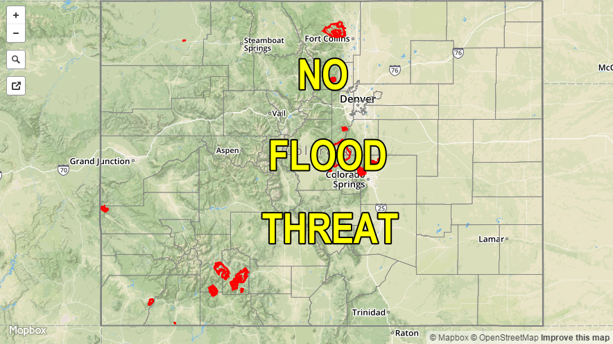
NO FLOOD THREAT IS FORECAST.
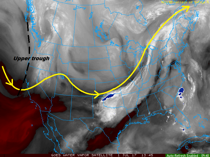
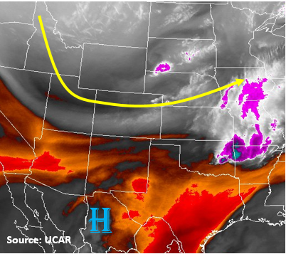
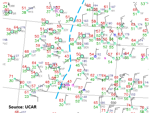
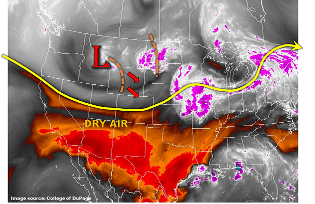
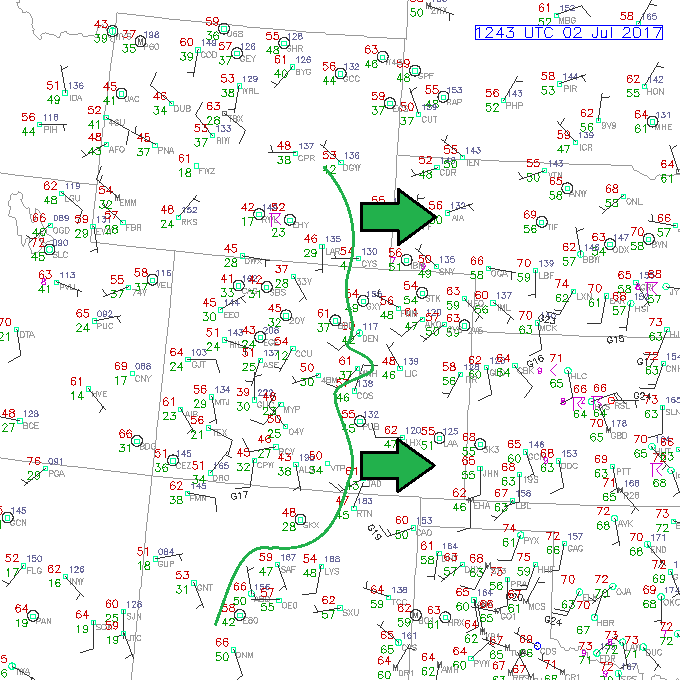
Today’s forecast features an uptick in showers/thunderstorms as a mid-level disturbance pushes across the region during the afternoon and evening hours. The increase in shower/thunderstorm coverage does not come with an increase in the flood threat, however, due to high temperature-dewpoint spreads in the low-levels and at the surface. I have annotated the current position of the 40°F dewpoint line on the surface observation map below. This line will shift east through the morning and into the afternoon hours as dry air aloft mixes down to the surface, pushing the best surface moisture over the far eastern plains. Even so, where the surface moisture hangs on, the high temperature will be in the low-to-mid 90’s, resulting in an “Inverted-V” atmospheric profile. The “Inverted-V” is indicative of efficient evaporation of falling precipitation, which will limit the rain rates at the surface.
West of the 40°F dewpoint line, and over the mountains especially, shower/thunderstorm activity will produce mainly light rain and gusty winds due to the same aforementioned “Inverted-V” atmospheric profile. The main threat will be the potential for dangerous cloud-to-ground lightning with thunderstorms, so remember that “if thunder roars, go indoors.”
Today’s Flood Threat Map
For more information on today’s flood threat, see the map below (hover over threat areas for more details). For Zone-Specific forecasts, jump below the map.

Zone-Specific Forecasts
Front Range, Southeast Mountains, and Urban Corridor:
Scattered showers/thunderstorms are expected to develop over the mountains around 11 AM, spreading eastward with time, and impacting the Urban Corridor by 1 PM. Most activity will wind down by 10 PM, but a few lingering showers/thunderstorms will hang around into the early morning hours. Maximum rain rates will be 0.3-0.6 inches/hour for the mountains, and 0.4-0.8 inches/hour for the Urban Corridor.
Palmer Ridge, Northeast Plains, and Southeast Plains:
Scattered showers/thunderstorms are expected to develop around 2 PM, continuing through the evening hours, and exiting the state to the east by 1 AM. A few storms near the CO/KS and CO/NE border will become strong-to-severe, with the main threats being damaging straight-line winds and large hail. Brief periods of heavy rain will also attend the strongest storms near the border, but will remain under flash flood threat thresholds. Maximum rain rates are as follows:
Western half of the Palmer Ridge: 0.4-0.8 inches/hour
Eastern half of the Palmer Ridge: 0.8-1.2 inches/hour
Northeast Plains and Southeast Plains: 1.25-1.75 inches/hour
Northern Mountains, Northwest Slope, Central Mountains, Grand Valley, Southwest Slope, San Juan Mountains, and San Luis Valley:
Scattered showers/thunderstorms are expected to develop later this morning (between 10 AM and Noon), continuing through the afternoon and evening hours, diminishing after sunset, and coming to an end around midnight. Light rain and gusty winds will be the main impact from this activity, but dangerous cloud-to-ground lightning will be the main threat from thunderstorms. Maximum rain rates are expected to remain low at 0.25-0.5 inches/hour.