Issue Date: Saturday, July 22, 2017
Issue Time: 10:00AM MDT
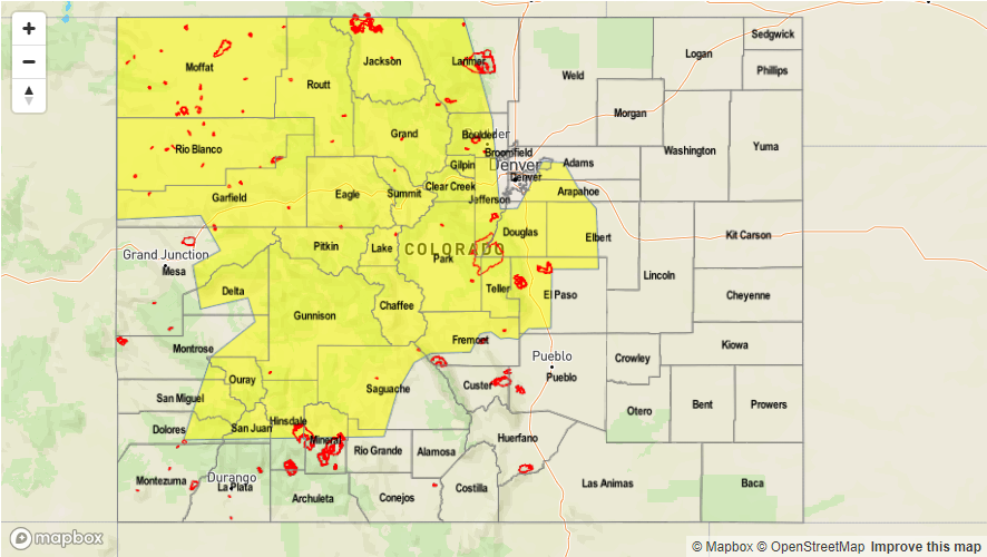
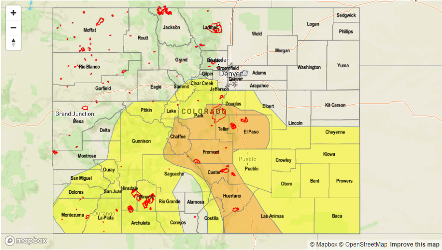
— MODERATE flood threat for Central Mountains, Front Range, Urban Corridor, Palmer Ridge, Southeast Mountains, Southeast Plains, Raton Ridge
—LOW flood threat for parts of Palmer Ridge, Urban Corridor, Front Range, Central Mountains, Southwest Slope, San Juan Mountains, Southeast Mountains, Southeast Plains, Raton Ridge
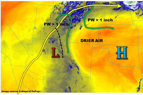
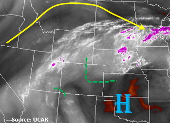
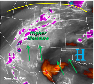
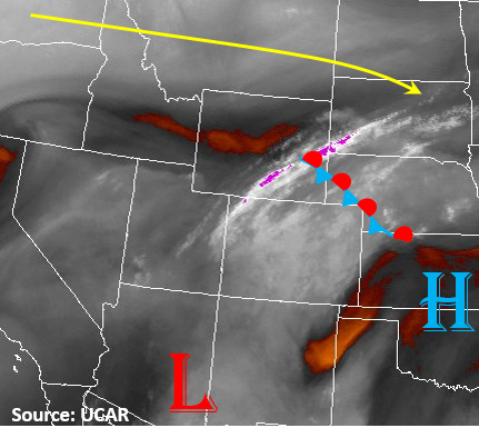
The upper-level ridge begins to rebuild north and west of Colorado today. In the water vapor imagery below, you can see some drier air over Wyoming that will mix into the northern part of the state later this morning and afternoon. Currently, there is heavy cloud cover over the mountains and eastern plains. It may take some time for this burn off, but should by early this afternoon with both the drier air and increasing sun. Partly cloudy skies should limit temperatures and instability today in the northeastern portion of the state. Currently, Precipitable Water (PW) is 0.82 inches in Denver and 0.92 in Grand Junction. Pockets of PW greater than 1 inch will be confined to the southeastern plains and SW corner of the state. There should still be enough moisture for thunderstorms over the higher terrain in the northern portion of the Front Range.
Upslope flow will set up once again today favoring the moisture rich areas in the south for the heavier rainfall. Storms should begin firing over the San Juan Mountains, Southeast Slope and Central Mountains by 11am with all the higher terrain storms firing just after noon. As the storms begin to move off the mountains in the late afternoon, there is a chance for an isolated shower over the Palmer Divide with more widespread thunderstorms over the adjacent Southeast Plains and Raton Ridge. Max 1-hour rain rates for the mountains could be as high as 1.3 inches. Threats include road and small stream flooding, mud flows and debris slides over the steeper terrain. A Moderate threat has been placed over portions of the SE mountains and adjacent plains due to high instability and moisture. Burn scars in the Southeast Mountains need to be monitored close with already saturated soils and high probability for rain rates greater than 0.5 inches again today. Mud flows and debris slides are possible, so campers near these burn scars and steep terrain need to watch the weather carefully. Over the adjacent plains, expect 1-hour rain rates up to 1.9 inches with 3-hour totals of 2.6 inches. Threats include road flooding, field ponding and flooding of small streams. Hail up to 1 inch and gusty winds can accompany the more severe storms.
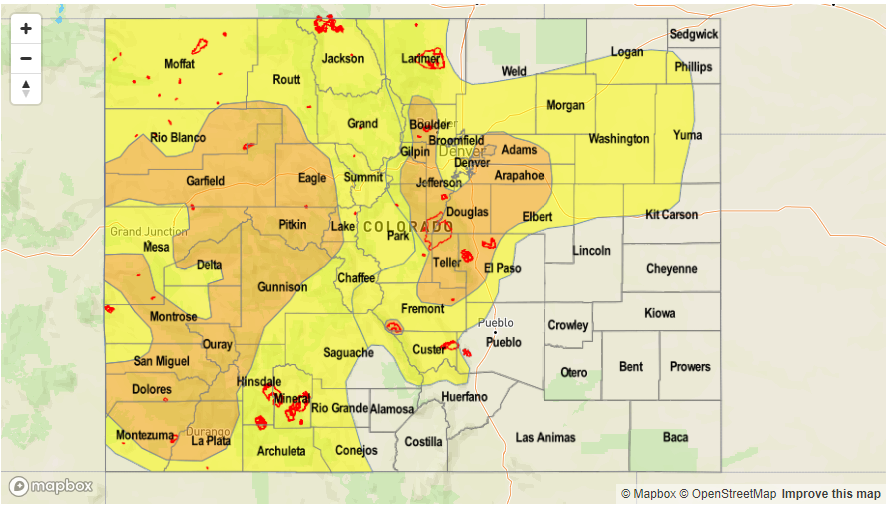
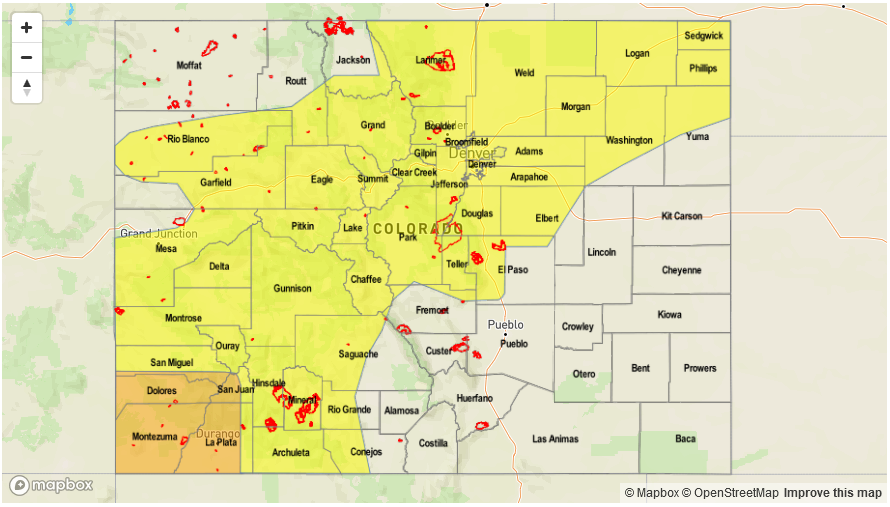
Today’s Flood Threat Map
For more information on today’s flood threat, see the map below (hover over threat areas for more details). For Zone-Specific forecasts, scroll below the map.

Zone-Specific Forecasts:
Front Range, Urban Corridor, Palmer Ridge, Southwest Slope, San Juan Mountains, San Luis Valley, Southeast Mountains, Southeast Plains, Raton Ridge:
Partly cloudy becoming sunny in spots until numerous showers and thunderstorms develop shortly after 11AM. Max 1-hour rainfall up to 1.3 inches and up to 1.9 inches below 6,000 feet. 3-hr totals up to 2.6 inches are possible below 6,000 feet. Isolated flash flooding, debris slides and mud flows will be possible especially over burns scars and where soils are already saturated from multiple days of rain. There is a slight chance of severe weather with the main hazards being hail up to 1 inch and gusty winds. A Moderate flood threat has been issued.
Primetime: 1PM to 1AM
Northwest Slope, Grand Valley, Northern Mountains, Central Mountains, Northeast Plains:
High temperatures will be 5-10F cooler today with the cloud cover over the Northeast Plains this morning. Partly cloudy early then scattered to numerous showers and thunderstorms developing just after noon. Max 1-hour rain rates up to 0.8 inches. Storms should be confined to the higher terrain. Storms will start to dissipate after sundown and should be over by about 10PM.
Primetime: 12PM to 10PM