FTB 08-19-2017: Beautiful Day with Slight Uptick in Showers

Issue Date: Saturday, August 19, 2017
Issue Time: 09:20AM MDT

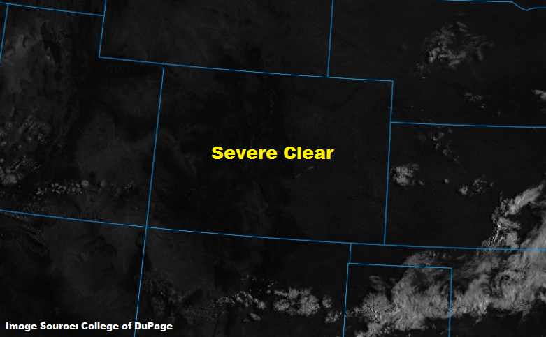
— There is NO flood threat today

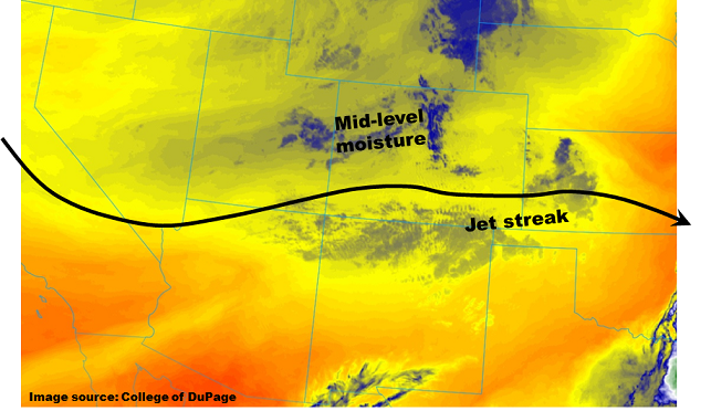
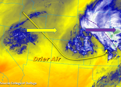
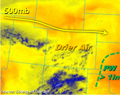
Another beautiful day of weather is expected statewide. The upper-level ridge continues to reside just north of Colorado. Light westerly flow under the ridge will help continue to dry out the moisture in the low and mid-levels of the atmosphere.  Precipitable Water (PW) at Denver and Grand Junction this morning was only 0.58 inches. PW is expected to remain under 1 inch across the state today, which will give us another break from heavy rainfall.

Storms will begin to fire over the mountains this afternoon. The limited moisture will reduce coverage of the showers once again. Expect storms that form to favor the climatologically active regions of the Palmer Ridge and San Juan Mountains. There is a chance for a few stronger storms to initiate over the Southeast Plains this afternoon along a convergence boundary. The low atmospheric moisture paired with high-based thunderstorms will keep rainfall rates below flood threat levels. Storms will end shortly after sundown. Flooding is not expected today.

Today’s Flood Threat Map

For more information on today’s flood threat, see the map below (hover over threat areas for more details). For Zone-Specific forecasts, scroll below the map.

Zone-Specific Forecasts:

Front Range, Urban Corridor, Palmer Ridge, Northeast Plains, Southeast Mountains, Raton Ridge, Southeast Plains:

Most sunny this morning become partly cloudy this afternoon. Isolated showers and weak thunderstorms will develop over the mountains this afternoon. 1-hour rain rates will be up to 0.6 inches. A few stronger storms may form over the Southeast Plains, with 1-hour rain rates up to 1 inch. There is no flood threat today.

Primetime: 1PM to 9PM

Northwest Slope, Grand Valley, Southwest Slope, Northern Mountains, Central Mountains, San Juan Mountains, San Luis Valley:

Sunny today becoming partly cloudy over the higher terrain this afternoon. Best chance for showers are over the San Juan Mountains. Weak thunderstorms may produce 1-hour rain rates up to 0.5 inches. Flooding is not expected today.

Primetime: 12PM to 8PM


FTB 08-18-2017: Pleasant Friday In Store, As Further Drying Expected

Issue Date: Friday, August 18, 2017
Issue Time: 9:10AM MDT

— Flooding is NOT expected today

As shown in the visible satellite imagery, below, for the first time in quite a while, there was not a cloud to be found over Colorado this morning. This does not always have predictive value, but today it will. Precipitable Water (PW) values this morning were in the 0.4 – 0.8 inch range, with only limited moisture in the boundary layer. Under light westerly flow, further gradual drying is expected today. With mid-level temperatures warming due to weak subsidence, rainfall coverage and intensity will decrease further today. Expect some isolated to possibly scattered showers and a weak thunderstorm in the climatologically favored Palmer Ridge and San Juans. However, flooding is not expected today.

Today’s Flood Threat Map

For more information on today’s flood threat, see the map below (hover over threat areas for more details). For Zone-Specific forecasts, scroll below the map.

Zone-Specific Forecasts:

Front Range, Urban Corridor, Palmer Ridge, Northeast Plains, Southeast Mountains, Raton Ridge, Southeast Plains:

Sunny this morning, then partly cloudy with isolated to scattered showers and a weak thunderstorm possible. Highest coverage will be over western parts of the Palmer Ridge. Max 1-hour rain rates up to 0.4 inches. Flooding is not expected today.

Primetime: 12PM to 7PM

Northwest Slope, Grand Valley, Southwest Slope, Northern Mountains, Central Mountains, San Juan Mountains, San Luis Valley:

Sunny early with isolated showers and a weak thunderstorm possible this afternoon. Highest coverage will be over southern parts of the Central Mountains as well as the San Juans. Max 1-hour rainfall up to 0.25 inches is possible. Flooding is not expected today.

Primetime: 12PM to 7PM

FTB 08-17-2017: Isolated Severe Weather Possible Southeast, But Drying For Most

Issue Date: Thursday, August 17, 2017
Issue Time: 9AM MDT

Flooding is NOT expected today

This morning’s water vapor image, below, shows a weak trough is currently positioned over Colorado. Westerly flow has advected drier air across most of the state, with the biggest impact seen at lower levels. This morning’s Precipitable Water values were in the 0.5 – 0.9 inch range, with the highest values being limited to the far southeast corner of the state. Mid-level moisture was noted across the state, organized by a jet streak positioned along the NM border. Despite the clouds, there will be enough sunshine this morning to generate light to moderate instability especially over the southeast quadrant of the state. Isolated to scattered showers and weak thunderstorms are expected this afternoon over the Palmer Ridge and plains to the south and east. Rainfall rates will be well below flood threat levels, and thus flooding is not expected today.

In the far southeast corner of the state, strong to severe thunderstorms will be possible during the late afternoon and evening. The biggest impact from these will be large hail, gusty winds and an isolated tornado. With westerly steering winds of 25mph+, rain rates should be limited to 1.2 inches per hour or less, which is below flash flood guidance.

Today’s Flood Threat Map

For more information on today’s flood threat, see the map below (hover over threat areas for more details). For Zone-Specific forecasts, scroll below the map.

Zone-Specific Forecasts:

Front Range, Urban Corridor, Palmer Ridge, Northeast Plains, Southeast Mountains, Raton Ridge, Southeast Plains:

Isolated to scattered showers and weak thunderstorms developing by early afternoon, lasting through sunset (except 9PM in the far southeast). Highest coverage will be over the Palmer Ridge and Southeast Plains. Strong to severe thunderstorms are possible in the far southeast regions towards the OK and KS border. Max 1-hour rainfall up to 1.2 inches (southeast) and 0.6 inches (west). Hail up to 1.25 inches, gusty winds up to 65 mph and isolated tornadoes will be possible with the strongest storms in the southeast corner of the state. However, flooding is not expected today.

Primetime: 1PM to 9PM

Northwest Slope, Grand Valley, Southwest Slope, Northern Mountains, Central Mountains, San Juan Mountains, San Luis Valley:

Partly cloudy early with isolated showers and a weak thunderstorm possible this afternoon. Highest coverage will be over the Central Mountains and San Juans. Max 1-hour rainfall up to 0.4 inches is possible. Flooding is not expected today.

Primetime: 12PM to 7:30PM

FTB 08-16-2017: Downtick in Moisture and Break from Heavy Rainfall

Issue Date: Wednesday, August 16, 2017
Issue Time: 09:40AM MDT

—There is NO flood threat today

The upper level trough that helped support thunderstorm activity yesterday can be seen in the water vapor imagery below. The trough continues to move east this morning and is currently helping support cloud cover and light showers over the far eastern plains. The 500mb pattern today is a bit more zonal over Colorado before the ridge starts rebuilding itself the next couple of days. In the wake of the upper-level system, subsidence is forecasted over the majority of the state. This will limit widespread thunderstorm activity today. Precipitable Water (PW) at Denver and Grand Junction this morning are 0.79 and 0.70 inches, respectively. This forecasted to decrease statewide throughout the day as moisture retreats to the east. With lower surface pressures and westerly winds, the entire state will also see drying in the mid-levels. The most drying will occur over the western portion of the state, especially the SW corner.

Best chances for showers today are over the Front Range and adjacent plains over the Palmer Divide. Storms begin to initiate over the higher terrains later in the afternoon and slowly meander SE over the adjacent plains. With drying at the surface and mid-levels, gusty winds are more likely than heavy rainfall. Storms are expected to quickly end after sundown due to the lack of support of upper-level dynamics. There is no flood threat today.

Today’s Flood Threat Map

For more information on today’s flood threat, see the map below (hover over threat areas for more details). For Zone-Specific forecasts, scroll below the map.

Zone-Specific Forecasts:

Front Range, Urban Corridor, Palmer Ridge, Northeast Plains, Southeast Mountains, Raton Ridge, Southeast Plains:

Becoming mostly sunny with highs being a few degrees cooler today. Shower activity will be limited to the Front Range and Palmer ridge with 1-hr rain rates up to 0.6 (east) and .9 (west).

Primetime: 2PM to 10PM

Northwest Slope, Grand Valley, Southwest Slope, Northern Mountains, Central Mountains, San Juan Mountains, San Luis Valley:

Sunny throughout the day with some light clouds over the mountains this afternoon. Temperatures will be a bit cooler than the last couple of days. Isolated showers expected in the Northern Mountains with max 1-hr rainfall up to 0.5 inches. There is a no flood threat for today.

Primetime: 1PM to 9PM