Issue Date: 5/2/2018
Issue Time: 9:05 AM
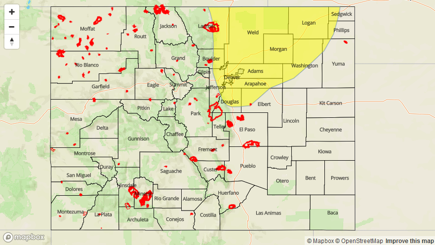
A LOW FLOOD THREAT IS FORECAST TODAY FOR PORTIONS OF THE FRONT RANGE, URBAN CORRIDOR, PALMER RIDGE, AND NORTHEAST PLAINS.
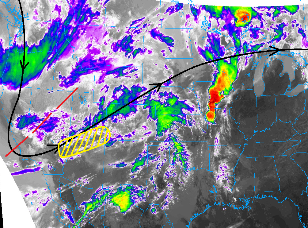
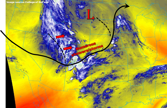
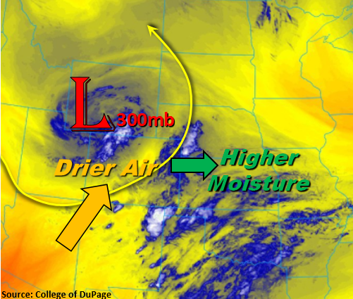
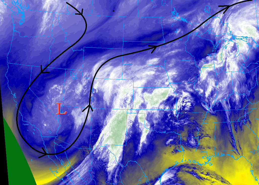
The water vapor imagery below tells a large part of this period’s weather story. The upper-level low, highlighted by the red “L”, and associated trough will swing across the region today, bringing broad support for showers and thunderstorms nearly statewide. An attendant surface low-pressure center will also develop over the Southeast Plains, which will force upslope flow across the Northeast Plains, Urban Corridor, and into the Front Range – this is the one of the driving mechanisms behind today’s low flood threat.
Overall, it is going to be a day of widespread precipitation across Colorado, with higher elevation snow (above 9000-10,000 feet) combining with lower elevation showers and thunderstorms. A couple severe storms are expected to rumble across the Northeast Plains, where better instability and moisture will be in place. The low flood threat is of the long-duration, moderate rainfall variety, with a few stronger thunderstorms sprinkled in. Upslope flow, good moisture, and multiple rounds of rainfall are the driving force, and more specifics regarding timing and rain rates will be laid out in the zone-specific forecast discussions below.
For the far Southeast Plains, specifically Baca County and eastern portions of Las Animas County, rainfall will be hard to come by as the low-levels will remain too dry. In fact, Red Flag Warnings are in place for these areas this afternoon and evening due to the expected dry and windy conditions.
Today’s Flood Threat Map
For more information on today’s flood threat, see the map below (hover over threat areas for more details). For Zone-Specific forecasts, jump below the map.

Zone-Specific Forecasts
Front Range, Urban Corridor, Palmer Ridge, and Northeast Plains:
Scattered-to-widespread showers and thunderstorms are expected throughout the period, producing periods of moderate rainfall, gusty winds, and small hail. A few strong-to-severe thunderstorms are expected east of I-25, and mainly over the Northeast Plains region. The main threat from these stronger storms will be hail up to 1.25 inches in diameter, brief periods of heavy rain, and strong winds up to 40-50 mph. The snow-level will spend much of the day between above 11,000 feet, dropping to around 9,000-10,000 feet overnight. While it won’t rain/snow constantly during the entire period, expect several rounds of precipitation, especially over/near the mountains, with more scattered thunderstorms over the plains. Maximum rain rates are as follows:
Front Range: 0.25-0.5 inches/hour
Urban Corridor: 0.5-0.8 inches/hour
Palmer Ridge: 0.5-1.0 inches/hour
Northeast Plains: 1.0-1.25 inches/hour
Timing: 11 AM – 11 AM
Raton Ridge and Southeast Plains:
While there is fire danger across Baca County and eastern Las Animas County, these regions will otherwise see scattered showers/thunderstorms during the period. Most rainfall will be of the light-to-moderate variety, as low-level moisture will still lack in these areas. The only area of concern is the recent MM 117 fire burn in El Paso County; this will be its first real rainfall test, so out of caution is should be monitored for any issues that may arise. Rainfall rates will generally be in the 0.05-0.15 inches/hour range, with a few thunderstorms over the better moisture in the northwest portions of the Southeast Plains region being able to produce 0.4-0.6 inches/hour.
Timing: 11 AM – 2 AM, with a few lingering showers into tomorrow morning
Northern Mountains, Northwest Slope, Southeast Mountains, Central Mountains, San Juan Mountains, Grand Valley, San Luis Valley, and Southwest Slope:
Scattered-to-widespread showers and a few thunderstorms are expected today, with snowfall above roughly 10,000 feet and rainfall below. Most of the activity will occur over the higher elevations, where upslope flow will drive more persistent activity in an otherwise transient storm regime. Locations below 10,000 feet will generally pick up on anywhere from a trace-to-0.25 inches of rainfall, with higher totals up to 1.0 inches or so expected where rainfall is most persistent. Above 10,000 feet, snowfall will result in liquid equivalence of anywhere from 0.5-2.5 inches, with the highest peaks generally receiving the most. As usual, the San Luis Valley will receive the least amount of rainfall, picking up on maybe 0.1 inches total. Overall, maximum rainfall rates will be in the 0.2-0.5 inches/hour range.
Timing: 11 AM – 11 AM