Issue Date: Monday, June 24th, 2019
Issue Time: 9:00AM MDT
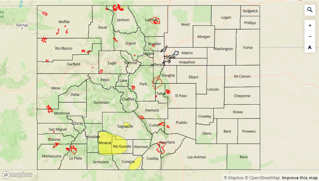
–A LOW flood threat is issued for Saguache Creek, the headwaters of the and along the Rio Grande in Mineral and west Rio Grande Counties and for the San Antonio, Conejos Rivers in south central Colorado, Arkansas River downstream of Pueblo Dam to Nepesta and rivers/streams in central Jackson County.
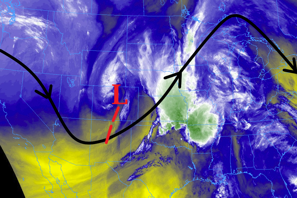
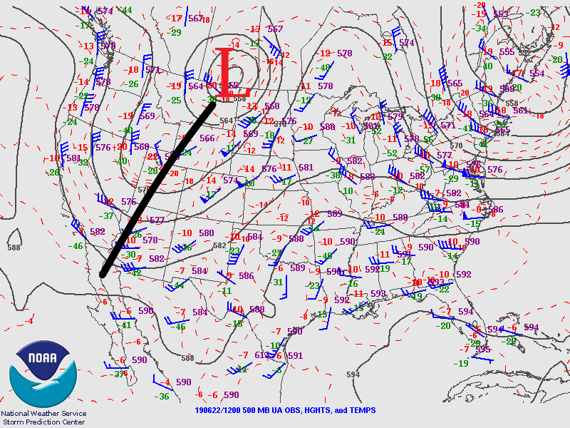
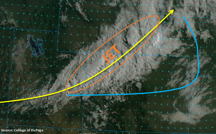
The main axis of the trough has passed to the east, which will place the state under northwesterly/westerly flow aloft today as the ridge slides in from the west and begins to build over the state the next couple of days. Rising pressure with only minimal residual moisture remaining under the ridge (PW was measured at 0.43 inches at Denver) will keep the rainfall today limited to high-based showers and weak thunderstorms favoring the Northern Mountains, eastern San Juan Mountains and southern Front Range/Palmer Ridge intersect for development this afternoon. A couple additional weak storms may be possible over the far Northeast Plains late this afternoon, but should not become severe. Storms are anticipated to dissipate as they move off the mountains with the northwest steering flow. All storm activity is forecast to come to an end a couple hours after sundown as instability declines. As anticipated, flooding from rainfall is not forecast.
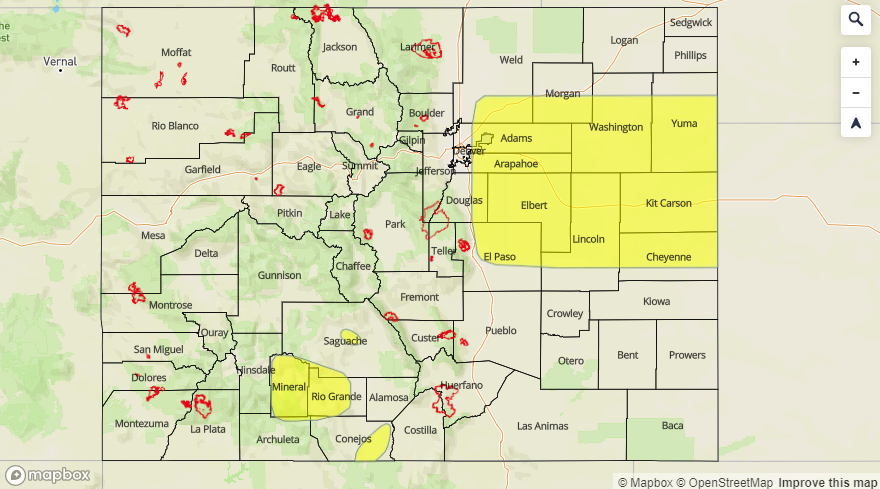
The riverine Low flood threat continues for various stretches of river across the state and are marked in the flood threat map below. Saguache Creek, the headwaters of the and along the Rio Grande in Mineral and west Rio Grande Counties and the San Antonio/Conejos Rivers in south central Colorado have a Flood Warning issued through this afternoon. Minor flooding has also been reported, with some rural roads being washed out, in central Jackson County due to snowmelt and heavy rainfall the last couple of days. This Flood Warning continues through 1PM this afternoon with river levels expected to decrease over the next day or two. Lastly, a Low flood threat has been issued for the Arkansas downstream of Pueblo Dam to Nepesta. The AHPS gage in Avondale is in the Minor flooding stage and is expected to remain elevated (at the current level) through today. For the most current updates and the latest information, follow your local NWS WFO (Weather Forecast Office).
Today’s Flood Threat Map
For more information on today’s flood threat, see the map below. For Zone-Specific forecasts, scroll below the map.

Zone-Specific Forecasts:
Front Range, Southeast Mountains, Raton Ridge, Urban Corridor, Northeast Plains, Palmer Ridge, Southeast Plains:
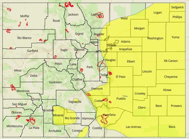
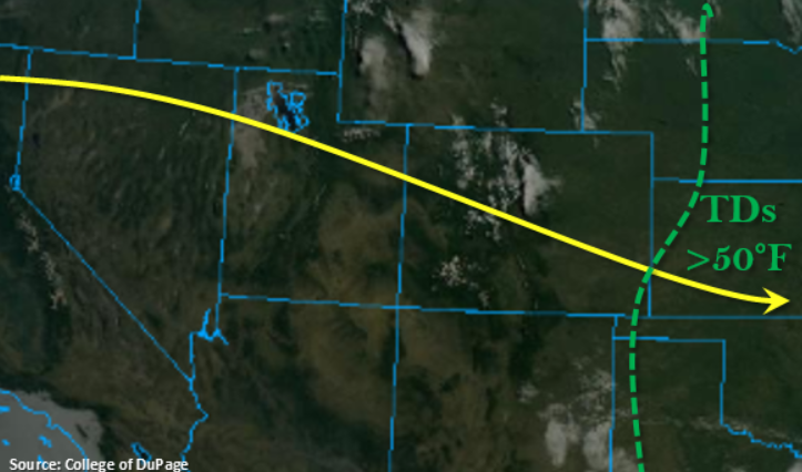
Much warmer temperatures today with the eastern plains reaching the 80°Fs. Most mountainous regions should reach the 60°Fs, so much warmer temperatures overall. Isolated max 1-hour rain rates up to 0.2 inches will be possible, but the majority of storms will produce under 0.15 inches or only trace amounts. Flooding is not anticipated except over the lower Arkansas from Pueblo Dam to Nepesta.
Primetime: 1PM to 10PM
San Juan Mountains, Northern Mountains, Central Mountains, Northwest Slope, Grand Valley, Southwest Slope, San Luis Valley:
Very low dew points over these regions and building high pressure, should keep the afternoon storm activity limited. Some high-based showers and a weak thunderstorm or two may be possible over the Northern and eastern San Juan Mountains. Max 1-hour rain rates up to 0.3 inches are possible though most storms will produce under 0.15 inches and plentiful virga. See the riverine section above for the latest on flooding, and also visit your local NWS office for the most recent updates.
Primetime: 2PM to 10PM