Issue Date: 6/23/2019
Issue Time: 8:15 AM
A LOW FLOOD THREAT IS FORECAST TODAY FOR THE FOLLOWING AREAS:
Saguache Creek, the headwaters of the and along the Rio Grande in Mineral and west Rio Grande Counties, the San Antonio and Conejos Rivers in south central Colorado, and the North Platte River near Northgate.
NOTE: Elevated snow melt runoff continues across the High Country, with various flood advisories issued. Please visit the website of your local National Weather Service Office for more details.
The upper-level low that has brought unsettled weather to Colorado the past couple of days is finally departing the region and will be centered over South Dakota/Nebraska by tonight. Before it leaves, though, it will bring another day of below average temperatures and isolated-to-scattered showers/thunderstorms. With cooler temperatures in place, storms will not have the same “oomph” they have had the past few days, with the vast majority of them being garden-variety. Near the CO/KS border, an isolated severe storm or two cannot be ruled out, with the potential to produce half-dollar-sized hail and gusty winds up to 65 mph.
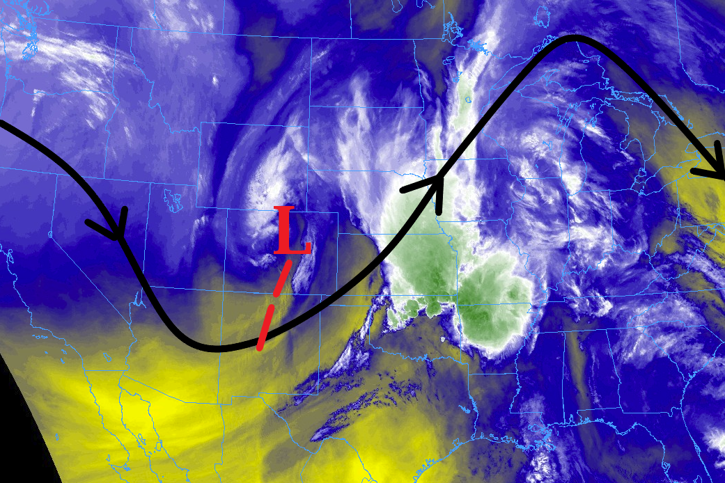
The best coverage of storms today will be north of Highway 50, due to proximity to the low-pressure center aloft and good mid-level moisture. South of Highway 50, drier air and less support aloft will keep a fairly tight lid on things with only a few isolated showers over the mountains and a couple isolated showers/storms east of the mountains. Storm motions will be quick enough, and rain rates low enough, to avoid the issuance of any rainfall-induced flood threats. The only flood threats on the map today are due to ongoing snowmelt.
For more details on timing and rain rates, please see the zone-specific forecast discussions below.
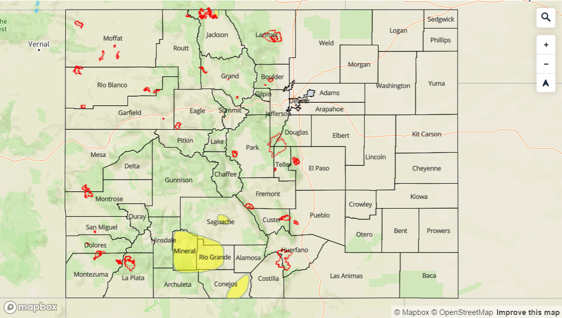
Today’s Flood Threat Map
For more information on today’s flood threat, see the map below. For Zone-Specific forecasts, jump below the map.

Zone-Specific Forecasts
Urban Corridor, Northeast Plains, Southeast Plains, Palmer Ridge, and Raton Ridge:
Isolated showers are ongoing north of I-70 this morning. By lunchtime, additional isolated-to-scattered showers/thunderstorms will develop, mainly north of Highway 50, and continue into the late-afternoon hours. Shower/storm activity will diminish by 6 PM, with all activity ending by 9 PM or so. One or two storms near the CO/KS border may become strong/severe, with the potential to produce half-dollar-sized hail, strong winds up to 65 mph, and heavy rain at 1.0-1.5 inches/hour. Otherwise, all of the activity is expected to be garden-variety, producing moderate rainfall and gusty winds with rain rates of 0.3-0.6 inches/hour.
Front Range, Northern Mountains, Northwest Slope, Grand Valley, and Central Mountains:
Isolated-to-scattered rain and snow showers are expected, with snowfall above 9,000 feet and rain below. Showers will be brief, moving quickly towards the southeast, with rain rates less than 0.25 inches/hour. Activity will end from west to east this evening, with all activity ending by 8-9 PM.
Southeast Mountains, San Luis Valley, San Juan Mountains, and Southwest Slope:
A couple isolated showers, mainly over the higher terrain, are expected. Otherwise, the rest of the area will remain dry under mostly sunny skies. Rain rates from any showers will be less than 0.2 inches/hour.
Timing: 2 PM – 7 PM