Issue Date: Monday, September 16th, 2019
Issue Time: 9:15AM MDT
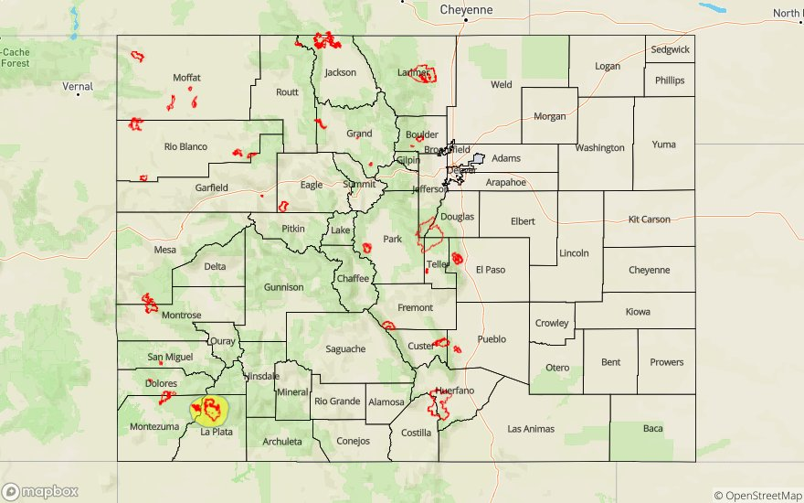
— A LOW flood threat has been issued for the 416/Burro burn area
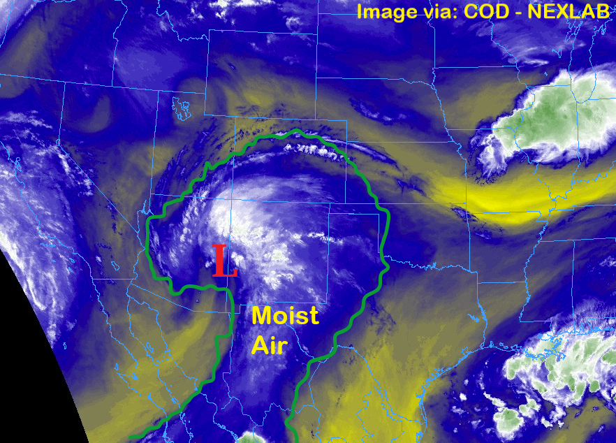
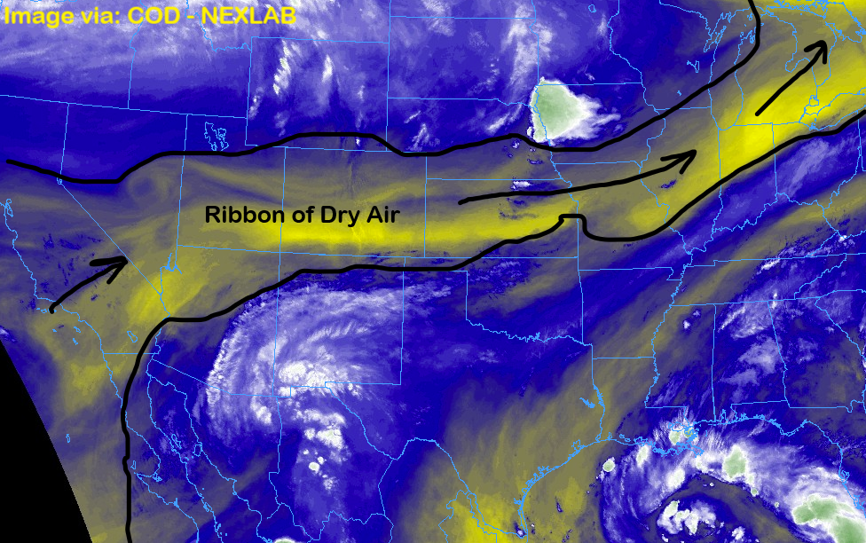
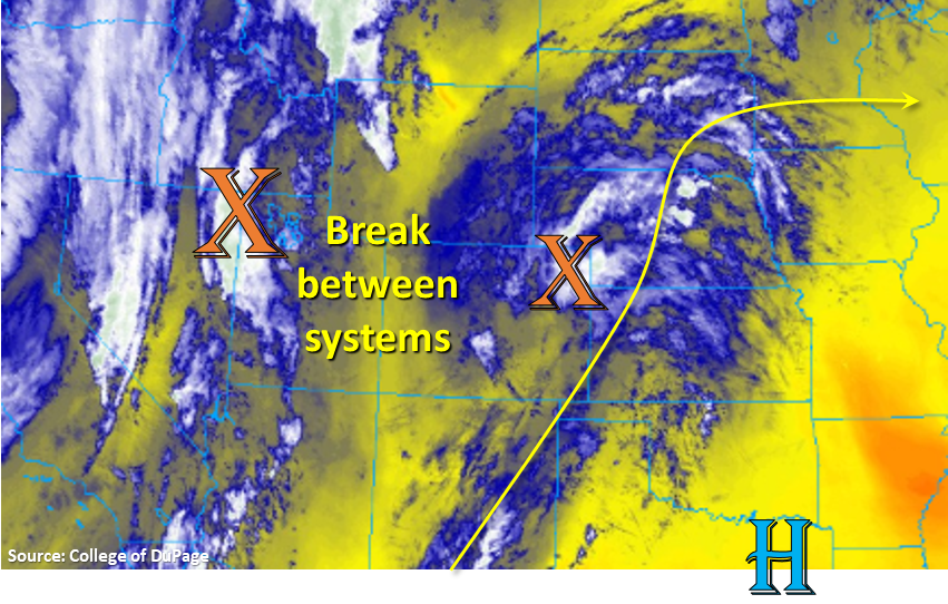
Taking a look at the water vapor imagery below, there will be a couple systems over our area through the next 48-hours. The first system, from yesterday, is now starting to exit eastward. Some mid-level energy is still helping to produce moderate rainfall over the southwest corner of the state and fog over the Central and San Juan Mountains. This feature will continue to lift to the northeast throughout the day and help spark some weak, scattered afternoon showers and thunderstorms over the Front Range and adjacent plains. With PW at 0.57 inches this morning (Denver), not much accumulation is anticipated with highest totals anticipated near the Continental Divide. Overnight cloud cover associated this system also helped keep warmer low temperatures in place, so not a huge diurnal temperature swing. Expecting this to occur again tonight (west), though not quite as pronounced, with mostly cloudy skies expected for eastern Colorado tomorrow as the trough moves through the state.
Dry air will fill in behind the first system, so there may be some clearing for a bit over western Colorado. However, another round of storms are expected to move over the western border from New Mexico and Arizona (associated with mid-level energy from the approaching trough) this afternoon. With a little drier air in place (decreasing PW), storms should be high-based, which will limit their heavy rainfall potential and may produce some brief, gusty winds. As mentioned, the next shortwave will start to move through overnight, so showers will be possible over the western high terrains again early tomorrow morning. While some isolated 24-hour totals up to 1.25 inch will be possible over the southeastern San Juan Mountains again (counting rainfall occurring this morning), rainfall rates are forecast be gradual enough that major flooding issues should be avoided. The 416 burn area received around 0.3 inches yesterday (RAWS/CWOP stations), and with possible storms totals today up to 0.75 inches near the scar, a Low threat has been issued for extra caution.
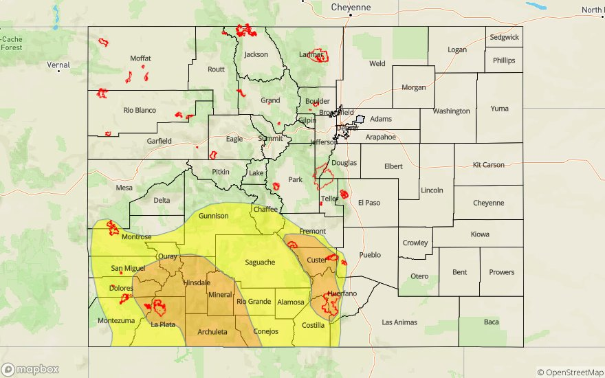
Today’s Flood Threat Map
For more information on today’s flood threat, see the map below. For Zone-Specific forecasts, scroll below the map.

Zone-Specific Forecasts:
Central Mountains, Northern Mountains, San Juan Mountains, Northwest Slope, Grand Valley, Southwest Slope, San Luis Valley:
Max 1-hour rain rates up to 0.5 inches (San Juan Mountains) and 0.3 inches (Southwest Slope) will be possible today. Isolated totals up to 1.25 inches over the southeastern San Juans (southwest facing slopes) will be possible, but rainfall should be gradual enough as to not cause flooding issues. A Low flood threat has been issued for the 416 burn area due to rainfall helping saturate soils yesterday. With 2-3 hour totals up to 0.75 inches possible near the recent scar, mud flows and debris slides chances increase this afternoon. Along the western border, 1-hour rain rates up to 0.25 inches will be possible with northern high terrains receiving up to 0.15 inches in 1-hour. The San Luis Valley is forecast to receive some rainfall as well with totals up to 0.25 inches possible on the fringes. Expect another round of showers over the western high terrains to start tomorrow morning.
Primetime: Ongoing to 12AM
Front Range, Southeast Mountains, Raton Ridge, Palmer Ridge, Urban Corridor, Southeast Plains, Northeast Plains:
Rainfall chances increase over the southern Front Range and Southeast Mountains this afternoon with weak mid-level energy combining with diurnal flow. Storms will be high-based, so best chance for accumulations will be along the Divide over the west facing slopes. Totals up to 0.15 inches will be possible over this area. As storms move to the northeast, moisture is confined to the mid-levels, so this should produce more cloud cover than wetting rains. Although isolated storm totals just over 0.25 inches will be possible over the eastern plains/Raton Ridge.
Primetime: 1PM to 8:30PM