STP 05-14-2015: Scattered Showers and Thunderstorms Brought Another Day of Rainfall

Issue Date: Thursday, May 14th, 2015
Issue Time: 9:00 AM MDT

Summary:

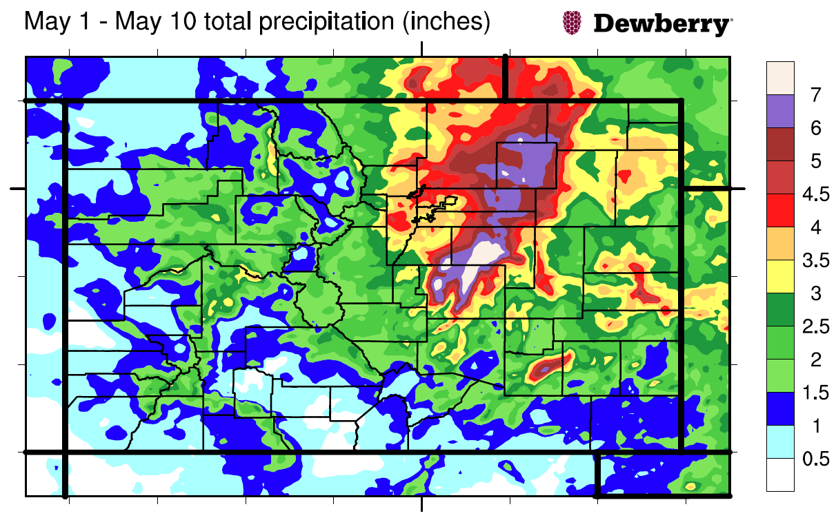
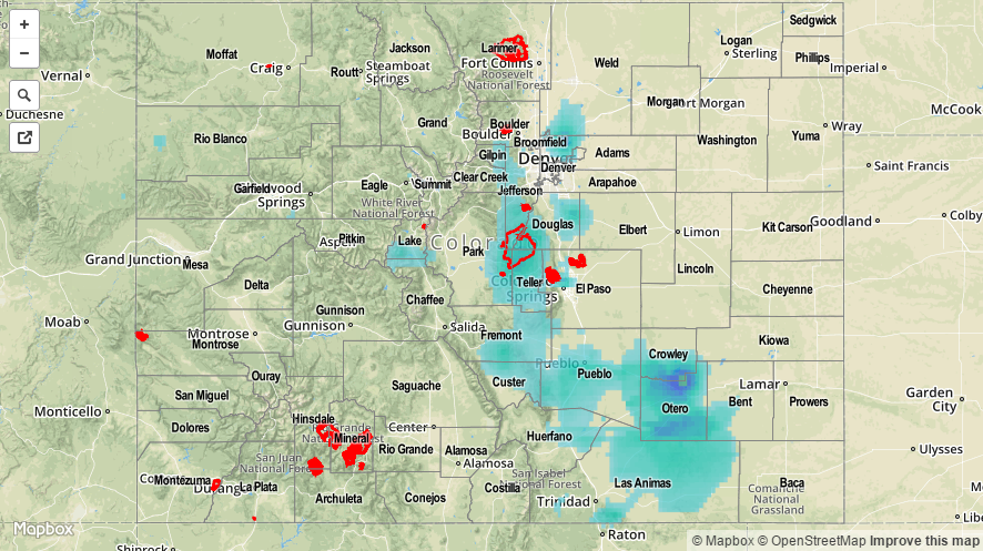
In what has been a wet start to the Spring/Summer seasons here in Colorado, yesterday was no different. A combination of upper-level dynamics and weak instability created scattered showers and thunderstorms throughout the day, bringing generally light-to-moderate rainfall to areas along and east of the Front Range. A few mountain locations west of the Divide received rainfall between a trace and 0.10 inches, but most stayed dry. According to CoCoRaHS observers, the big winners for rainfall totals yesterday were:

Weld County: 0.87 inches
Boulder County: 0.81 inches
Prowers County: 0.65 inches
Larimer County: 0.47 inches

Most other locations across the Front Range, Urban Corridor, Palmer Ridge, Northeast Plains, and Southeast Plains received between 0.1 and 0.4 inches.

No flash flooding was reported yesterday.

05142015_MapImage
Storm Total Precip Legend

STP 05-13-2015: Beneficial Rain For The Southwest, Otherwise Mainly Quiet Weather

Issue Date: Wednesday, May 13th, 2015
Issue Time: 8:58 AM MDT

Summary:

After a brief break on Monday, Mother Nature was back in action, producing rain over Colorado on Tuesday. This time, it was exactly over drought plagued areas that needed it the most: the southwest part of the state. Showers and thunderstorms developed over the higher terrain by early afternoon and raced northeastward. Despite the fast storm motion, several areas over the San Juan Mountains, namely La Plata, Montezuma, Archuleta and even normally dry Alamosa counties were able to squeeze out between 0.25 to 0.5 inches of rain. A spotter in Arriola (Montezuma county) even reported that 0.57 inches of rain and some 0.5 inch hail fell in a 45 minute time span. This was not enough to induce any flooding concerns, but was certainly beneficial for the area. Some snowflakes were also observed.

All the way across the Divide, the South Platte and Arkansas Rivers continued their elevated flows after the weekend’s impressive rain and snow storm. It appears that the rivers have crested (“crest” means that a river reaches its highest point during a particular event) in most locations, obviously barring future rain. Several impressive crests were noted:

  • South Platte River at Kersey crested at 12.11 feet, making it the second highest crest on record and only second to the 2013 September flood!
  • South Platte River at Weldona, Fort Morgan and Balzac have crested, or will shortly crest in their top 5 all-time readings.
  • Arkansas River at La Junta experienced a top 5 crest.

As always, please see the map below for estimated precipitation amounts in your area.

20150513_STPImageStorm Total Precip Legend

STP 05-12-2015: Drier and Cooler Across the State, A Few Showers Over the Mountains

Issue Date: Tuesday, May 12th, 2015
Issue Time: 9:00 AM MDT

Summary:

After the wet, 10-day period from May 1 – May 10, it was nice to get a break and see the sunshine once again. The majority of locations yesterday experienced mostly sunny skies and dry conditions, making Monday just a little bit more bearable. The only exceptions to the dry conditions were a few isolated, weak showers over the mountains, resulting in rainfall amounts of a trace-0.01 inches.

No flash flooding occurred yesterday, but portions of the Arkansas River, Cache la Poudre and South Platte River remained in minor/moderate flood stage.

STP_snapshot_20150513

STP 05-11-2015: A Welcome Downtick in Precipitation

Issue Date: Monday, May 11th, 2015
Issue Time: 9:00 AM MDT

Summary:

After all of the action from the past 8-10 days, a downtick in precipitation was very much welcome across a soaked Colorado. The large-scale system that was in place finally moved east, leaving behind a drier and notably cooler air mass. Much of the state still managed to receive some rain and snow, but much less than previous days. From CoCoRaHS observers, the big winners in yesterday’s precipitation sweepstakes were:

Denver County: 0.76 inches
Pueblo County: 0.66 inches
Fremont County: 0.44 inches

Most locations that experienced rain received between a trace and 0.1 inches.

As far as the entire event is concerned (May 1 – May 10), take a look at the total precipitation map below. 7+ inches fell across parts of El Paso, Elbert, Douglas, Morgan, and Weld Counties!

total_precip_20150501_20150510

No flash flooding occurred yesterday, but the Arkansas River remained in minor flood stage, and the South Platte River was in minor/moderate flood stage.

20150511_STPImage
Storm Total Precip Legend