Issue Date: Wednesday, May 13th, 2015
Issue Time: 8:58 AM MDT
Summary:
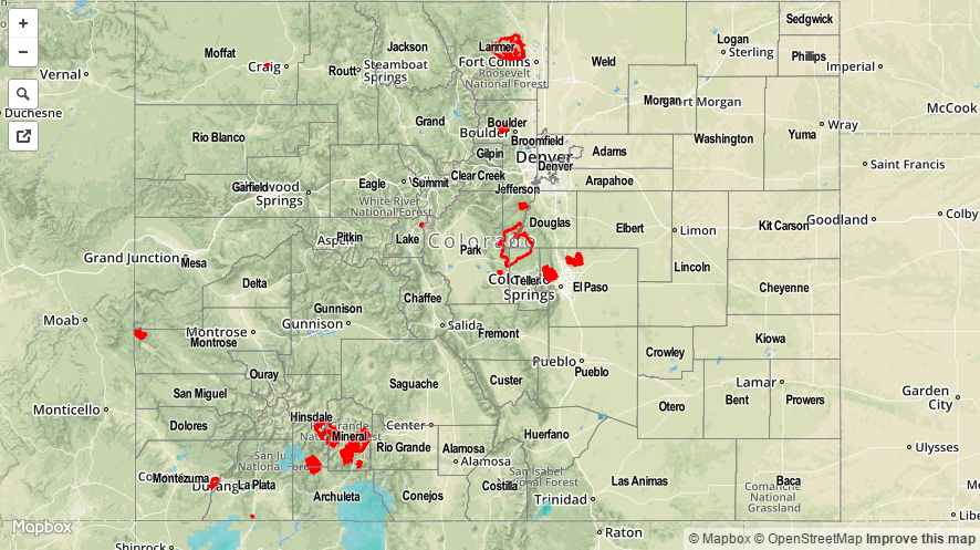
After a brief break on Monday, Mother Nature was back in action, producing rain over Colorado on Tuesday. This time, it was exactly over drought plagued areas that needed it the most: the southwest part of the state. Showers and thunderstorms developed over the higher terrain by early afternoon and raced northeastward. Despite the fast storm motion, several areas over the San Juan Mountains, namely La Plata, Montezuma, Archuleta and even normally dry Alamosa counties were able to squeeze out between 0.25 to 0.5 inches of rain. A spotter in Arriola (Montezuma county) even reported that 0.57 inches of rain and some 0.5 inch hail fell in a 45 minute time span. This was not enough to induce any flooding concerns, but was certainly beneficial for the area. Some snowflakes were also observed.
All the way across the Divide, the South Platte and Arkansas Rivers continued their elevated flows after the weekend’s impressive rain and snow storm. It appears that the rivers have crested (“crest” means that a river reaches its highest point during a particular event) in most locations, obviously barring future rain. Several impressive crests were noted:
- South Platte River at Kersey crested at 12.11 feet, making it the second highest crest on record and only second to the 2013 September flood!
- South Platte River at Weldona, Fort Morgan and Balzac have crested, or will shortly crest in their top 5 all-time readings.
- Arkansas River at La Junta experienced a top 5 crest.
As always, please see the map below for estimated precipitation amounts in your area.