STP 05-26-2015: A Mostly Pleasant Memorial Day Thanks to a Downtick in Thunderstorm Activity

Issue Date: Tuesday, May 26th, 2015
Issue Time: 9:00 AM MDT

Summary:

FLOOD WARNINGS CONTINUE FOR PORTIONS OF THE CACHE LA POUDRE, SOUTH PLATTE, AND ARKANSAS RIVERS.

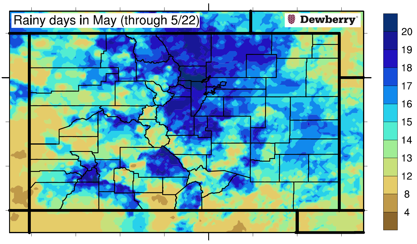
Yesterday featured a downtick in thunderstorm activity allowing for most people to get outside and enjoy the holiday. Afternoon/evening showers and thunderstorms provided some late day fireworks with lightning and some brief moderate-to-heavy rain, but nothing that caused flash flooding issues. One afternoon thunderstorm, 4 miles NE of Beulah (Pueblo County), provided the only severe report of the day with 1 inch hail. Sub-severe, quarter-inch hail fell in Cedaredge (Delta County), covering the ground 1.5 inches of accumulating hail.

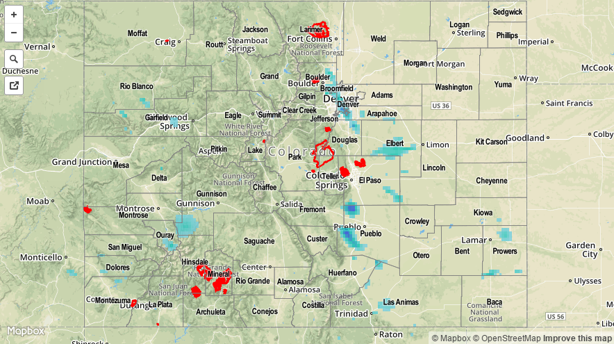
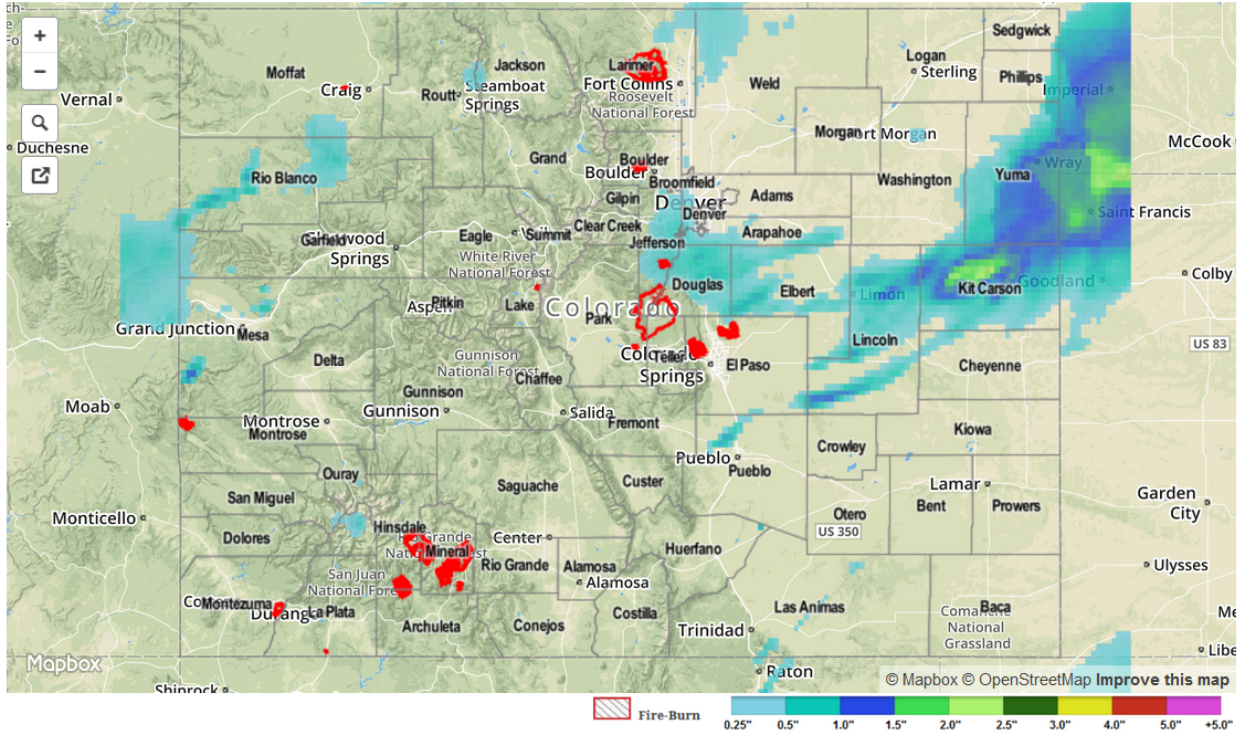
The strongest thunderstorm of the day rumbled across central portions of the Urban Corridor during the evening, producing the highest observed rainfall totals of the day. From CoCoRaHS observers:

Arapahoe County: 1.31 inches
Jefferson County: 1.18 inches
Douglas County: 0.84 inches
Denver County: 0.84 inches
Boulder County: 0.55 inches

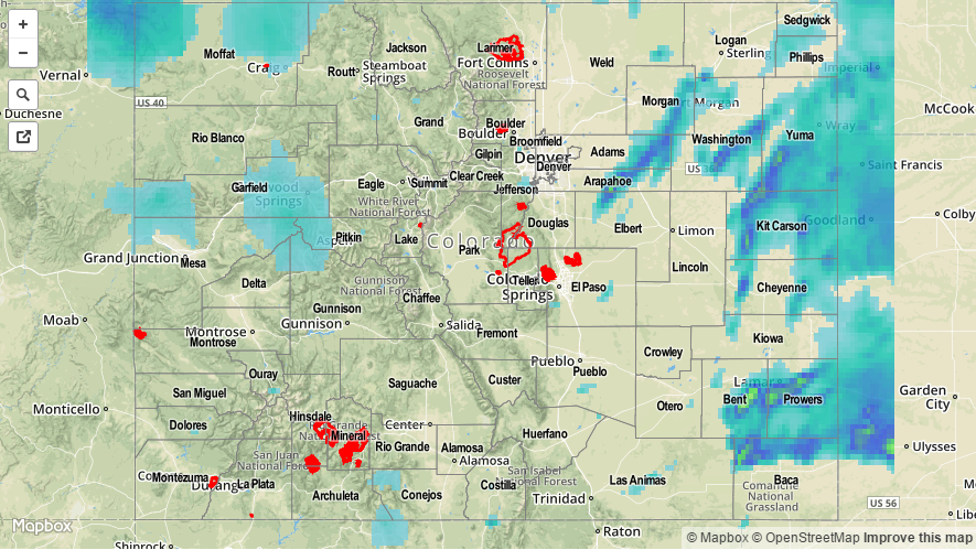
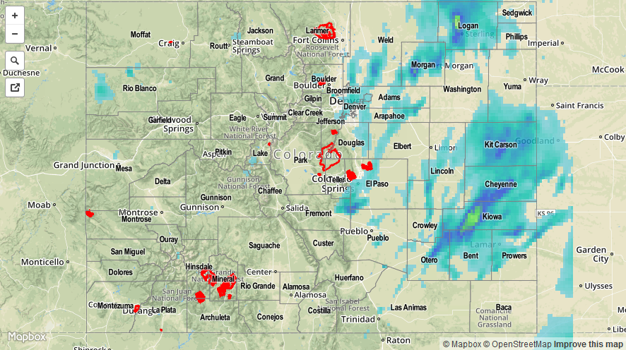
No flash flooding occurred yesterday. Be sure to check out the radar-estimated rainfall map below.

20150526_STPImage
Storm Total Precip Legend

STP 05-25-2015: Scattered Showers and Thunderstorms, a Few Severe, to End the Weekend

Issue Date: Monday, May 25th, 2015
Issue Time: 9:00 AM MDT

Summary:

Another day, another bout with showers and thunderstorms across Colorado. East of the mountains, a few of those thunderstorms were severe, producing hail, strong winds and even a few tornado reports. Rain totals were generally light under showers, with most location reporting less than 0.15 inches of rain. However, under the stronger storms (mainly near the CO/KS border), more than 0.5 inch of rainfall was reported in a few locations. From CoCoRaHS observers, these counties had the big rainfall winners yesterday:

Yuma County: 1.35 inches
Kit Carson County: 1.33 inches
Phillips County: 0.80 inches
Bent County: 0.78 inches
Morgan County: 0.69 inches
Cheyenne County: 0.53 inches

As far as severe storm reports are concerned, hail greater than 1 inch in diameter was the main impact, however a few funnel clouds/tornadoes were reported in Baca County, El Paso County, Prowers County, and Otero County.

Flash flooding was reported in Swink (Otero County); the underpass on Highway 50 was flooded with about 12 inches of water.

20150525_STPImage
Storm Total Precip Legend

STP 05-24-2015: Fortunately, Most Storms Underwhelmed Yesterday

Issue Date: May 24, 2015
Issue Time: 9:10AM

On Saturday, the pesky upper-level system that has been the talk of Colorado weather for the past 2-3 days, pushed closer to the state. Like spokes on a bicycle wheel, smaller features that were tied to the main system, rotated through the state causing numerous rounds of shower and thunderstorm activity. Fortunately, atmospheric instability was once again very marginal, arguably lower than forecasted possibly due to the early storm formation. This kept rainfall intensities below anticipated values and precluded any major flooding on day one of this holiday weekend. Most hourly rainfall intensities were in the 0.4 to 0.6 inch per hour range. There were bursts of much heavier rainfall, but this only lasted for very short periods of time. The one exception to this was in Logan County where radar estimated rainfall showed 2 to 3 inches of rainfall occurred, leading to flooding in parts of Sterling.

Highest observed 24-hour rainfall totals were about 1.50 inches. Morgan, Logan, Phillips and Prowers counties reported rainfall over 1 inch. A flash flooding report was received from Otero County in the afternoon, noting that Highway 50 was flooded. This report came from the same storm that produced a tornado.

Otherwise, hail was in no shortage on Saturday, with over two dozen reports received across the state. Most hail was pea size to half an inch owing to the aforementioned weak instability. However, several storms in the Southeast Plains produced hail up to 2 inches (Pueblo County).

Lastly, snow once again fell above 10,000 feet. What was considered to be a poor snow condition a month ago now appears to be coming closer to average, especially along and east of the Continental Divide.

As always, please check the map below for estimated rainfall in your area. Note that hail contamination inflated some of the totals east of the Divide.

052415_STPImage
Storm Total Precip Legend

STP 05-23-2015: Mother Nature Runs The Weather Gamut, Again

Issue Date: 5/23/2015
Issue Time: 9:10 AM

Friday was just another run of the mill weather day in Colorado. Just like the ones we have grown accustomed to in May. You know, just a normal day when snow, cold rains, heavy rains, hail, lightning, a funnel cloud, flood warnings and a taste of summer heat are all reported across the state!

Before we get to yesterday’s weather round-up, we spent some time reflecting on the rainy May thus far. The map below shows the number of rainy days that have been observed across the state since May 1st. The numbers are quite impressive: portions of Larimer, Boulder and Jefferson counties have observed rain on every single day in May! At the end of the month, we will check records to see where this kind of feat stands. Many other locations across the state have observed rain more than 14 out of the 22 May days. Very impressive, given our state’s semi-arid climate.

may_rainydays

A disturbance moved out of the state before noon yesterday, but clearing in its wake allowed temperatures to jump from the 40s and 50s to the 60s and 70s, leading quickly to thunderstorms. Once again, most all places had limited instability so that rainfall did not cause any problems. General rainfall of 0.25 to 0.75 inches was spread out across several hours both east and west of the Continental Divide. However, along the Palmer Ridge, many factors came together to produce efficient rainfall-producing thunderstorms by early afternoon. Rainfall amounts up to 1 inch were common across Douglas and Elbert counties. Farther east, though, rain rates up to 1.5 inches per hour over a several hour period prompted flash flood warnings over Kit Carson and Yuma counties. There, rainfalls up to 2.3 inches were noted, with higher amounts up to 3-4 inches noted by radar estimates over sparsely populated areas. See our rainfall map below.

In addition to rainfall, elevations above 10,000 feet noted a trace to several inches of wet snow as temperatures hovered right near the freezing mark. From a different angle, the cold upper-level temperatures also helped bring hail suspended in thunderstorm updrafts down to the surface. An observer in Mesa County noted 1 inch hail, while 0.75 inch hail was reported in Pueblo County.

One official flooding report came in yesterday: flash flooding was observed in Kit Carson county late in the afternoon. County roads 36 and 34 were nearly impassable close to Bethune, CO.

As always, please check the map below for estimated rainfall in your area.

STP_snapshot_20150523