STP 08-22-2015: A Rogue Storm Out East, A Few Dry Storms Out West, And Lots of Haze Elsewhere

Issue Date: 8/22/2015
Issue Time: 9:15AM

Summary:

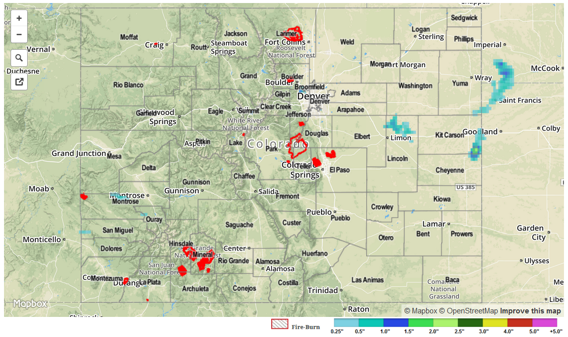
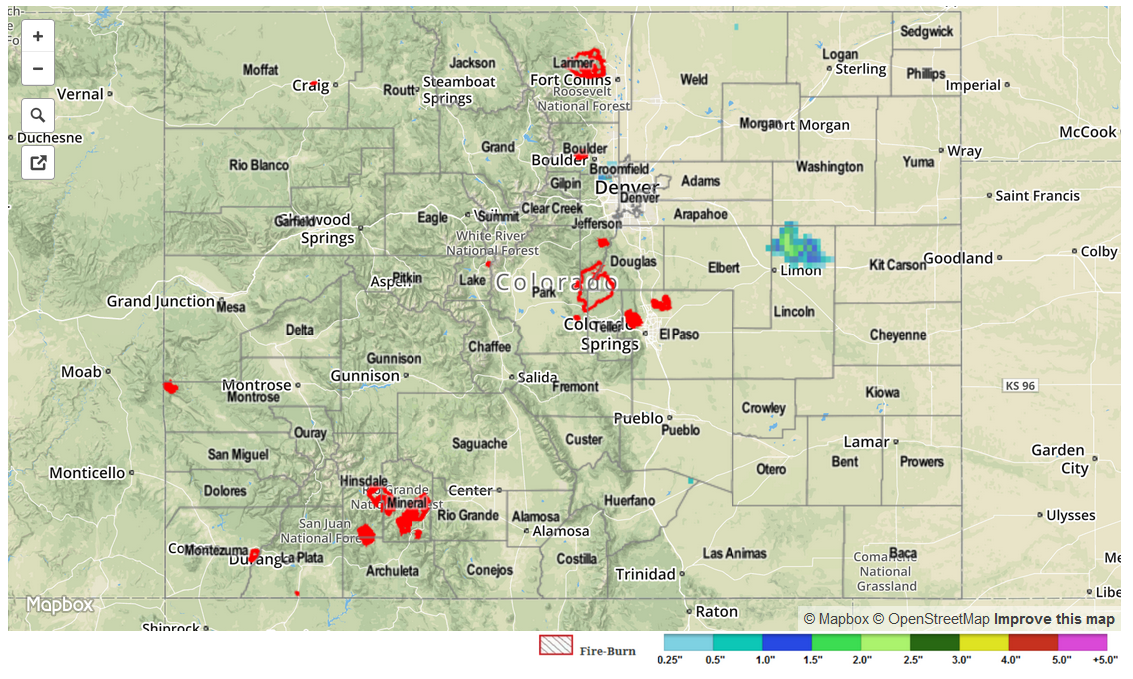
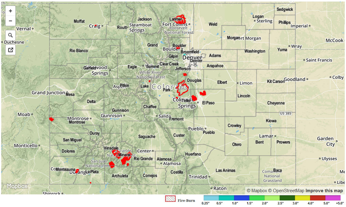
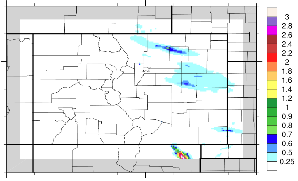
Smoke and haze from the Northwest U.S. wildfire activity continued to be transported into Colorado on Friday. Otherwise, it was another mostly dry day across the state with a very dry atmosphere overhead. There were two exceptions to this generalization. First, a line of weak to moderate thunderstorms popped up along a cool front on the border of Kit Carson County and Kansas. This resulted in up to 1.0 inch of rainfall before storms slipped into Kansas. There was even a report of 2.5 inch hail south of Burlington. This storm also prompted a Flash Flood Warning. Second, though odds were not in their favor, a line of mostly “dry” thunderstorms moved through the Grand Valley and into the Central Mountains yesterday afternoon. The inflow air to these storms had very low dewpoint temperatures, in the 20s and 30s, making it miraculous that they were able to produce any rainfall. They ended up producing up to 0.05 of an inch over Montrose County.

Flooding was not reported yesterday. For estimated rainfall in your area, check out radar-estimated map below.

STP_snapshot_20150822

STP 08-21-2015: A Smoky Late Summer Day

Issue Date: 8/21/2015
Issue Time: 9:02AM

Summary:

With dry air continuing its grasp on Colorado, the big story on Thursday was not weather related but instead the large plumes of smoke that traveled into the state from the northwest. The map below, from the USDA Forest Service, shows at least two dozen active wildfires in Montana, Idaho, Washington and Oregon. As Colorado had 30-50 mph northwesterly flow in the mid and upper-levels, the smoke from these fires was quickly transported into our state. The haze was so thick that residents in Colorado Springs could not see Pikes Peak.

active_fires

Weather wise, it was a textbook late summer day with a cool start leading to mostly sunny skies and seasonably warm temperatures. Dewpoint temperatures fell into the 20s and 30s, which are some of the lowest values that we have seen since the start of the Flood Threat Bulletin on May 1st. Fortunately wildfires were not reported across Colorado on Thursday.

No flooding or rainfall occurred received yesterday. It appears that our radar estimated rainfall map, below, was affected by insects or birds leading to spurious readings in Lincoln County.

STP_snapshot_20150821

STP 08-20-2015: Beautiful Fall-Like Day Across Colorado

Issue Date: 8/20/2015
Issue Time: 9:10AM

Summary:

The passage of a fall-like cool front on Tuesday left Colorado under sunny skies on Wednesday. Early morning temperatures dipped all the way into the 30s in higher elevation valleys and foothills, while 40s were common elsewhere. Some early morning rain showers were observed mainly across the Front Range, Urban Corridor and Northeast Plains. However, this did not amount to much, with only 0.05 to 0.20 inches reported.

This cool weather, however, will be a temporary thing as much warmer temperatures are in store for Thursday.

No official flooding reports were received yesterday. For an estimate of 24-hour rainfall that occurred in your area, please check out our radar based map below.

STP_snapshot_20150820

STP 08-19-2015: A First Taste of Fall as Cooler Air Invaded the State

Issue Date: Wednesday, August 19th, 2015
Issue Time: 9:00 AM MDT

Summary:

Behind a seasonably strong cool front, Colorado was treated to a day of cooler temperatures and drier air. It was a very pleasant day overall, with high temperatures 8-14 degrees below the previous days’ highs, on average. Late in the afternoon, broad-scale lift returned with the presence of a jet streak, bringing scattered showers and weak thunderstorms to areas along and east of the Continental Divide. In fact, light showers are ongoing this morning across the Southeast Plains. I wouldn’t blame you if you craved pumpkin-flavored everything today, because this morning’s lows are reminiscent of Autumn.

Light showers were persistent, leading to the following rainfall totals (from CoCoRaHS observers):

Morgan County: 0.66 inches
Kit Carson County: 0.50 inches
Larimer County: 0.46 inches
Douglas County: 0.35 inches
Weld County: 0.33 inches

No flash flooding was reported yesterday.

STP_snapshot_20150819